 Route Editor

| Guide | ♦ | 275 Triplogs | 0 Topics |
details | drive | permit | forecast | 🔥 route |
stats |
photos | triplogs | topics | location |
| 661 | 275 | 0 |
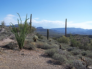
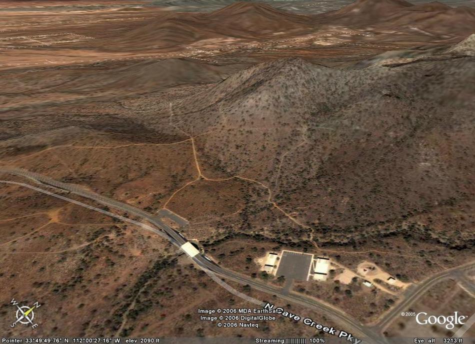
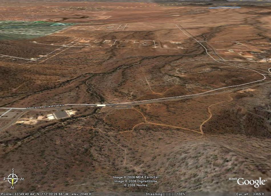
Nice Connector by Al_HikesAZ  Overview OverviewThis is a pleasant hike close to North Phoenix and North Scottsdale with access to abandoned mines. You can hike the Overton Trail out and back, and you can use it to create longer or shorter loops with the Go John Trail or use it to access State Trust Land if you have your permit. This area is popular with hikers, mountain bikers, and equestrians. Great facilities and staging areas. Note The posted official route (as seen to the right) is backward for map readability on the Cave Creek Recreational Map. The following description reads as you would approach from the SE end nearest a trailhead.
From the Overton East Trailhead (elevation 2,060 feet), head west past the very lovely restrooms and picnic area. At 0.3 miles, a small spur joins the trail from the south from the Overton West Trailhead. Continue west. Climb a small hill. At 0.4 miles, you reach a small saddle. You can take an excursion to the left onto the Clay Mine Trail to an abandoned mine. This was a mining area, and there are a lot of interesting rocks. Continue west on the Overton Trail. The campground is in the distance on your left. You curve around the mountain and begin a modest climb. State Trust Land is on your left. You continue to curve around the mountain until you are heading northeast. At 1.2 miles, a spur trail to the northwest leads out of the Cave Creek Recreation Area onto State Trust Land. If you have a State Trust Land Permit, you can hike that area. Continue on the Overton Trail. At 1.9 miles, you crest a saddle at 2,445 feet and start downhill. At 2.1 miles, you intersect the Go John trail in a riparian area. You now have three choices: 1) turn left to take the longer portion of the Go John Loop and add 4 miles to the loop (or to leave the Cave Creek Recreation area and explore the State Trust Land if you have a State Trust Land Permit) 2) turn right to take the shorter portion of the Go John Loop up the hill to an abandoned mine and then down to the Go John Trailhead and back past the picnic area to the Overton Trailhead (a 1.2-mile trail back to the Overton Trailhead) 3) turn around and make this an out and back on the Overton Trail. The round trip distance for this hike is the out and back on the Overton Trail.
Check out the Official Route and Triplogs. Leave No Trace and +Add a Triplog after your hike to support this local community. | ||||||||||||||||||||||||||||||||||||||||||||||||||||||||||||||||||||||||||||||||||||||||||||||||||||||||||||||||||||||||||||||||||||||||||||||||||||||||||||||||||||||||||||||||||||||||||


