 Route Editor

| Guide | ♦ | 46 Triplogs | 1 Topic |
details | drive | no permit | forecast | map |
stats |
photos | triplogs | topic | location |
| 320 | 46 | 1 |
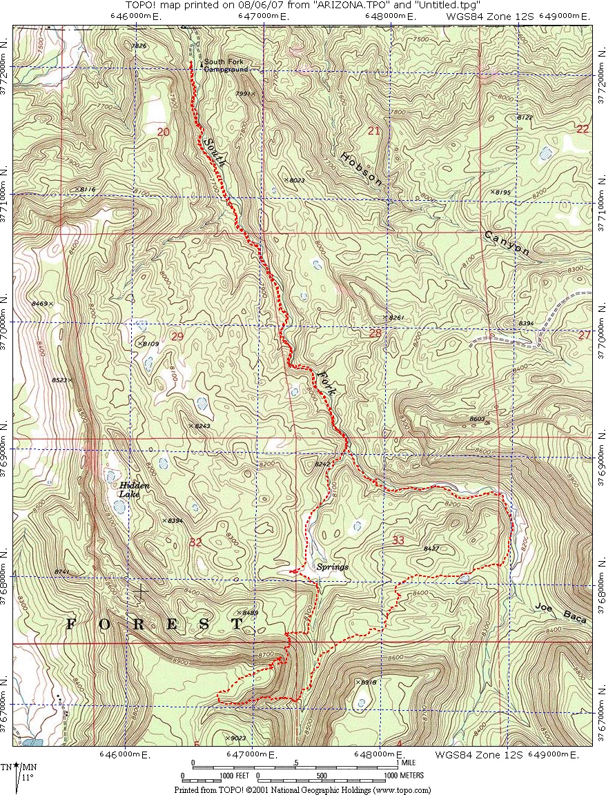
Hey, hay, hey! by hikeaz  A few of us hiked this short, beautiful trail this past Saturday, July 7th. From the southern trailhead, the overall elevation LOSS is about 1400 feet. A few of us hiked this short, beautiful trail this past Saturday, July 7th. From the southern trailhead, the overall elevation LOSS is about 1400 feet.Starting at its southern terminus, we hiked north about 7 miles to the South Fork Campground and trailhead.
The trail then transitions into a more wooded section with excellent pine needle carpeted tread. Making your way down, the trail bends west; and from this point, endless views to the north are made available. Eventually, you will reach a promontory and a sign indicating that a steep section awaits you. The sign does not lie, but the good news is that the steep section is 100 yards long. After the steep section, as you wind your way down to the South Fork of the Little Colorado River, you will have more nice smooth tread on which to hike while you hike through this transitional area. Upon reaching and crossing the creek, an entirely different hike opens up. From this point, you have about 2 miles left until you reach the trailhead at South Fork Campground. As you hike along the pine-tree-lined bench just above the creek-bed, you will see myriad flowers, and of course, the accompanying butterflies. This visual cornucopia is serenaded by the creek's soft, fast-moving. This is a beautiful area. This beauty, coupled with the South Fork's easily accessed northern trailhead, means that you may start to see other hikers through this section. It is all flat walking back to the South Fork campground/trailhead. I want to note that the South Fork Campground, originally a historic fish hatchery site, converted into a campground in 1940 ($10.00 per site of this writing), has excellent widely-spaced sites and a terrific CG host, Manny.
Check out the Triplogs. Leave No Trace and +Add a Triplog after your hike to support this local community. One-Way Notice This hike is listed as One-Way. When hiking several trails on a single "hike", log it with a generic name that describes the hike. Then link the trails traveled, check out the example. | ||||||||||||||||||||||||||||||||||||||||||||||||||||||||||||||||||||||||||||||||


