 Route Editor

| Guide | ♦ | 25 Triplogs | 0 Topics |
details | drive | no permit | forecast | route |
stats |
photos | triplogs | topics | location |
| 147 | 25 | 0 |
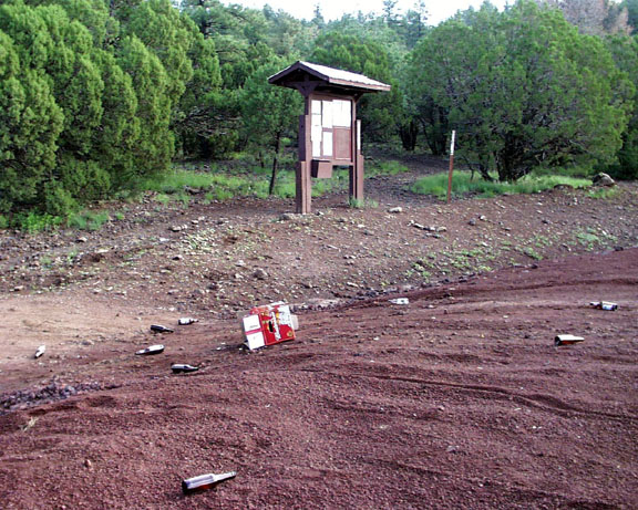
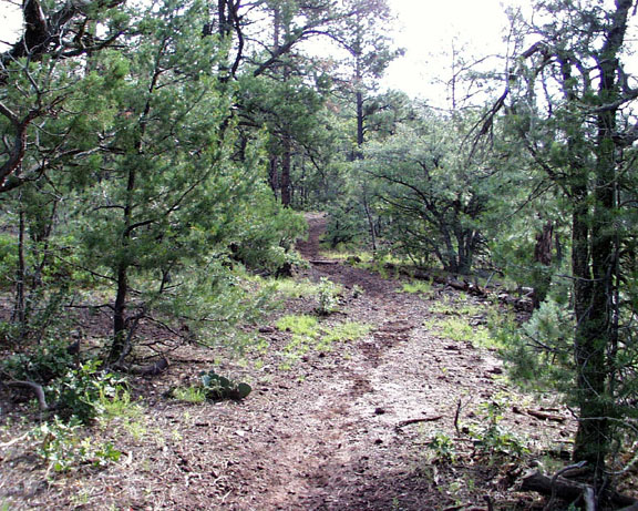
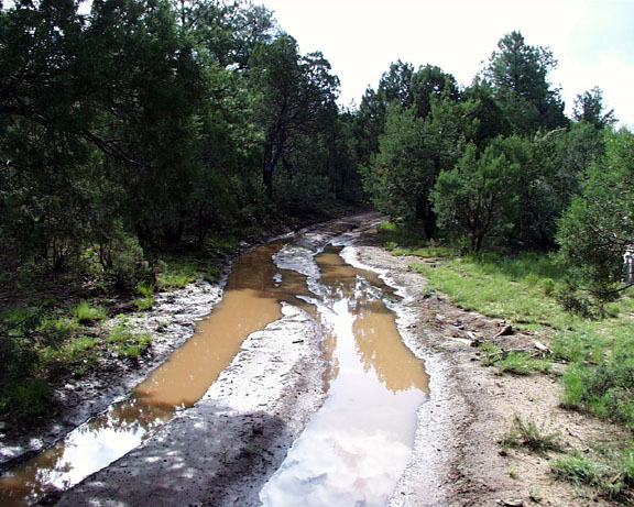
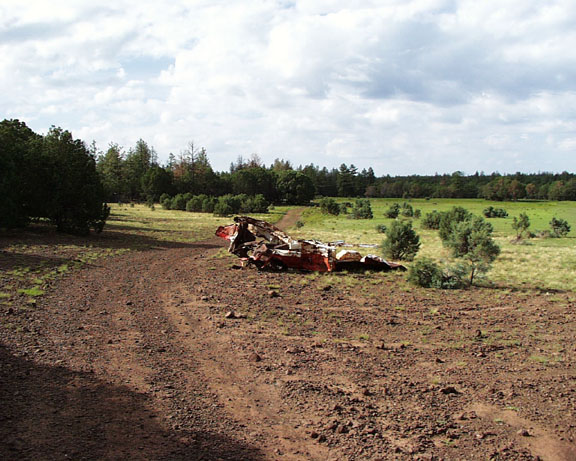
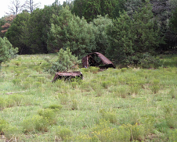
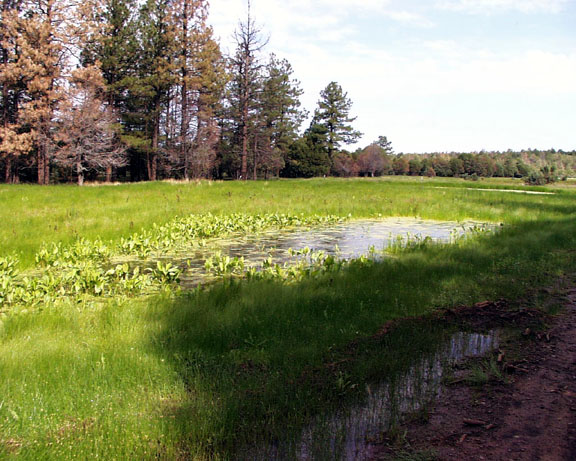
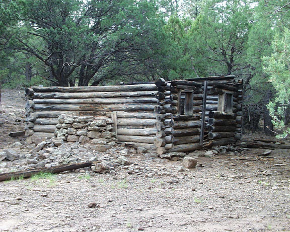
Pleasant by conform6073  The White Mountains Trail System comprises twelve trails, eleven of which are loops, plus numerous connectors within the Lakeside Ranger District of Apache Sitgreaves National Forest. An organization of volunteers called TRACKS constructed and maintains the system. You can view their web site. The trails vary in length from 3 to 16 miles, lie between 6,200 and 8,500 feet in elevation, and are well marked with blue plastic blazes. These markers seem to invite attention from travelers exercising their second amendment rights. Trailheads are on all-weather Forest Service or County roads, and most are a very short drive from the communities of Show Low and Pinetop-Lakeside. Designated for foot, bike, and horse use only, nearly all the trails trace, in part, old logging roads and experience interlopement by ATV and 4WD. The White Mountains Trail System comprises twelve trails, eleven of which are loops, plus numerous connectors within the Lakeside Ranger District of Apache Sitgreaves National Forest. An organization of volunteers called TRACKS constructed and maintains the system. You can view their web site. The trails vary in length from 3 to 16 miles, lie between 6,200 and 8,500 feet in elevation, and are well marked with blue plastic blazes. These markers seem to invite attention from travelers exercising their second amendment rights. Trailheads are on all-weather Forest Service or County roads, and most are a very short drive from the communities of Show Low and Pinetop-Lakeside. Designated for foot, bike, and horse use only, nearly all the trails trace, in part, old logging roads and experience interlopement by ATV and 4WD.The Timber Mesa trailhead is one of the closest to both the local population base and a paved road, making it a good choice for folks who feel the need to amble on short notice. That proximity also lures nocturnal party animals who leave the parking lot a mess. The 6-mile elongated loop divides equally into a pleasant single-track course through, mainly, oak, juniper, pinon woods, and a tedious, rutted fire-control road popular with ATV enthusiasts. The former departs in a counter-clockwise direction from the trailhead, climbing a couple of hundred feet to the top of the mesa and then proceeding north and west tracing the mesa's edge. Along the way, two connectors branch to the east and eventually join the Panorama Trail - #635 - making possible much longer loop excursions. Although one is never far above the plain at the mesa's base, there are frequent good views. Views include forest and mountains to the south, the extensive, lush riparian area created by the sanitary district to the west, and for the commerce-inclined, Walmart, and (soon to open) Home Depot to the north. As the trail reaches its northernmost point, it descends and returns via a rocky, rutted double-track. This road is popular with trash dumpers, and some of the trash has been around long enough to qualify for archeological designation. The way does not totally lack appeal, though, as it skirts Jaques Marsh, which, nourished by the sanitary district outflow, harbors a wide variety of birdlife. It also passes the remains of an early settler's log cabin, waste piles of a long-gone sawmill, and two tall chimneys, all that's left of the homesteads of one of the area's prominent pioneer families.
Check out the Official Route and Triplogs. Leave No Trace and +Add a Triplog after your hike to support this local community. | |||||||||||||||||||||||||||||||||||||||||||||||||||||||||||||||||||||||||||||||


