Route Editor

| Guide | ♦ | 104 Triplogs | 3 Topics |
details | drive | no permit | forecast | 🔥 route |
stats |
photos | triplogs | topics | location |
| 1.2k | 104 | 3 |
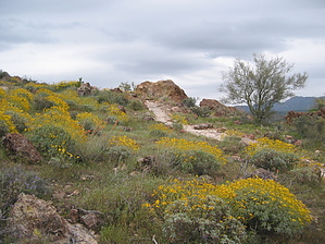
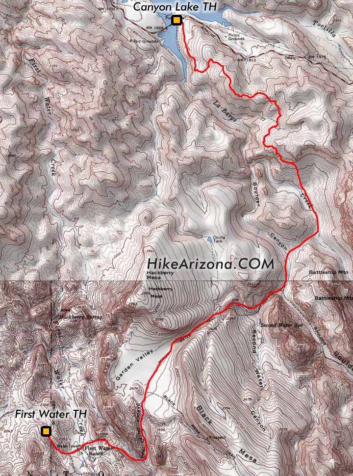
Very diverse by OhOh7  I only see parts of this hike in the index. It involves 3 different trails and I want to put them together here as a great shuttle hike. It starts at First Water Trailhead going SE on the Dutchman's trail (104). After almost 0.3 miles there is a junction with Second Water Trail(236). In another mile and a half, there is a junction with Black Mesa Trail (also a great loop). Stay on Second Water Trail as it crosses Garden Valley which, for a while, as Joe B. puts it, is an "easy stroll". However, do not get too carried away with the calm, flat, wide trail. As you proceed East the trail begins to drop down into Second Water Spring. The trail gets somewhat steep here but still fairly easy. In my March hike, there was lots of water and one could hear the water flowing. I only see parts of this hike in the index. It involves 3 different trails and I want to put them together here as a great shuttle hike. It starts at First Water Trailhead going SE on the Dutchman's trail (104). After almost 0.3 miles there is a junction with Second Water Trail(236). In another mile and a half, there is a junction with Black Mesa Trail (also a great loop). Stay on Second Water Trail as it crosses Garden Valley which, for a while, as Joe B. puts it, is an "easy stroll". However, do not get too carried away with the calm, flat, wide trail. As you proceed East the trail begins to drop down into Second Water Spring. The trail gets somewhat steep here but still fairly easy. In my March hike, there was lots of water and one could hear the water flowing.I owe great thanks to Trish (Trishness) who, I found out during the hike, is famous as hikers passing us in the opposite direction and said they knew of her photos and writings! Trish is a perfect hiking partner. However, she does move right along at a lively pace (for me anyway). Fortunately, she loves the area flowers and stops to take many close-up photos. I hope she will share some of them. These stops gave me many moments of much-needed rest. We had both conquered the Flatiron in the previous two weeks so anything ahead would be duck soup! Oh really? At the bottom of the Second Water Spring area (Boulder Canyon) the Second Water trail ends and one can go North or South on the Boulder Canyon Trail (103).
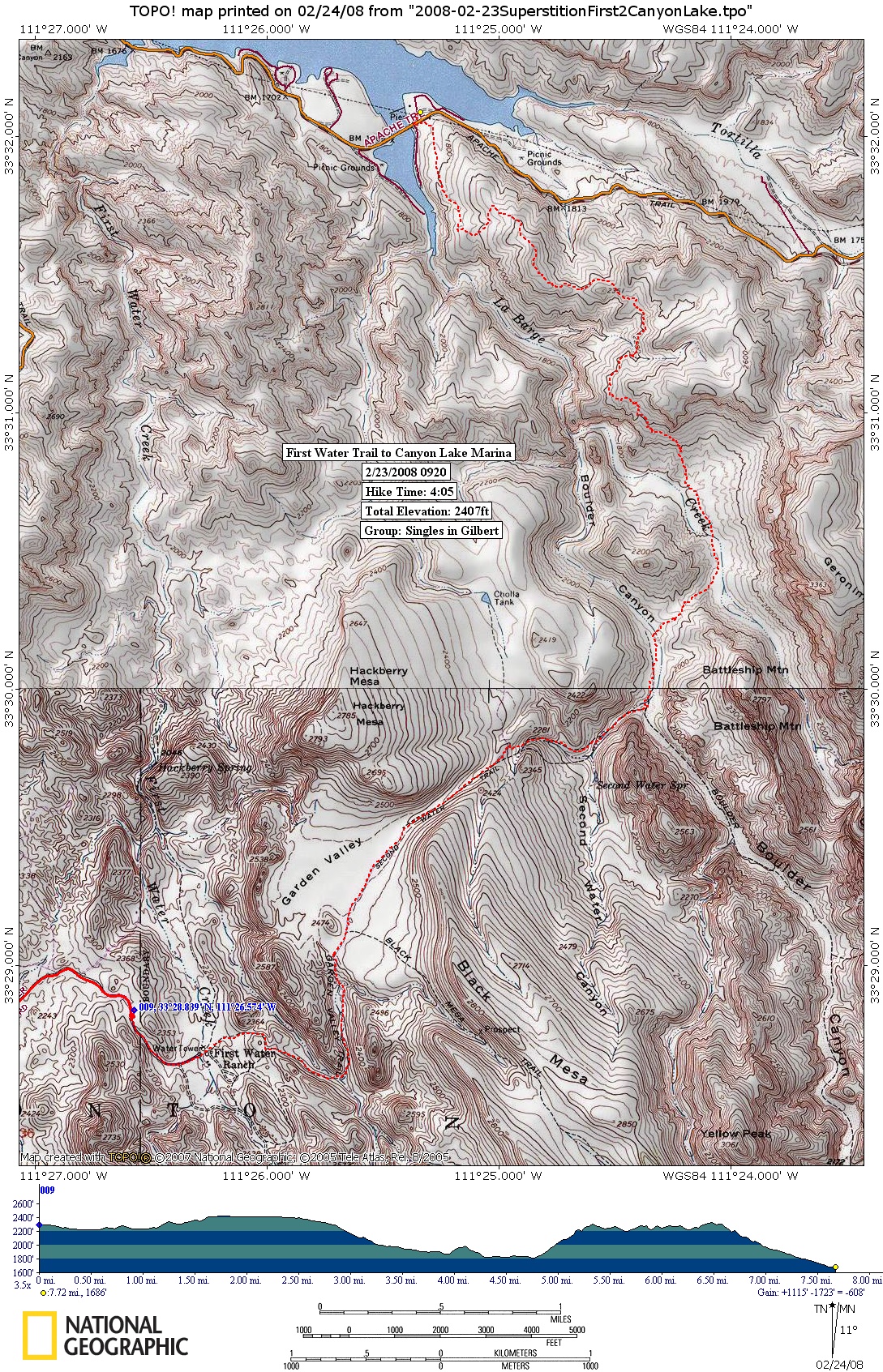
The distance is listed as 7.6 miles but I calculate it from the First Water Parking lot to a table with cold water in the Lakeside restaurant as 8 miles although we did take a few side jaunts on the way to see Indian ruins and the Indian Paint mine. The shuttle distance from First water to Canyon Lake is about 12 miles. I congratulated myself, as this was the first Superstition hike I have done in the time they say it can be done. This hike shows the rugged grandeur of the Superstitions. Battleship Mountain is enormous. There are many "Weaver's Needle" views and other imposing rock walls and towers. Midway through the hike, everything around you is red (at the paint mine) and then you see black lava and grey stone. I am sharing my photos of this hike as the recent rains have made the entire area a carpet of green and flowers. My friends in other states are amazed that they think I live in a desert and cannot believe the growth. Thank you Trish for your guidance and patience. One of the most enjoyable hikes I have been on. I highly recommend this one to even a casual hiker. The big climb is challenging but take it slowly and look behind you many times! The views are hard to believe! By the way, I think the direction we went is the best. I know one can start at Canyon Lake but that climb right at the start is tough. Also, the views of Canyon Lake are welcomely anticipating the ice water waiting for you and you save a few bucks on parking fees!
Check out the Official Route and Triplogs. Leave No Trace and +Add a Triplog after your hike to support this local community. | ||||||||||||||||||||||||||||||||||||||||||||||||||||||||||||||||||||||||||||||||||||||||||||||||||||||||||||||||||||||||||||||||||||||||||||||||||||||||||||||||||||||||||||||||||||||||||||||||||||||||||||