Route Editor

| Guide | ♦ | 85 Triplogs | 5 Topics |
details | drive | no permit | forecast | 🔥 route |
stats |
photos | triplogs | topics | location |
| 1.4k | 85 | 5 |
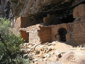
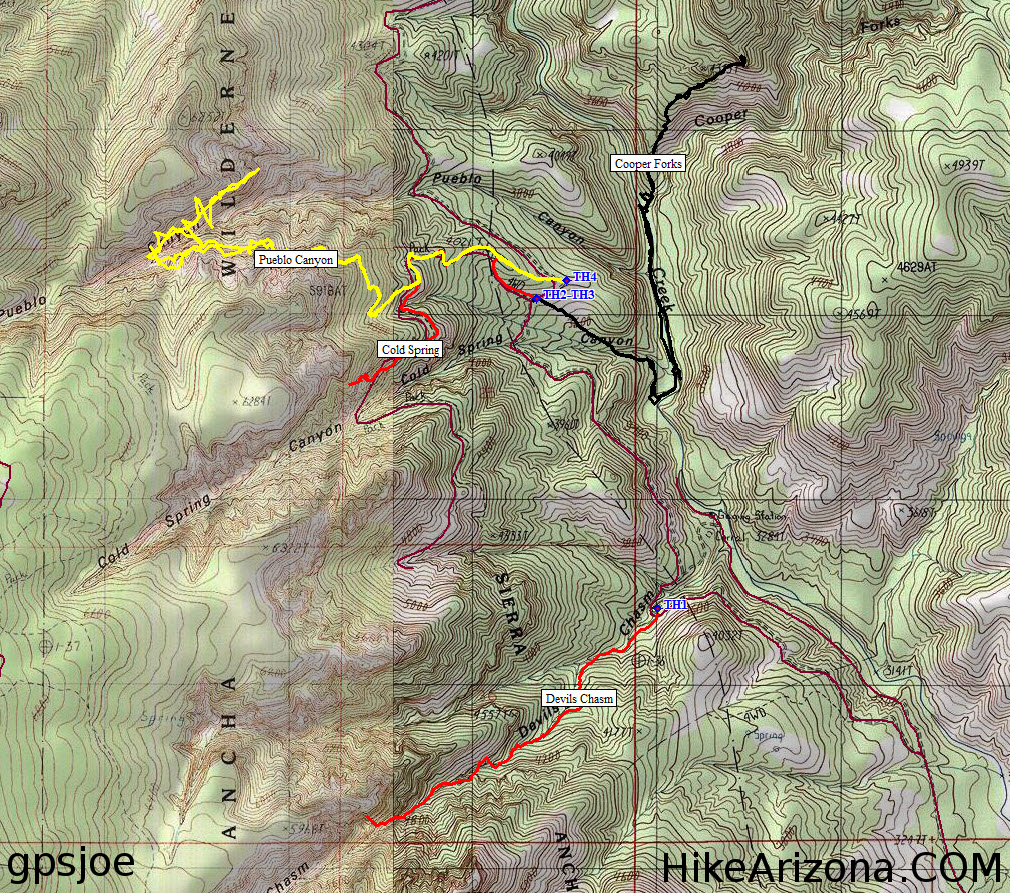
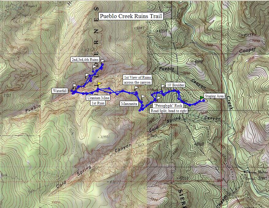
strenuous by Randal_Schulhauser   History HistoryPueblo Canyon derives its name from a group of cliff dwellings. The nearby asbestos mine named Pueblo Mine takes its name from the canyon. Look for an old mining road that crosses FR203 (Cherry Creek Road) between mile 23 and mile 24. There is a partially buried steel drainage pipe that crosses FR203 just before the mining road. Hike is described in Dave Wilson's book, "Hiking Ruins Seldom Seen". There are 4 distinct sets of ruins spread over the last mile of the hike. The site was first inhabited around A.D. 1290 and abandoned by A.D. 1330.
2017 dmassion writes Parking area for ruins (for GPS) is N 33 50.377’ W 110 51.924’ about 23.7 miles on FR203 (Cherry Creek Rd). Opposite parking area trail passes a sign and leads to the old mine road. Hike up the road staying along the ridge line, loose rocks everywhere so boots are better than tennis shoes. Trail will swing left but after entering the burn area you will cut back to the right and continue around to Pueblo Canyon. The first mile is tough and you gain 1000 feet, just 1500 feet to go! Now for the good/bad news: Good news, the Summer fires have burned all the manzanita so you don't have to stoop and bend through a tunnel of vegetation anymore. Bad news, as you approach the first ruins, and beyond burned dead falls block the trail so you have to climb over or crawl under these blacked beasts. White t-shirts no longer recognizable! Waterfall spectacular and was really flowing but very slippery.
Check out the Official Route and Triplogs. Note This is a moderately difficult hike. Leave No Trace and +Add a Triplog after your hike to support this local community. | ||||||||||||||||||||||||||||||||||||||||||||||||||||||||||||||||||||||||||||||||||||||||||||||||||||||