username
X
password
register
for free!
help


Cane Spring to Amethyst Peak, AZ

Guide 2 Triplogs  0 Topics
  0 of 5  
Fav
Wish
3
details
drive
no permit
forecast
map
stats
photos
triplogs
topics
location
14 2 0
Statistics
tap row or icons for details
Difficulty 5 of 5
Route Finding 3 of 5
Distance Round Trip 11.5 miles
Trailhead Elevation 2,874 feet
Elevation Gain 4,700 feet
Avg Time Round Trip 10 hours
Kokopelli Seeds 35
 Interest Off-Trail Hiking & Peak
 Backpack Yes
feature photo
Photos Viewed All MineFollowing
13  2009-03-29
Cottonwood Camp Loop
Hansenaz
14  2004-09-29 joebartels
Author
author avatar Guides 16,843
Routes 17,472
Photos 24
Trips 1 map ( 6 miles )
Age 28 Male Gender
Location HAZ, TrailDEX
Associated Areas
list map done
Phoenix Region
Historical Weather
Trailhead Forecast
Expand Map
Preferred Apr, Oct, Mar, Nov → 8 AM
Seasons   Late Autumn to Early Spring
Sun  6:02am - 6:46pm
1 Route
 
0 Alternative


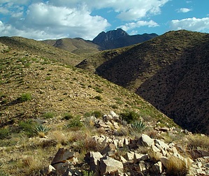
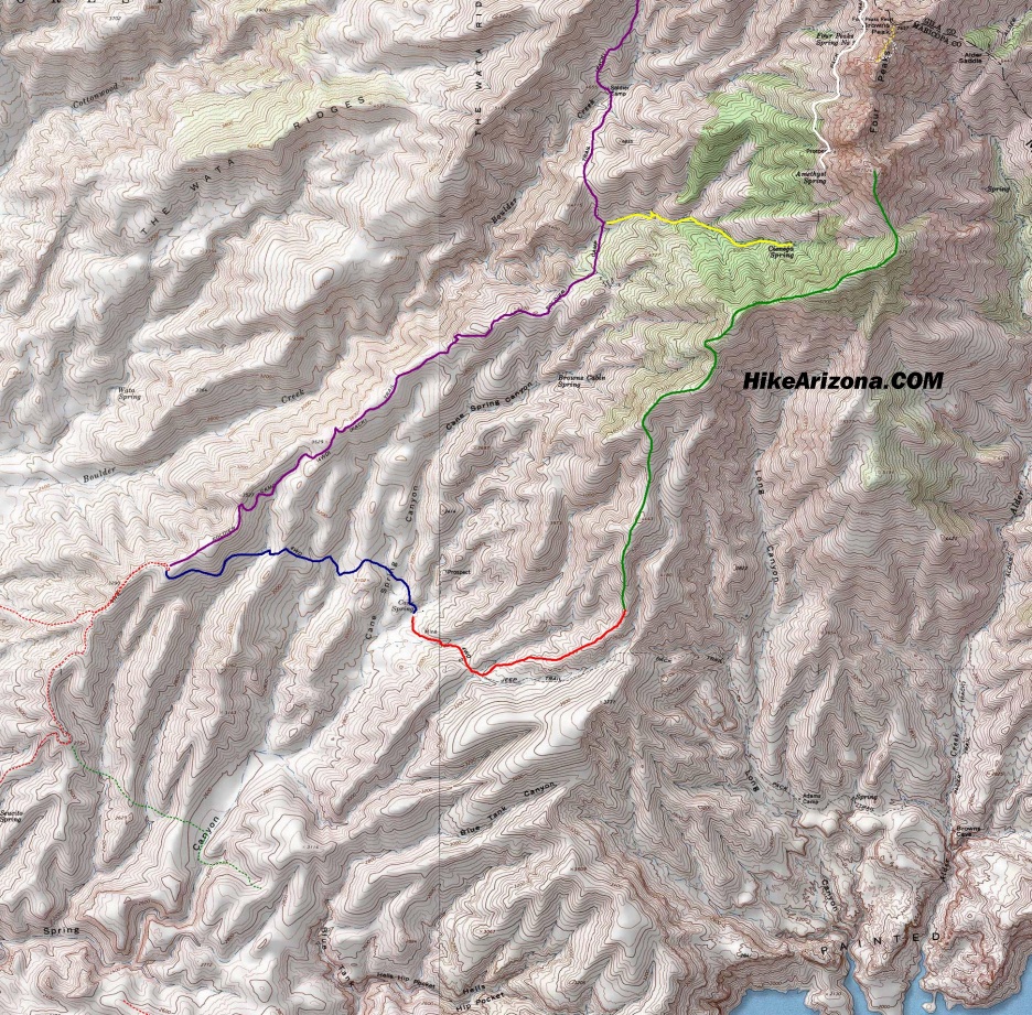
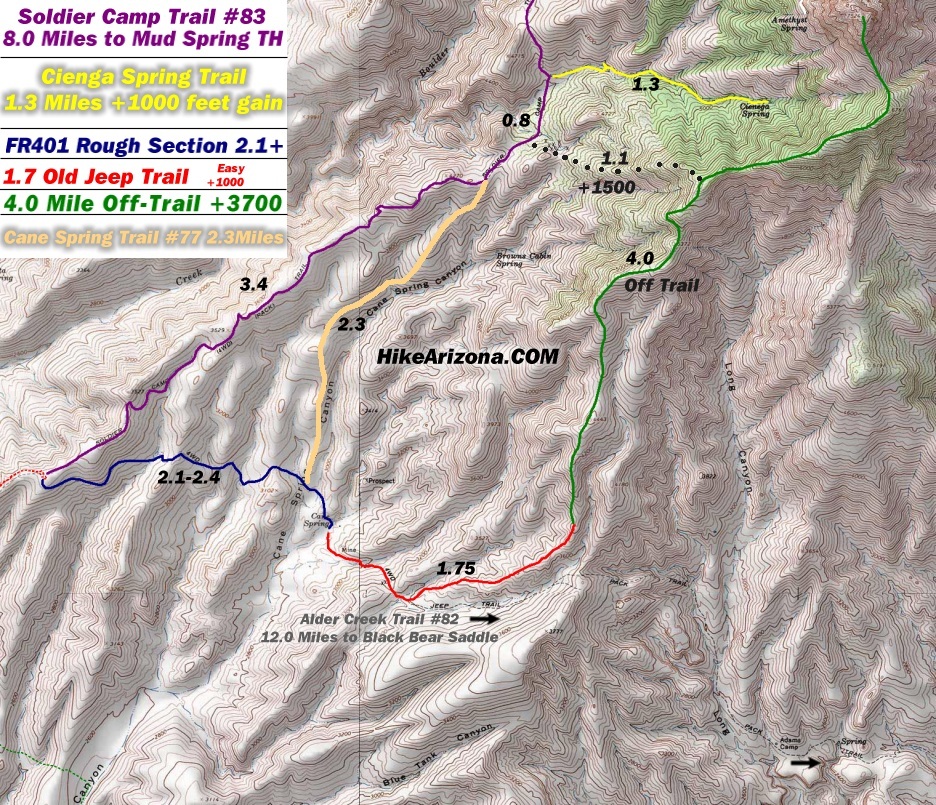
Southern Challenge
by HAZ_Hikebot


This may or may not be possible.

It's definitely possible up to the base of Amethyst Peak.


Terrain to base of peak "appears" to be easy off trail.
remove free decal offer
View 2nd map below for details.


  • Map Map
    guide related


Check out the Triplogs.

Note
This is a difficult hike. Arrive fit and prepared or this could get ugly.
Leave No Trace and +Add a Triplog after your hike to support this local community.
WARNING! Hiking and outdoor related sports can be dangerous. Be responsible and prepare for the trip. Study the area you are entering and plan accordingly. Dress for the current and unexpected weather changes. Take plenty of water. Never go alone. Make an itinerary with your plan(s), route(s), destination(s) and expected return time. Give your itinerary to trusted family and/or friends.

 Permit $$
None


 Directions
or
 Road
Strictly 4x4

To Cane Trailhead
From Scottsdale follow Shea Blvd East to its terminus at SR87. Turn Left onto SR87. Follow SR87(this is the Beeline) to the Four Peaks Turnoff which is FR143. FR143 is well marked. Follow FR143 to FR 401. Hang a right onto FR401(FR401A in 2023) and follow past Cottonwood Camp. Continue to where FR401 ascends out of Cottonwood Creek up the side of the mountain. Here on it's strictly 4x4. It starts low-key for the first couple of miles then turns... fun! It's 6 miles to Cane Spring Trailhead. The 4x4 section alone takes 1 to 1.5 hours.

Keep in mind albeit near the valley this is about 5 hours round trip depending on variables.

From PHX (I-10 & AZ-51) 52.0 mi, 1 hour 37 mins
From TUC (Jct 1-10 & Grant) 150 mi, 3 hours 7 mins
From FLG (Jct I-17 & I-40) 179 mi, 3 hours 38 mins In current traffic: 3 hours 38 mins I-17 S
 90+° 8am - 6pm kills
helpcorrectionissue

end of page marker