Route Editor

| Guide | ♦ | 17 Triplogs | 0 Topics |
details | drive | no permit | forecast | map |
stats |
photos | triplogs | topics | location |
| 35 | 17 | 0 |
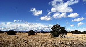
Hills, knolls and mountains by conform6073   Murray Basin Recreation Area is one of Apache-Sitgreaves National Forest's most recent projects. So recent that it's not mentioned on the official website; and the people who answer the phone at the Springerville Ranger District know next to nothing about it. Murray Basin Recreation Area is one of Apache-Sitgreaves National Forest's most recent projects. So recent that it's not mentioned on the official website; and the people who answer the phone at the Springerville Ranger District know next to nothing about it.Murray Basin and the surrounding hills, knolls, and mountains appear to occupy about 5,000 acres of pinon and juniper forest and grassland just south of the conjoined communities of Eagar and Springerville. The basin itself lies at about 7,200 feet elevation, and Flat Top Mountain, the highest point, reaches above 8,100 feet. The trail system comprises three trails - Homestead, Windmill, and Murray Basin - and, possibly, a fourth to the top of Flat Top Mountain, totaling about fifteen miles.
Check out the Triplogs. Leave No Trace and +Add a Triplog after your hike to support this local community. | |||||||||||||||||||||||||||||||||||||||||||||||||||||||||||||||||||||||||||||