 Route Editor

| Guide | ♦ | 22 Triplogs | 2 Topics |
details | drive | no permit | forecast | 🔥 route |
stats |
photos | triplogs | topics | location |
| 281 | 22 | 2 |
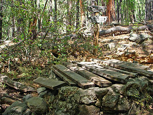
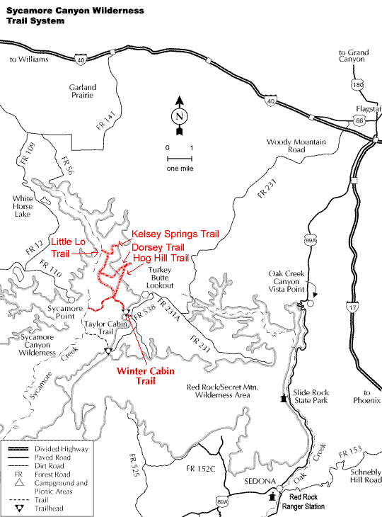
descent into canyon by cyroc   From all the reports I'd been able to find, the upper area of Sycamore Canyon was seldom visited, yet beautiful. Having spent a week hiking out of a base in Tucson, I was ready for the road less traveled. My wife and I tackled this one in May '04. Good call. From all the reports I'd been able to find, the upper area of Sycamore Canyon was seldom visited, yet beautiful. Having spent a week hiking out of a base in Tucson, I was ready for the road less traveled. My wife and I tackled this one in May '04. Good call.The latest update from the RS in Flagstaff suggested that the rental car wouldn't make it to the Kelsey trailhead. The drive out to the turnoff to Casner Tank was scenic and very smooth. Road maintenance seems to end at that point. Progressively worsening obstacles had us entertained for less than a half-mile before we had to park just shy of the Tank. Ample parking spaces there suggest that this was a commonly used unofficial trailhead. A few very deep mud holes block two-wheel access between there and the real trailhead. The additional 1.5 mile and 200' descent is a minor inconvenience only.
After setting up camp and getting a bite, we retraced our steps to check out the unnamed canyon to the northeast of Geronimo Spring. It narrowed and was very scenic for the short distance we went. We got stopped by a pool and mud hole spanning the canyon, cliffs on both sides. There might have been mountain lion tracks in the mud. Going back to camp, we set out up the broad floored Sycamore Canyon upstream to explore as much as we could. There are campsite possibilities on both sides where floodplains have developed. Interesting pools in the occasional limestone floor seem to indicate underground flow. Otherwise, the 'trail' is mostly boulder hopping. After a couple of miles, Volunteer Canyon comes in on the right, and we decided to explore it rather than the broader Sycamore. Like the unnamed canyon of earlier in the day, it too narrowed and was an incredible place! We got perhaps a mile up it before the fear of loss of daylight forced us to turn back. Yes, we both had adequate headlights, but the thought of boulder hopping after dark... As it was, we had allowed ample time to get back and cook and eat dinner before night fell. The next day we broke camp, dumped excess water, and hiked/climbed out. That gradient was steep, a good workout, but we beat our estimated time ( I forget what it was ). That 200' 'ascent' from the trailhead to the car was not even noticeable.
Check out the Official Route and Triplogs. Leave No Trace and +Add a Triplog after your hike to support this local community. One-Way Notice This hike is listed as One-Way. When hiking several trails on a single "hike", log it with a generic name that describes the hike. Then link the trails traveled, check out the example. | |||||||||||||||||||||||||||||||||||||||||||||||||||||||||||||||||||||||||||||||||||||||||||||||||||||||||||||||||||||||||||||||||||||||||||||||||||||||||||||||||||||||||||||||||||||||||||||||||


