 Route Editor

| Guide | ♦ | 67 Triplogs | 0 Topics |
details | drive | permit | forecast | 🔥 route |
stats |
photos | triplogs | topics | location |
| 283 | 67 | 0 |
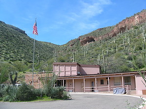
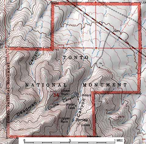
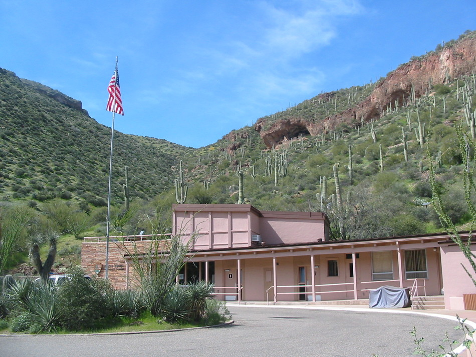
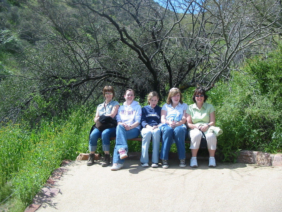
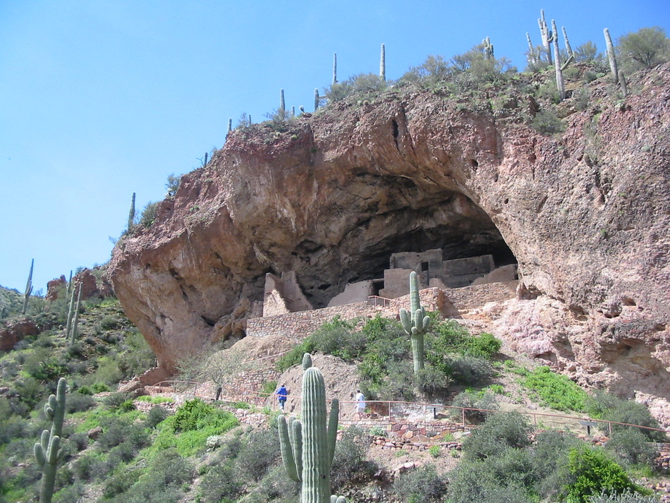
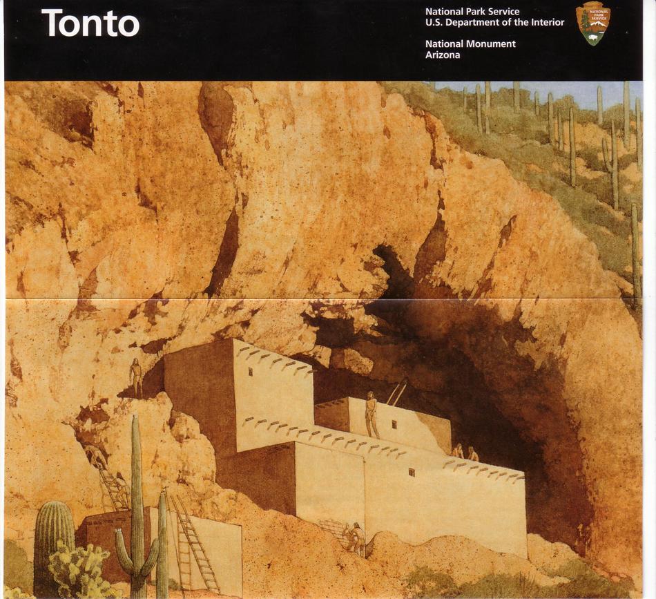
Roosevelt attractions by Randal_Schulhauser  The Tonto National Monument is an Arizona icon appearing in just about every travel brochure or guidebook on the American South West. With March break in full swing and our house full of "city" visitors from Canada, a combination of Arizona scenery, history, culture, and non-strenuous exercise is in order. A trip to the lower cliff dwellings will score high on all four criteria. The Tonto National Monument is an Arizona icon appearing in just about every travel brochure or guidebook on the American South West. With March break in full swing and our house full of "city" visitors from Canada, a combination of Arizona scenery, history, culture, and non-strenuous exercise is in order. A trip to the lower cliff dwellings will score high on all four criteria.Start your hike at the visitor's center. There's an interpretive film playing continuously in the amphitheater that provides background history about the Salado people. Artifacts are also prominently displayed. I was impressed by the impromptu collection of wildflower photos and identification hints. Learned the names of a couple of flowers I'd previously been unable to identify! The ranger on duty proved to be an encyclopedia of knowledge...
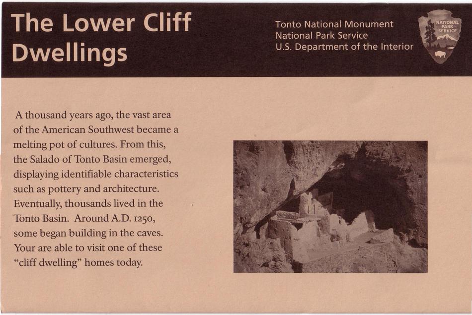
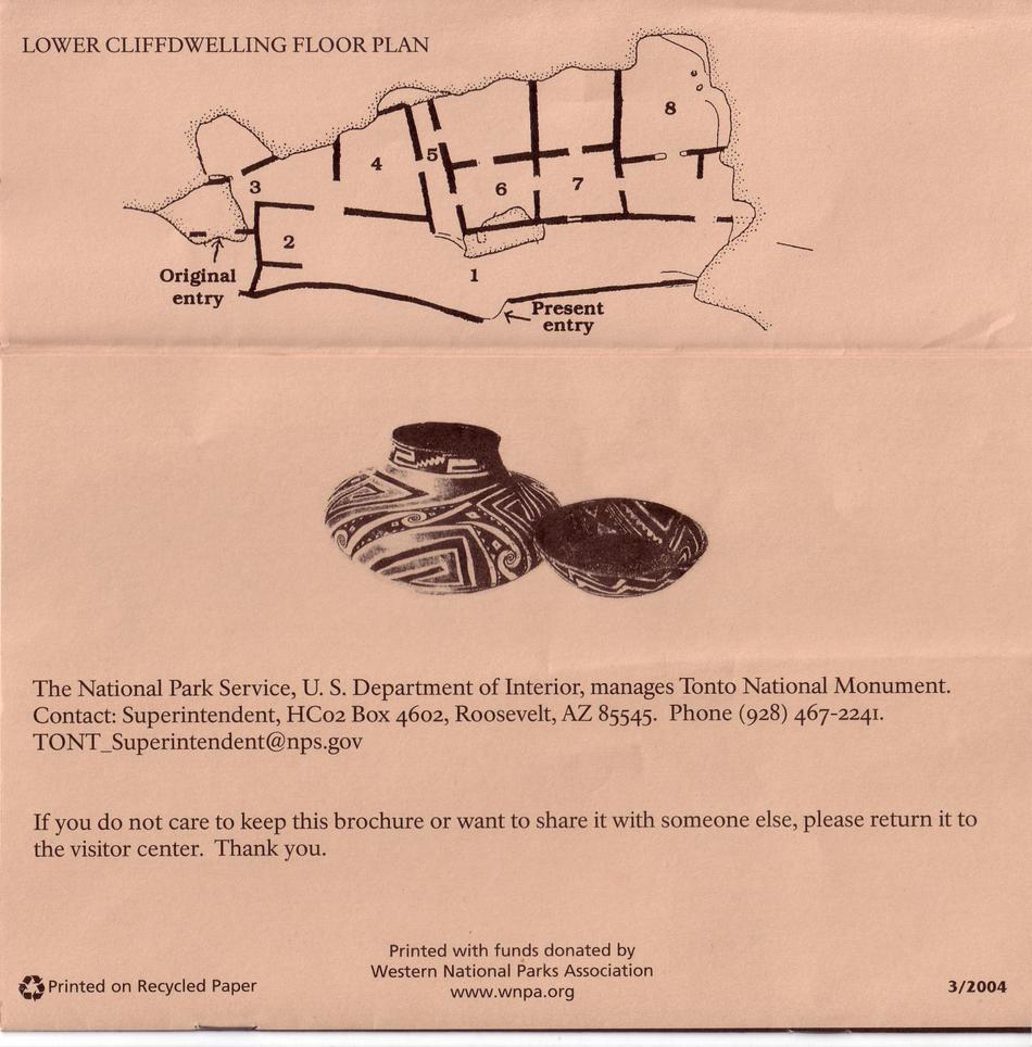
The Lower Cliff Dwellings come into prominent view at the next-to-last switchback. This is a primo photo spot! Once at the cliff dwellings, take your time exploring the 8 areas/rooms identified on the floor plan. You will discover that the extreme west side of the ruin was the original entry to the cliff dwelling. The "V-shaped" notch in the wall was the only way to enter the cliff dwelling. A removable ladder provided access. Also, note the wooden beams supporting the saguaro-ribbed roof. The remains of a mano and metate (grinding stone and basin) are located in one of the more complete rooms. Many more factoids are shared in the NPS brochure available at the visitor's center. This easy trail is an excellent introduction to the archeological wonders of the American southwest, particularly for kids. This is a highly recommended destination if you have out of state visitors with varied physical capabilities or interests. Enjoy!
Tonto NM NPS Details Well-preserved cliff dwellings were occupied by the Salado culture during the 13th, 14th, and early 15th centuries. The people farmed in the Salt River Valley and supplemented their diet by hunting and gathering native wildlife and plants. The Salado were fine craftsmen, producing some of the most exquisite polychrome pottery and intricately woven textiles to be found in the Southwest. Many of these objects are on display in the Visitor Center museum. The monument is located in the Upper Sonoran ecosystem, known primarily for its characteristic saguaro cactus. Other common plants include: cholla, prickly pear, hedgehog, and barrel cactus (blooming April through June); yucca, sotol, and agave; creosote bush and ocotillo; palo verde and mesquite trees; an amazing variety of colorful wild flowers (February through March); and a lush riparian area which supports large Arizona black walnut, sycamore, and hackberry trees. Check out the Official Route and Triplogs. Leave No Trace and +Add a Triplog after your hike to support this local community. | ||||||||||||||||||||||||||||||||||||||||||||||||||||||||||||||||||||||||||||||||||||||||||||||||||||||||||||||||||||||||||||||||||||||||||||||||||||||||||||||||||||||||||||||||||||||||||||||||||||||||||||


