 Route Editor

| Guide | ♦ | 47 Triplogs | 1 Topic |
details | drive | no permit | forecast | 🔥 route |
stats |
photos | triplogs | topic | location |
| 839 | 47 | 1 |
Canyons are inherently risky. Flash floods occur without notice on sunny days. Technical skills & surrounding topography knowledge required yet does not eliminate risk.
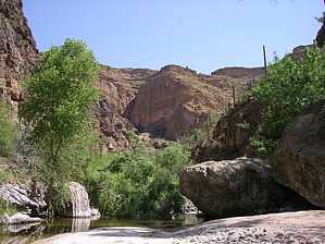
Beautiful, rarely visited canyon by AZOutdoorsman   Caution CautionThis canyon is susceptible to flash flooding and it does not have a trail, which makes it slow going... about one mile an hour. Having seen this Lower Fish Creek Canyon on the map, I have wanted to do this hike for years. I love water-hikes and have always wondered why this one doesn't get the publicity of its very popular "Upper" brother. Plus there is the added bonus of an easy shuttle setup. After completing this spectacular hike and not seeing a soul in the middle 90% of the hike I was torn as to whether to publish it. Well, lucky you, here it is.
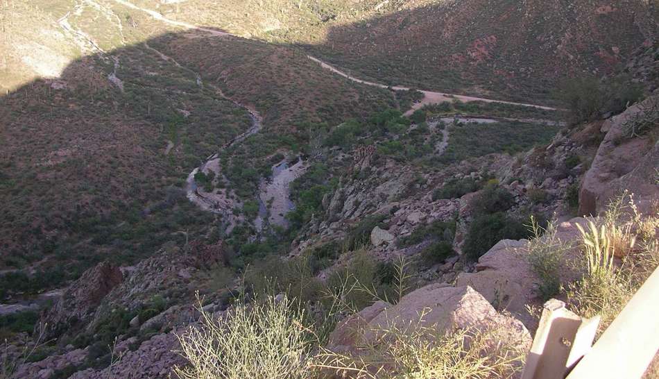
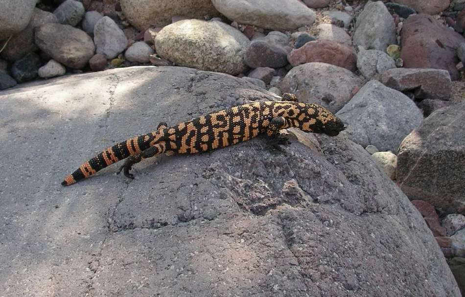
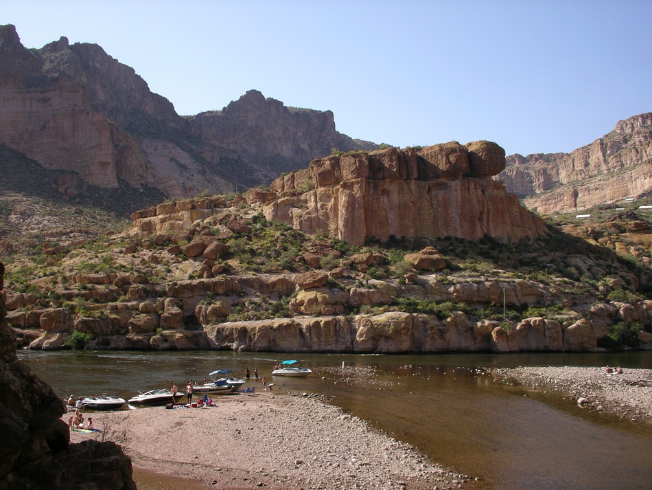
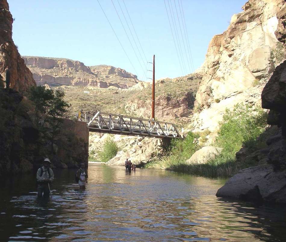
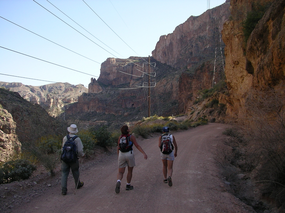
Drive in on the Apache Trail (AT) and just before Mile Post 219 take FR 80 - there is a sign (see map) 1.6 miles down to the locked gate and drop a shuttle vehicle there. Head back up to AT and continue heading east. After heading down the always-adventurous Fish Creek Hill you will cross the bridge and continue 0.7 miles to pullout on your left. Hike From your car head north to the creek and start hiking downstream. After about a mile the high canyon walls begin to close in as the canyon narrows. We were treated with a rare encounter of the "sonoran monster". This riparian paradise continues with many cottonwoods and sycamores. There were many creek crossings, but none above mid-thigh. There are beautiful pools to take a dip in if you like. There is lots of rock hopping, but not as much scrambling as Upper Fish. The last part of the canyon is narrow with wall-to-wall water where the lake is coming up into the creek. We started to run into boaters, and litter, which I cleaned up, from the river channel of Canyon Lake who hiked up the creek. The bridge across the creek will soon come into view; we exited the creek on our left at the bridge. This completes the 5.5-mile hike down the canyon, now we walked the road back up 2.5 miles to our waiting shuttle vehicle at the gate. This part of the hike is all uphill (+800'), as the first part down the canyon was of course all downhill (-450'). The drive back to the starting vehicle is 6.5 miles. Summary What an awesome hike! A beautiful creek encased with towering canyon walls, solitude, and an abundance of wildlife. It's so close to the valley and has a convenient shuttle. Let's keep it beautiful and pristine by cleaning up after others who may have a different level of consciousness. You can eat at Tortilla Flats afterward, but I prefer the Canyon Lake Marina Restaurant's back patio that overlooks the lake. Enjoy!!! : ) Gate Policy: If a gate is closed upon arrival, leave it closed after you go through. If it is open, leave it open. Leaving a closed gate open may put cattle in danger. Closing an open gate may cut them off from water. Please be respectful, leave gates as found. The exception is signage on the gate directing you otherwise.
Check out the Official Route and Triplogs. Leave No Trace and +Add a Triplog after your canyon trip to support this local community. | |||||||||||||||||||||||||||||||||||||||||||||||||||||||||||||||||||||||||||||||||||||||||||||||||||||||||||||||||||||||||||||||||||||||||||||||||||||||||||||||||||||||||||||||||||||||||||||


