username
X
password
register
for free!
help


Memorial Park, TX

Guide 2 Triplogs  0 Topics
  3 of 5  
Fav
Wish
0
details
drive
no permit
forecast
route  
stats
photos
triplogs
topics
location
28 2 0
Statistics
tap row or icons for details
Difficulty 0.5 of 5
Route Finding 1 of 5
Distance One Way 0 miles
Trailhead Elevation 75 feet
 Interest Perennial Creek
 Backpack No
feature photo
Photos Viewed All MineFollowing
Will recalculate on button tap!
28  2014-02-23 kingsnake
Author
author avatar Guides 116
Routes 337
Photos 11,399
Trips 894 map ( 8,139 miles )
Age 63 Male Gender
Location Sunnyslope, PHX
Associated Areas
list map done
Gulf Coast Region
Historical Weather
Trailhead Forecast
Radar Map
Expand Map
Preferred Feb, Dec, Mar, Nov
Sun  6:01am - 6:40pm
Official Route
 
0 Alternative


History: Houston's Memorial Park is located on the grounds of World War I-era Camp Logan. It has been a city park since 1924, and is named for those lost in The Great War. Depending on where you travel in the park, you may find remnants of Camp Logan, such as concrete walls, or bits of old blacktop.


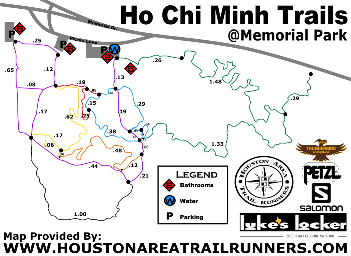
Overview: Memorial Park is a 1,503-acre city park with tennis courts, baseball fields, a golf course, fitness center, swimming pool and at least 10 miles of official biking/hiking trails, some paved, some not. (There are a couple more miles of unofficial trails.) At least the unpaved trails are multi-use.
remove free decal offer
The paved trail along Memorial Drive is so popular, my first impression was that I was seeing a walkathon or marathon. It makes Camelback's Cholla trailhead look sparsely populated.

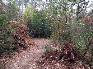
The unpaved trails south of Memorial Drive can be difficult to follow, due to heavy vegetation -- thus the nickname "Ho Chi Minh Trail" -- and many of them being unofficial (e.g. the southern leg of the green loop). The heavy vegetation makes it hard to spot bikes, so stay alert. As I did, you will probably make many wrong turns, even if armed with a map, but you can't get lost: If you hit the river: head north.

I could not find any rural hiking options in the area -- Houston is a ginormous metropolis -- so Memorial Park is a solid option near the middle of the city for any visitor's who want something more than the exercise room in their hotel.


2014-02-27 kingsnake
  • Map
    guide related
    Map


Check out the Official Route and Triplogs.
Leave No Trace and +Add a Triplog after your hike to support this local community.

One-Way Notice
This hike is listed as One-Way.

When hiking several trails on a single "hike", log it with a generic name that describes the hike. Then link the trails traveled, check out the example.
WARNING! Hiking and outdoor related sports can be dangerous. Be responsible and prepare for the trip. Study the area you are entering and plan accordingly. Dress for the current and unexpected weather changes. Take plenty of water. Never go alone. Make an itinerary with your plan(s), route(s), destination(s) and expected return time. Give your itinerary to trusted family and/or friends.

 Permit $$
None


 Directions
or
 Road
Paved - Car Okay

To hike
Houston's Memorial Park is located just inside I-610, the inner loop freeway, about four miles west of downtown. How you get there is up to you, but if you are unfamiliar with Houston traffic is brutal on the freeways, especially during weekday rush hour, despite there being lots of them. Best bet is probably to take a major city street to Memorial Drive, then travel east/west on that to the parking area, which is by the baseball fields.
page created by HAZ_Hikebot on Feb 27 2014 4:04 am
 90+° 8am - 6pm kills
helpcorrectionissue

end of page marker