 Route Editor

| Guide | ♦ | 48 Triplogs | 0 Topics |
details | drive | no permit | forecast | route |
stats |
photos | triplogs | topics | location |
| 438 | 48 | 0 |
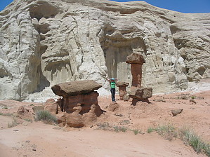
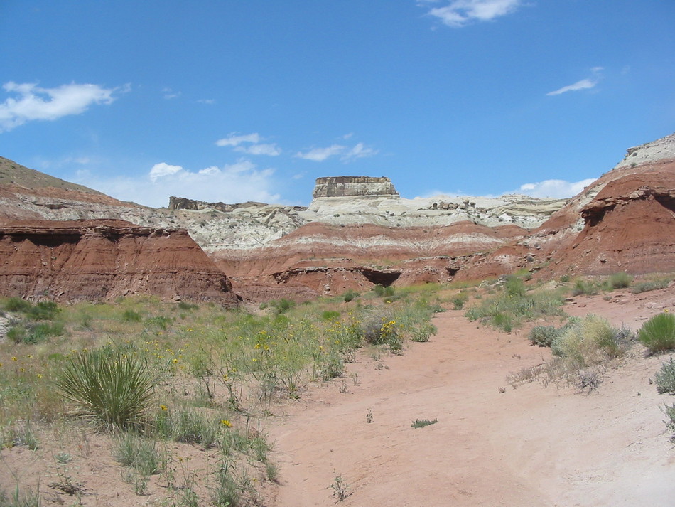
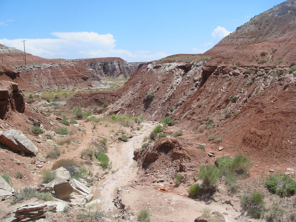
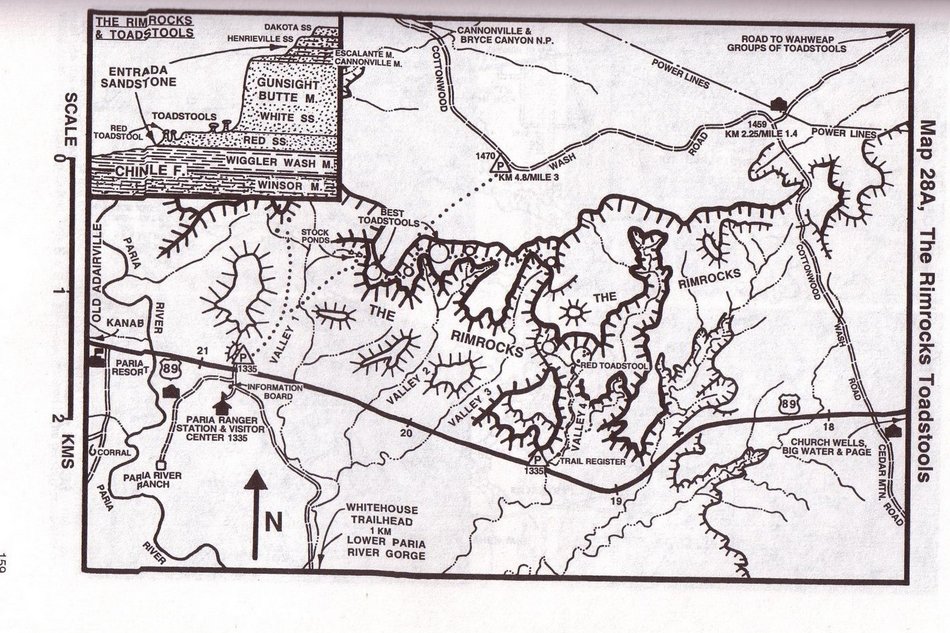
Mushrooms ROCK! by Randal_Schulhauser  Traveling west on Hwy 89, between mile marker 19 and 20 as you descend into the Paria River Valley, there will be trailhead parking on the North side. Note that you are in Utah, near the Arizona border. Pass through a hiker's gate and sign in at the trail register box. Wow... this is one of the few Trail Heads not collecting a $5 day use fees!
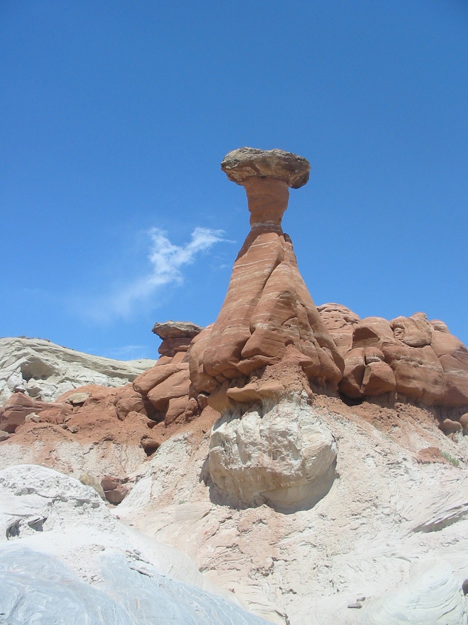
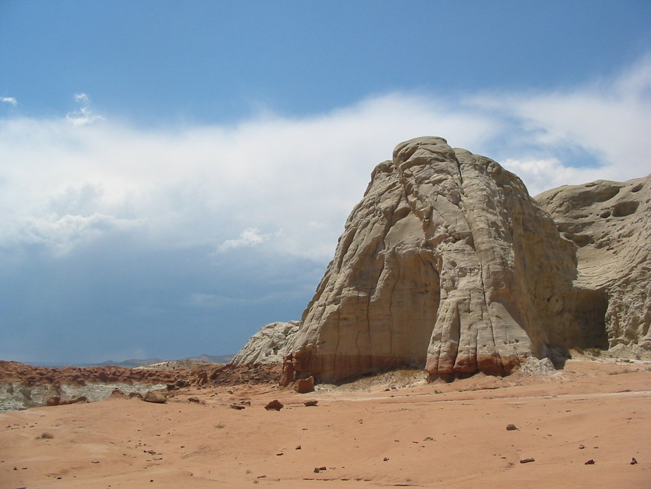
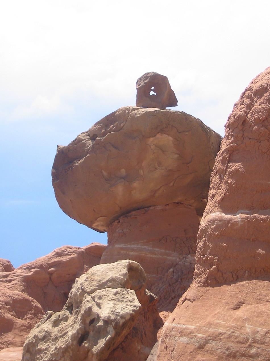
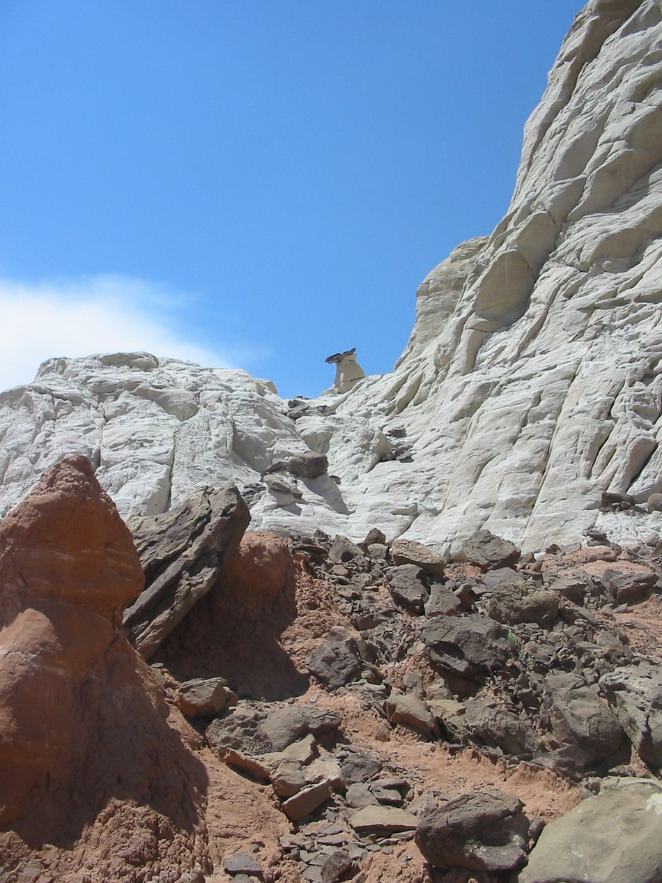
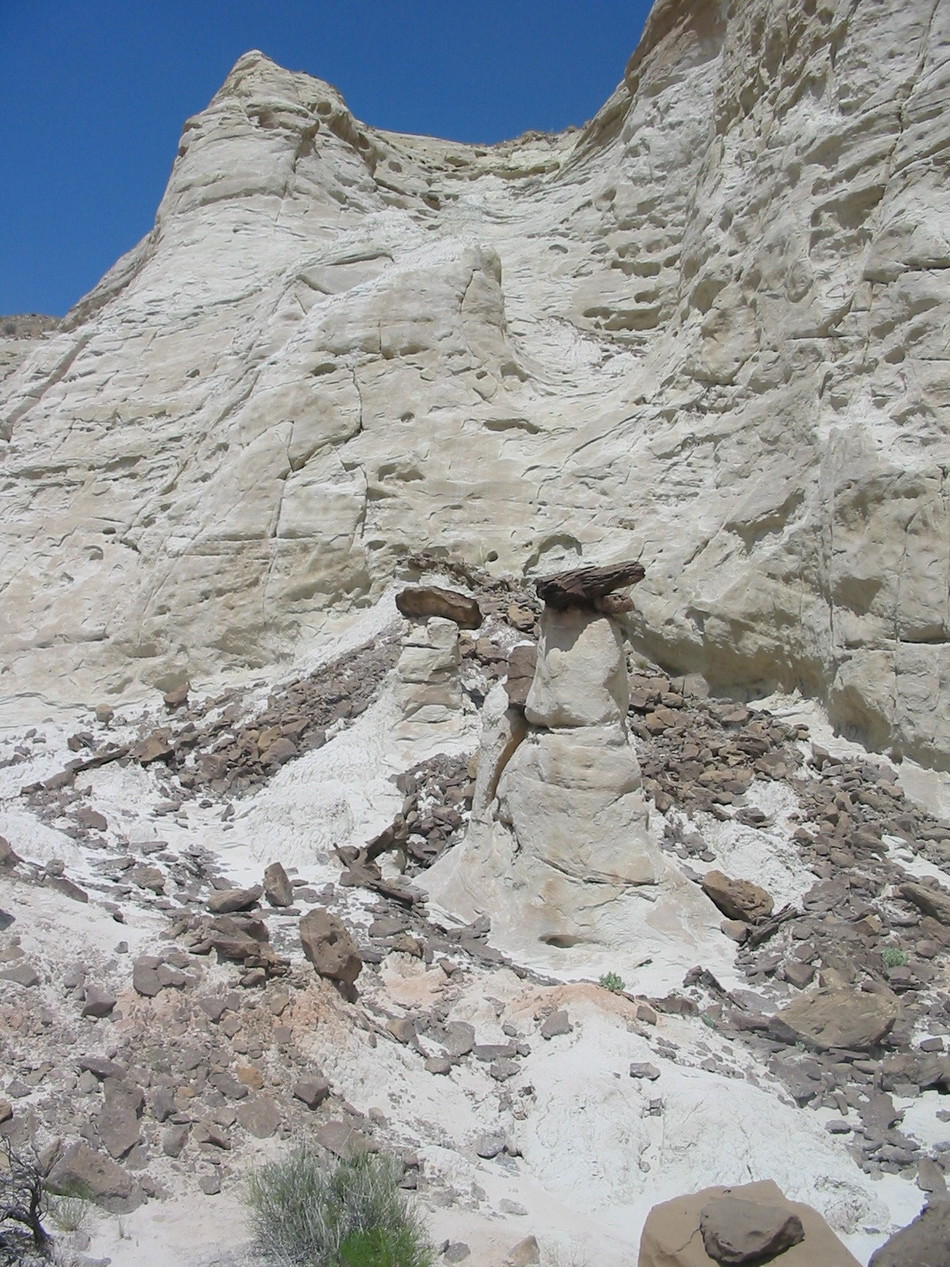
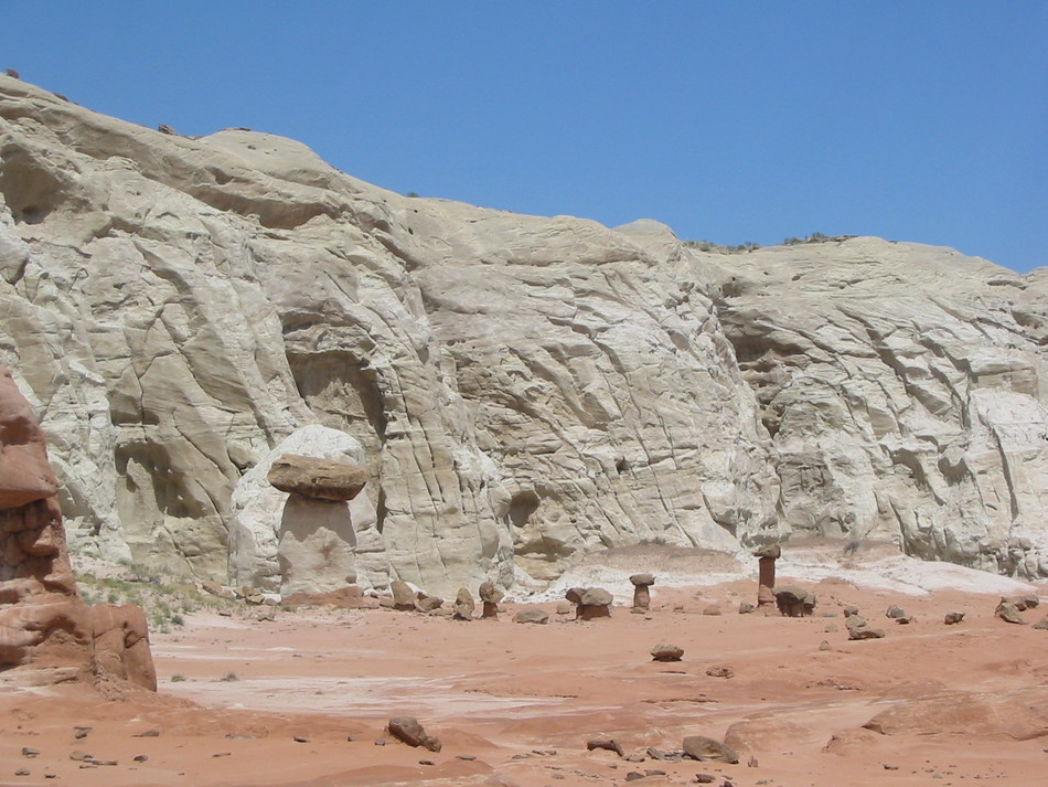
Climb up to the ledge behind the Red Toadstool to reveal several mushroom patches to the north and east about 500 feet. After exploring these mushroom patches, follow the cairns to the west towards the elephant foot rock formation. Beyond the elephant foot is a keyhole rock pointing towards a lone white stem with red cap toadstool. Climb around the ridge and obtain a spectacular view of the Paria River Valley. A fairy ring of toadstools can be found by following the rim to the north and east. Continuing along the rim will result in even more toadstools. Gate Policy: If a gate is closed upon arrival, leave it closed after you go through. If it is open, leave it open. Leaving a closed gate open may put cattle in danger. Closing an open gate may cut them off from water. Please be respectful, leave gates as found. The exception is signage on the gate directing you otherwise. Check out the Official Route and Triplogs. Leave No Trace and +Add a Triplog after your hike to support this local community. | ||||||||||||||||||||||||||||||||||||||||||||||||||||||||||||||||||||||||||||||||||||||||||||||||||||||||||||||||||||||||||||||||||||||||||||||||||||||||||||||||||||||||||||||


