 Route Editor

| Guide | ♦ | 36 Triplogs | 0 Topics |
details | drive | permit | forecast | route |
stats |
photos | triplogs | topics | location |
| 138 | 36 | 0 |
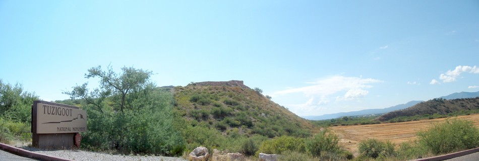
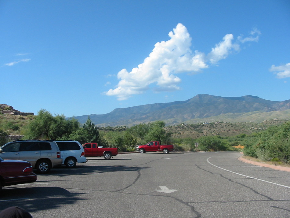
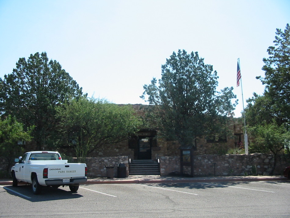
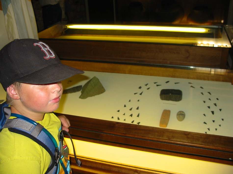
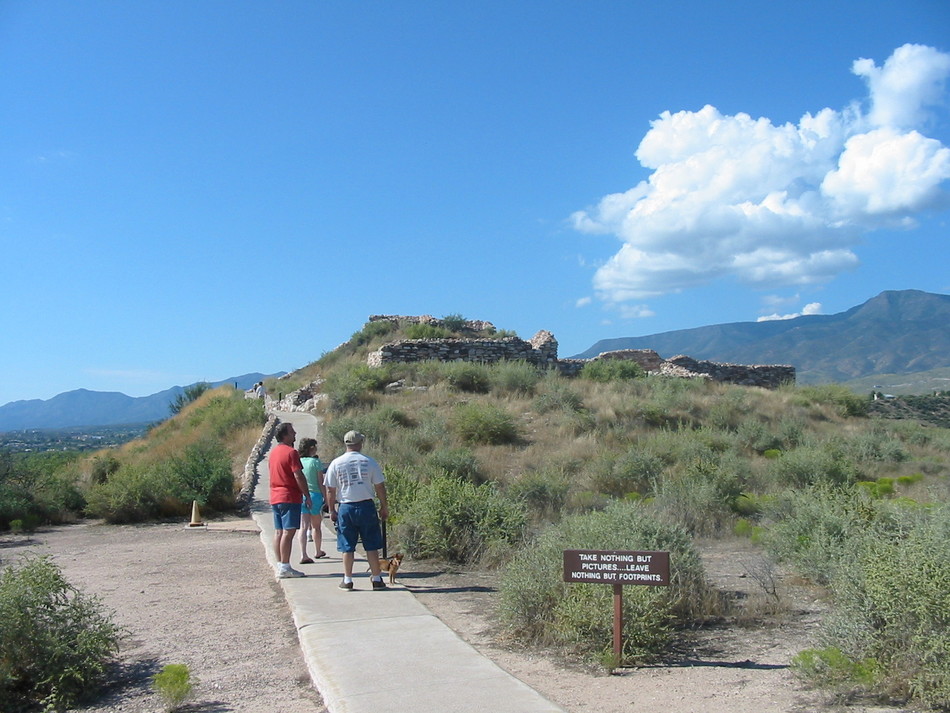
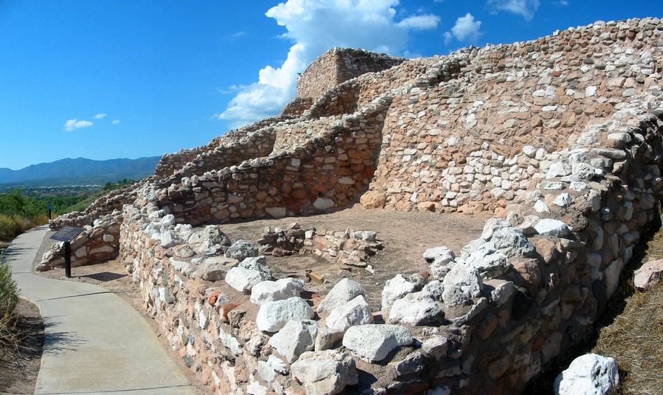
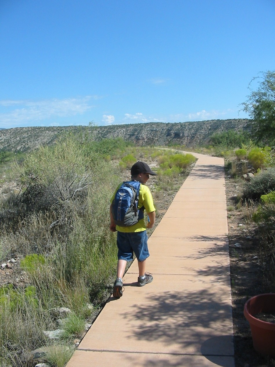
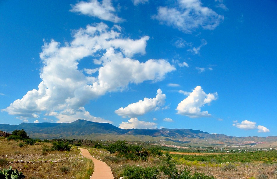
easy (kid friendly) by Randal_Schulhauser  Overview OverviewThe Tuzigoot National Monument is another Arizona icon prominently featured in many travel brochures and guidebooks on the American South West. I recently visited the "sister" National Monuments in the Verde Valley, Montezuma Well, and Castle, and missed out on Tuzigoot to complete the ruins "hat-trick". A recent trip to the area allowed me to make amends. Pull into the Visitor Center parking lot, and you will soon discover that there are 2 trails to be explored. The Ruins Loop trail is 0.70 miles (per my GPS) or 1/4 mile (per NPS) long. The Tavasci Marsh Overlook trail is 0.76 miles (per my GPS) or 1/4 mile (per NPS) long. Both trails are paved in concrete, so don't expect a wilderness experience. Suspect the distance discrepancy is a function of curiosity! There's plenty of park benches strategically located about every 100 feet allowing one to rest and ponder the history.
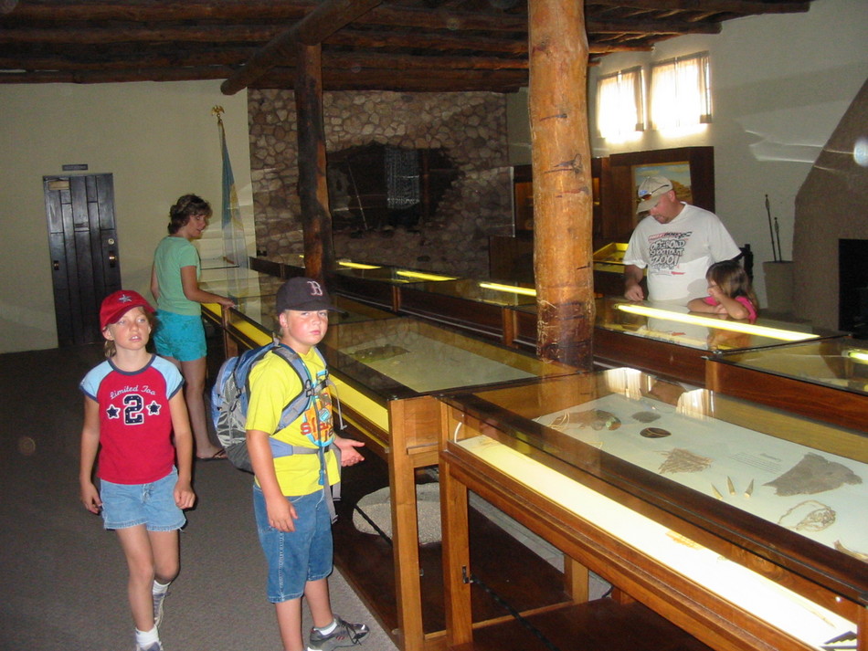
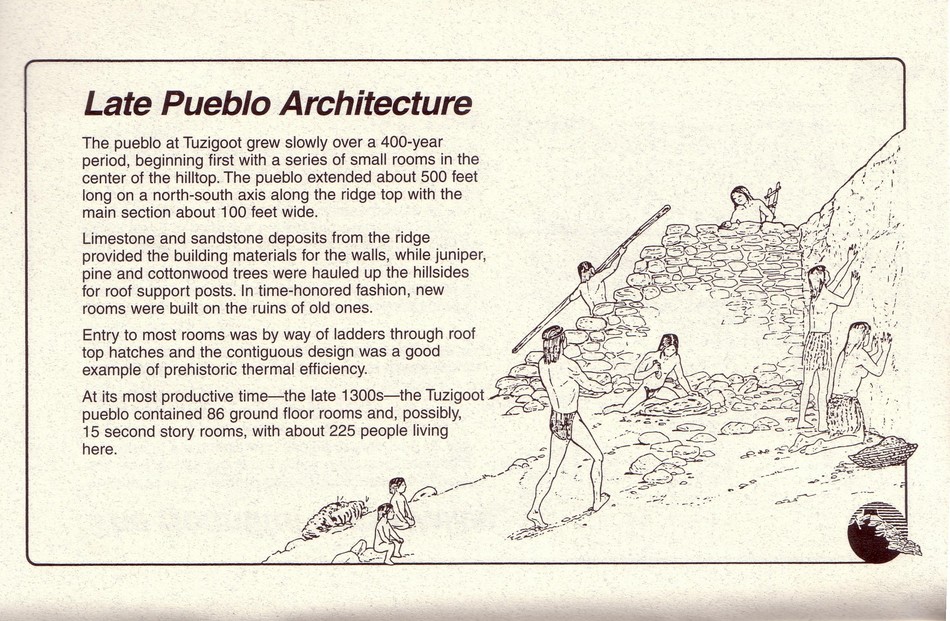
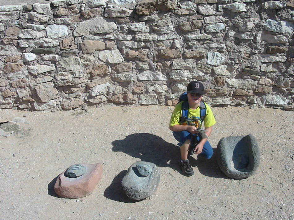
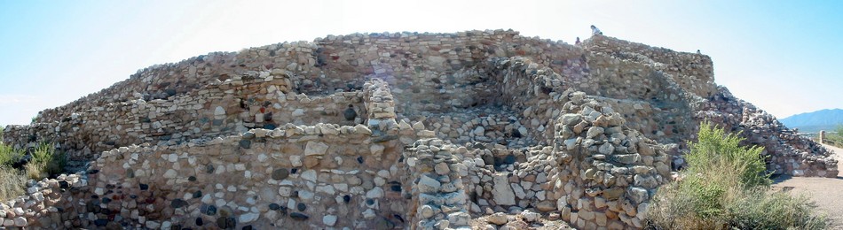
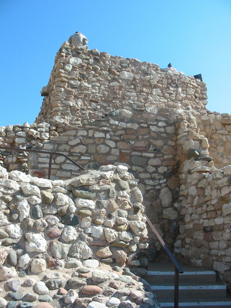
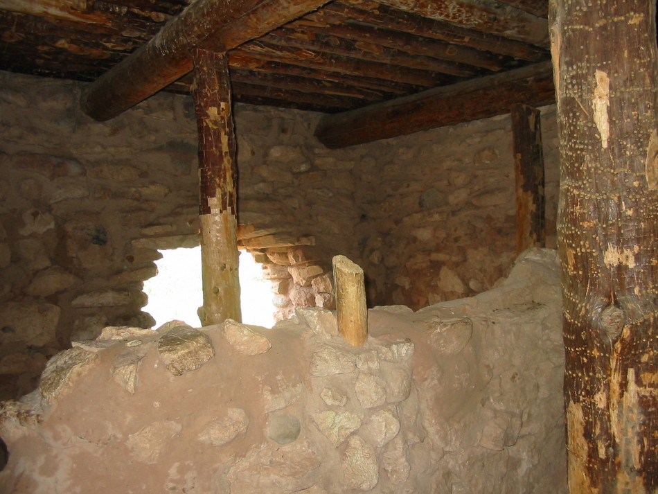
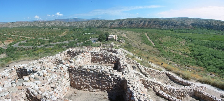
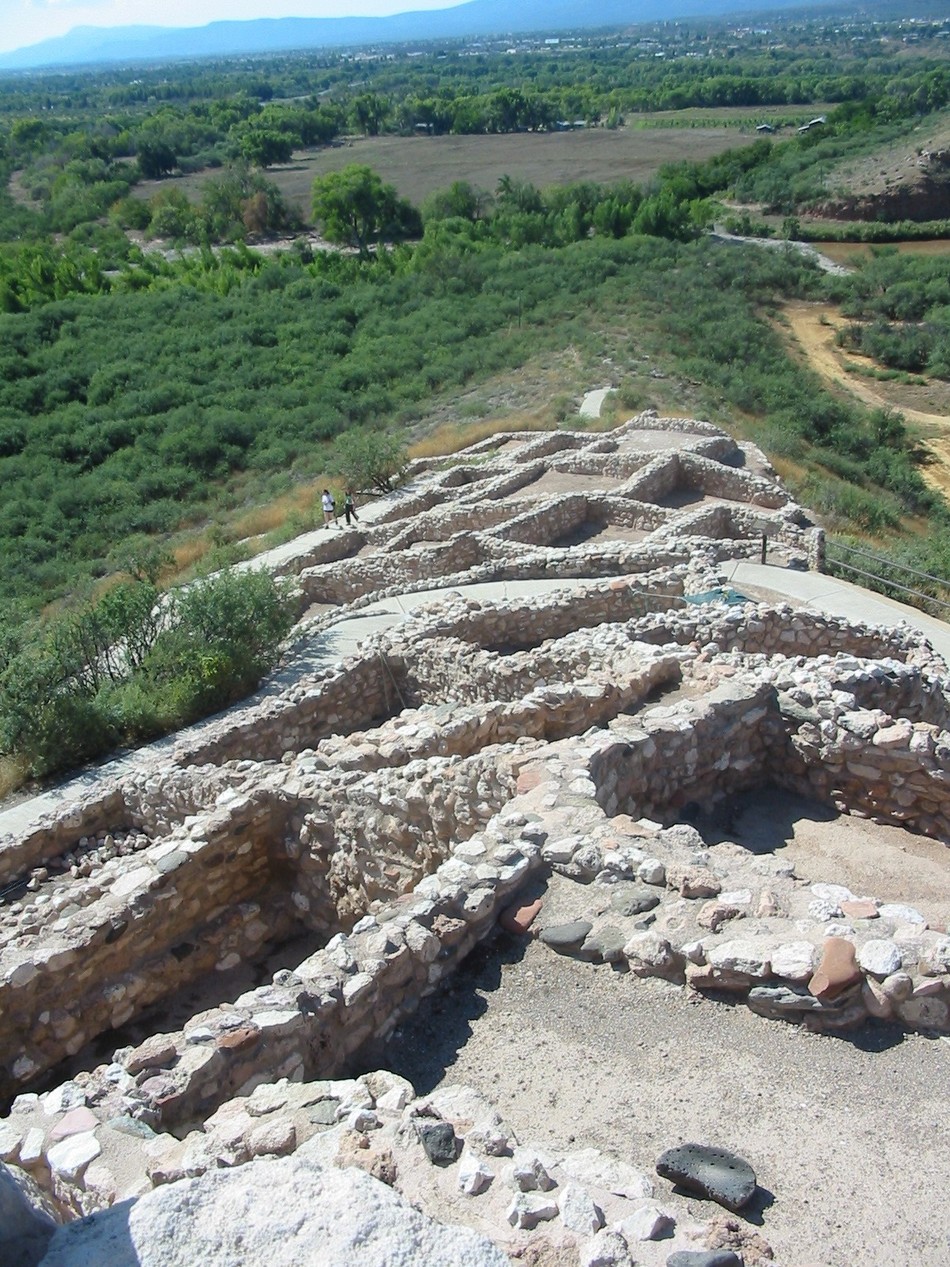
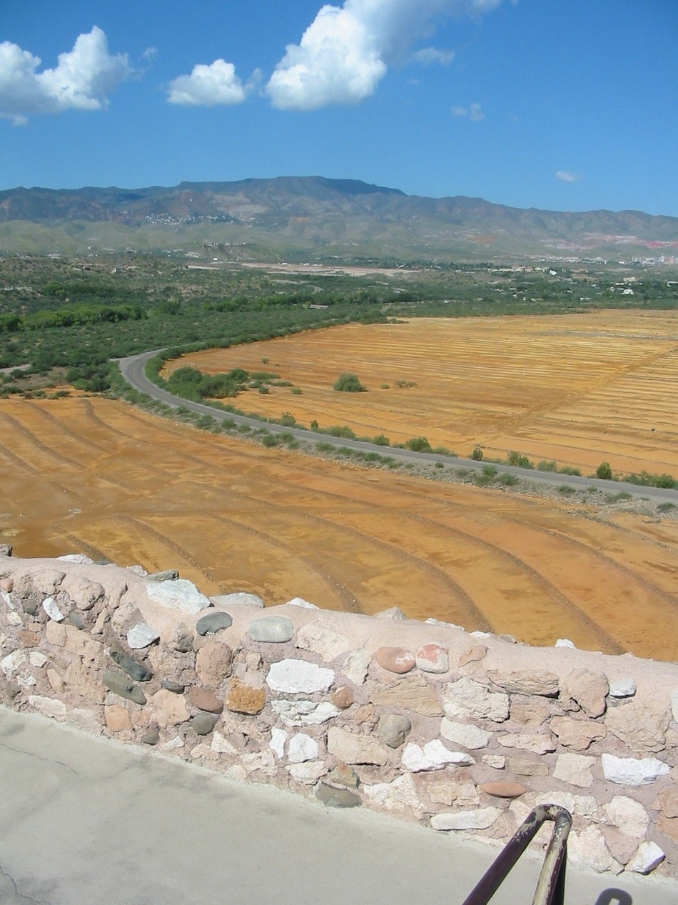
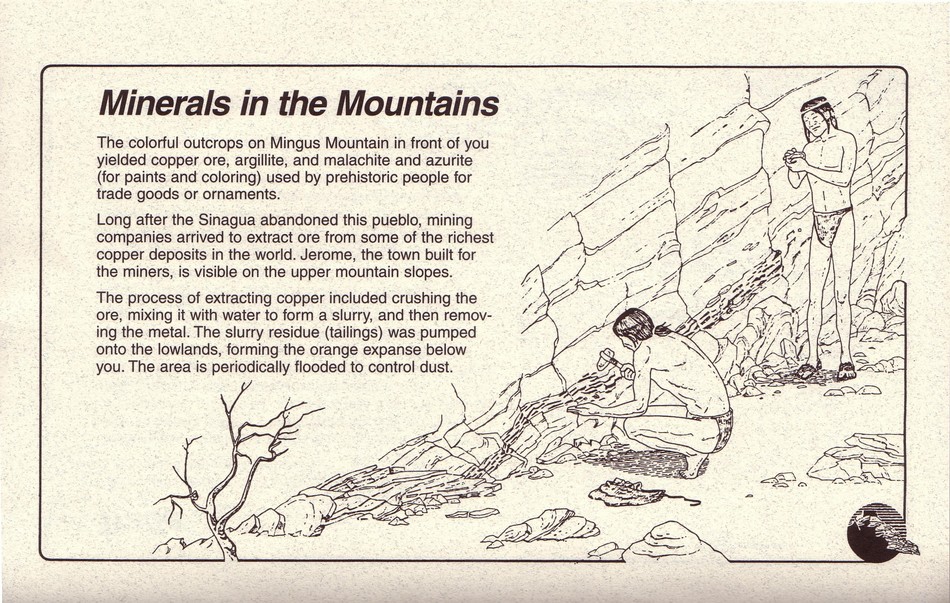
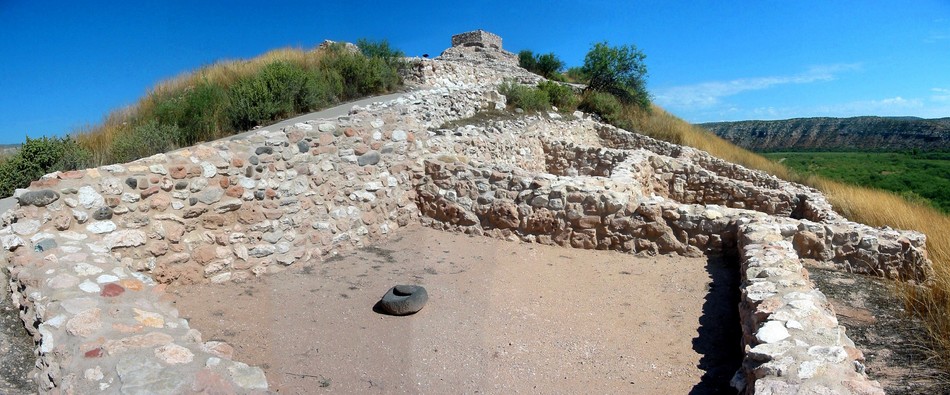
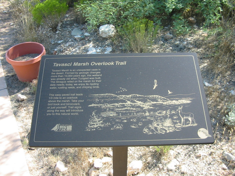
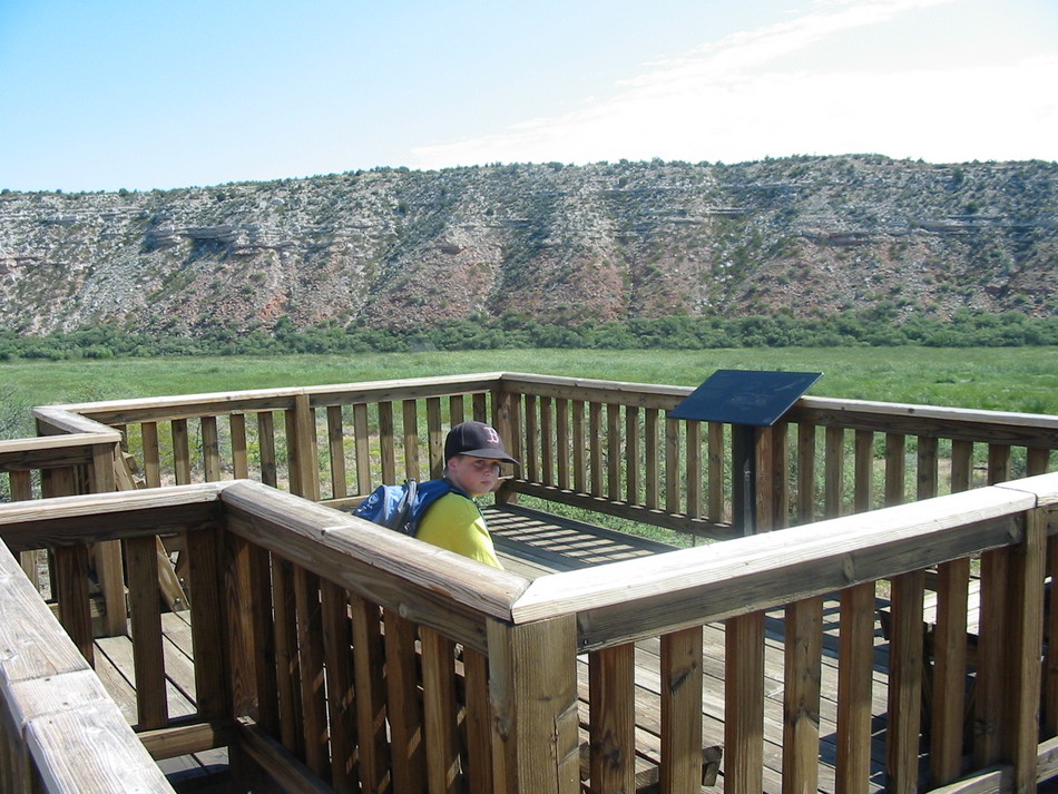
Ruins Loop Trail From the visitor's center, follow the sidewalk signage due south. There are many plaques along the walk way containing factoids about the Tuzigoot pueblo and life of the Sinagua inhabitants. Taking a counter-clockwise loop around the pueblo ruins you'll encounter several outer rooms on the north-west side with mano and metate (grinding stone and basin) intact. Walking along the west side, you'll notice the alignment of the rooms follows the contour of the ridge. I was pleasantly surprised to see people taking in the view from the pueblo ruins' highest vantage point. Continue along the walk to the south side, and you'll see stairs that climb to an entrance into an upper floor pueblo. Enter the room and take note of the construction. Notice the use of wooden beams and floorboards. From inside this room, stairs lead up onto the roof. The roof-top vista allows you to absorb the shear size of the ancient pueblo. Here is a roof top view looking north. Here is a roof top view looking south. The view to the west has prominent orange-colored collecting pools. A nearby plaque reveals the mystery and the continuing mineral heritage of the Verde Valley. Exit the roof top vista and continue walking along the loop trail to the south. Head along the east side and head back to the visitor's center. The best photo location of the pueblo ruins appears to be from the East. Unfortunately, I couldn't locate a path to this vantage point! Consulting a map afterward looks like Dead Horse State Park may be the primo pueblo ruins photo location... Tavasci Marsh Overlook Trail From the visitor's center, follow the sidewalk signage due north. Again there are many plaques along the walk way describing the marsh geological history and importance today for migratory birds. Sit a while at the observation deck listening to the birds, frogs and other marsh inhabitants. I'm often asked to recommend "family-friendly" hikes. This easy trail is an excellent introduction to the archeological wonders of the American southwest, particularly for kids. If you have out-of-state visitors with varied physical capabilities or interests, this is a highly recommended destination. Think of it as 2 mini-hikes in 1, a pueblo ruin loop-trail plus a unique riparian wetlands trail. It's an interesting side-trip while in the Sedona area. Enjoy!
Check out the Official Route and Triplogs. Leave No Trace and +Add a Triplog after your hike to support this local community. | |||||||||||||||||||||||||||||||||||||||||||||||||||||||||||||||||||||||||||||||||||||


