 Route Editor

| Guide | ♦ | 22 Triplogs | 1 Topic |
details | drive | no permit | forecast | map |
stats |
photos | triplogs | topic | location |
| 406 | 22 | 1 |
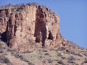
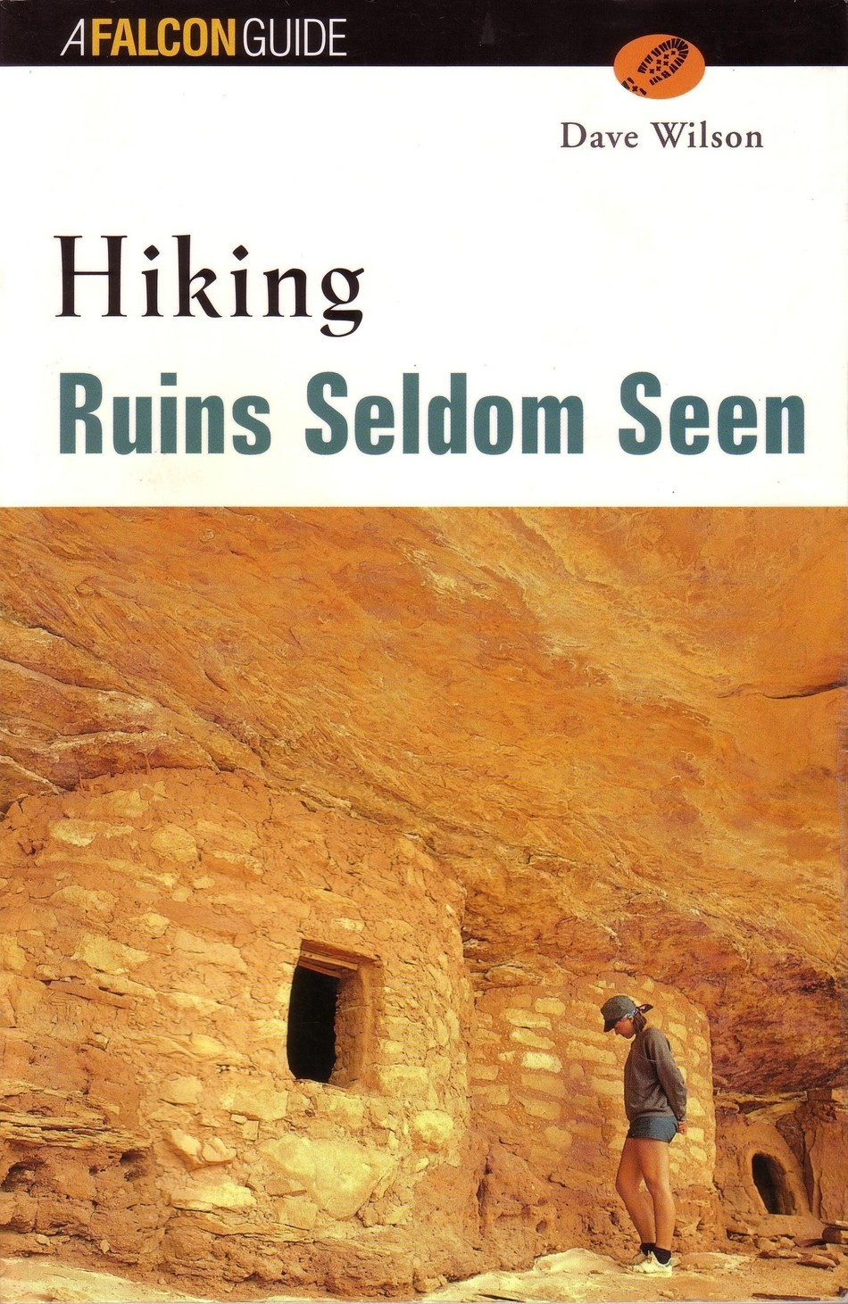
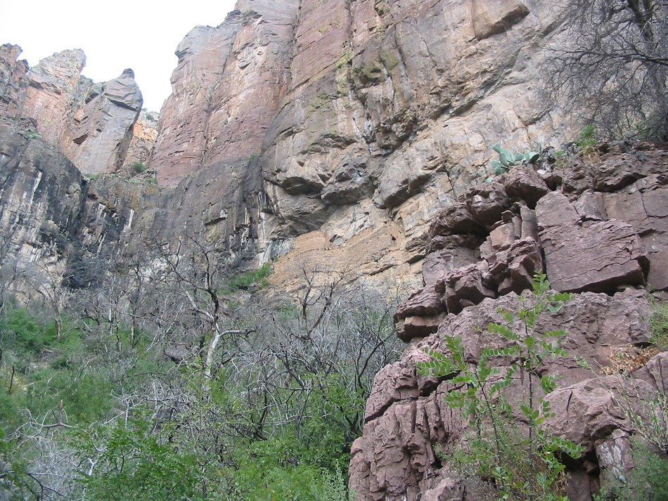
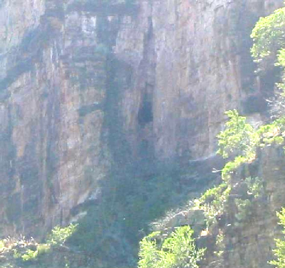
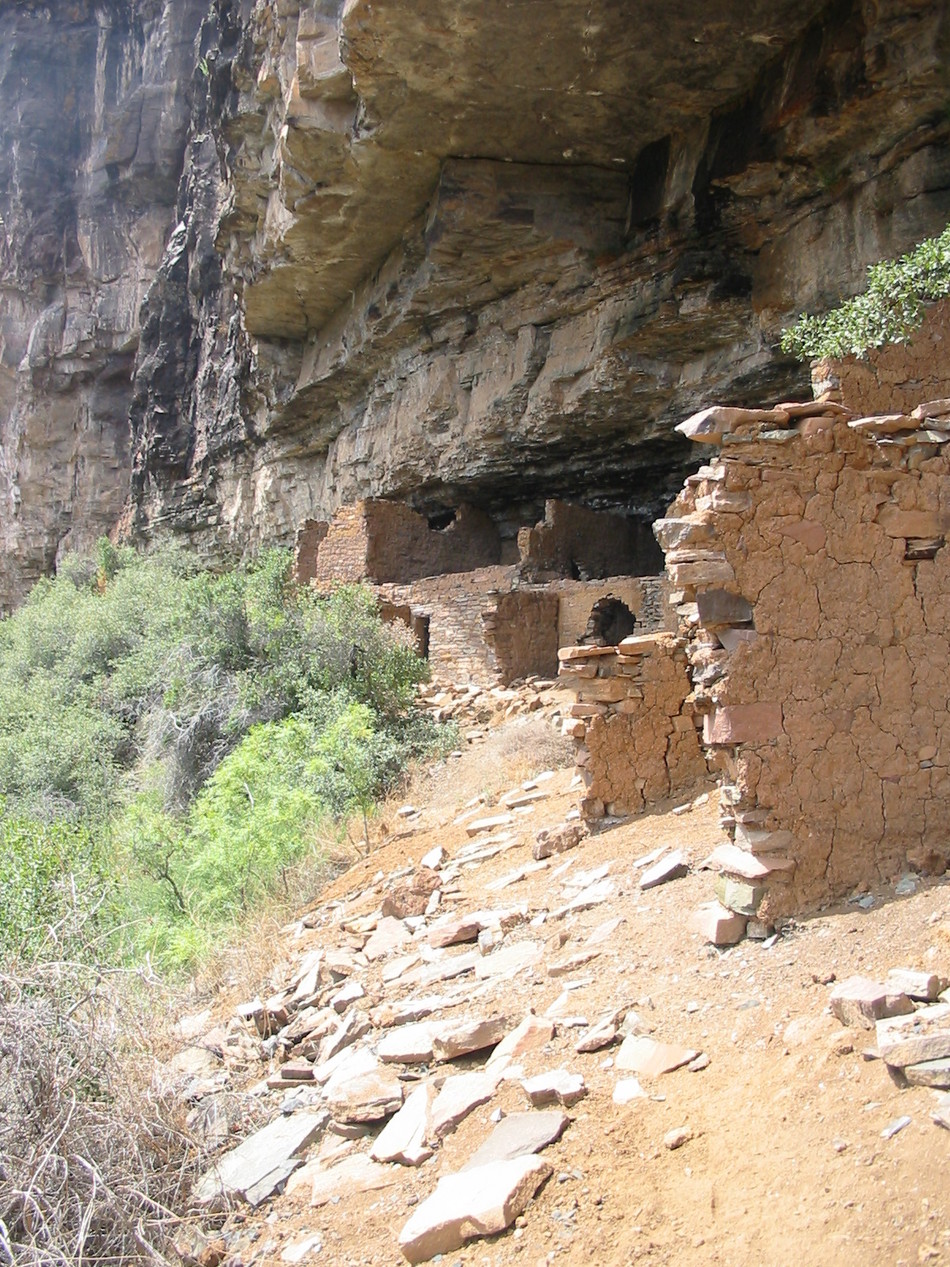
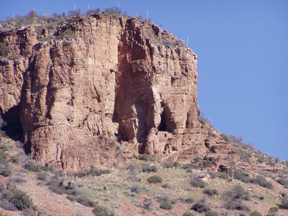
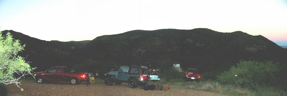
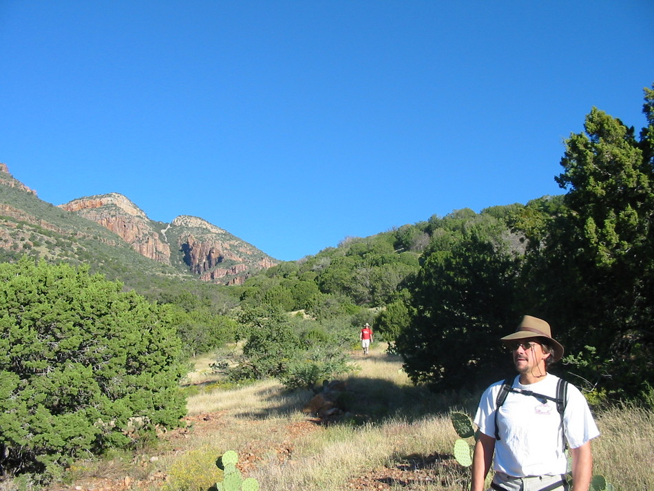
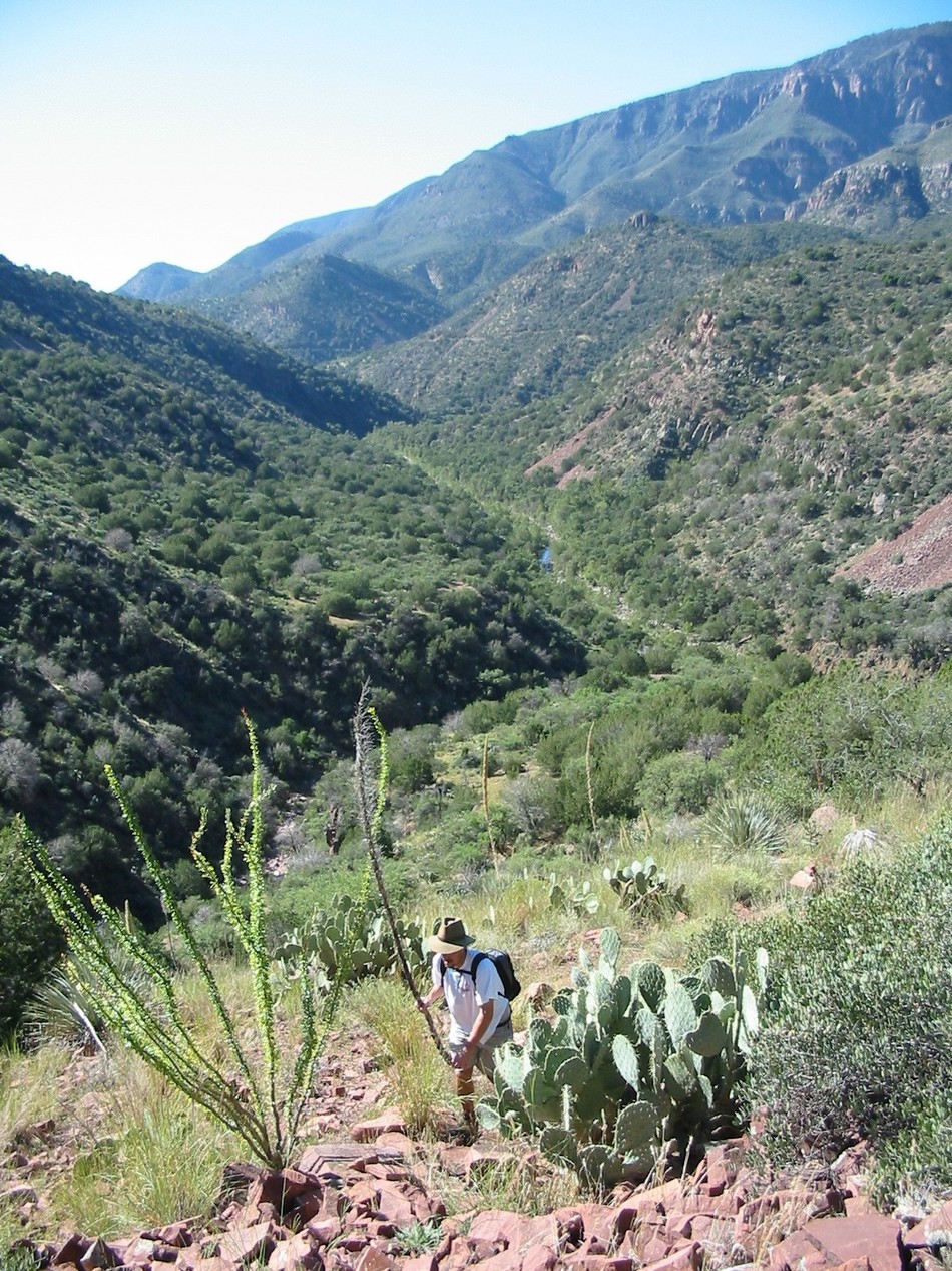
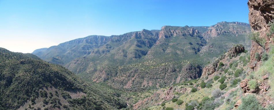
Vertical Endeavor by Randal_Schulhauser   Dave Wilson's book "Hiking Ruins Seldom Seen" describes the Cooper Forks Canyon cliff dwellings as "one of the more intimidating archaeological sites described in this book". With guidance from this book and confidence heightened through conversations with a couple of hikers that have successfully made the trek, a group of us recently accepted the challenge of hiking to the cliff dwellings. Dave Wilson's book "Hiking Ruins Seldom Seen" describes the Cooper Forks Canyon cliff dwellings as "one of the more intimidating archaeological sites described in this book". With guidance from this book and confidence heightened through conversations with a couple of hikers that have successfully made the trek, a group of us recently accepted the challenge of hiking to the cliff dwellings.The Sierra Anchan wilderness contains some of my favorite hiking adventures. Having previously hiked to the ruins in Coon Creek Canyon, Devil's Chasm, Cold Spring Canyon, and Pueblo Canyon, I've stared across the Cherry Creek Canyon at the ruins sitting high up against the cliffs on the east side and pondered how to hike to them. These are known as the Cooper Forks Canyon cliff dwellings and are visible to the unaided eye from FR203, particularly from Pottery Point. I've heard tales from fellow hikers who've attempted to reach these ruins; a classic "You just can't get there from here" conclusion could be made.
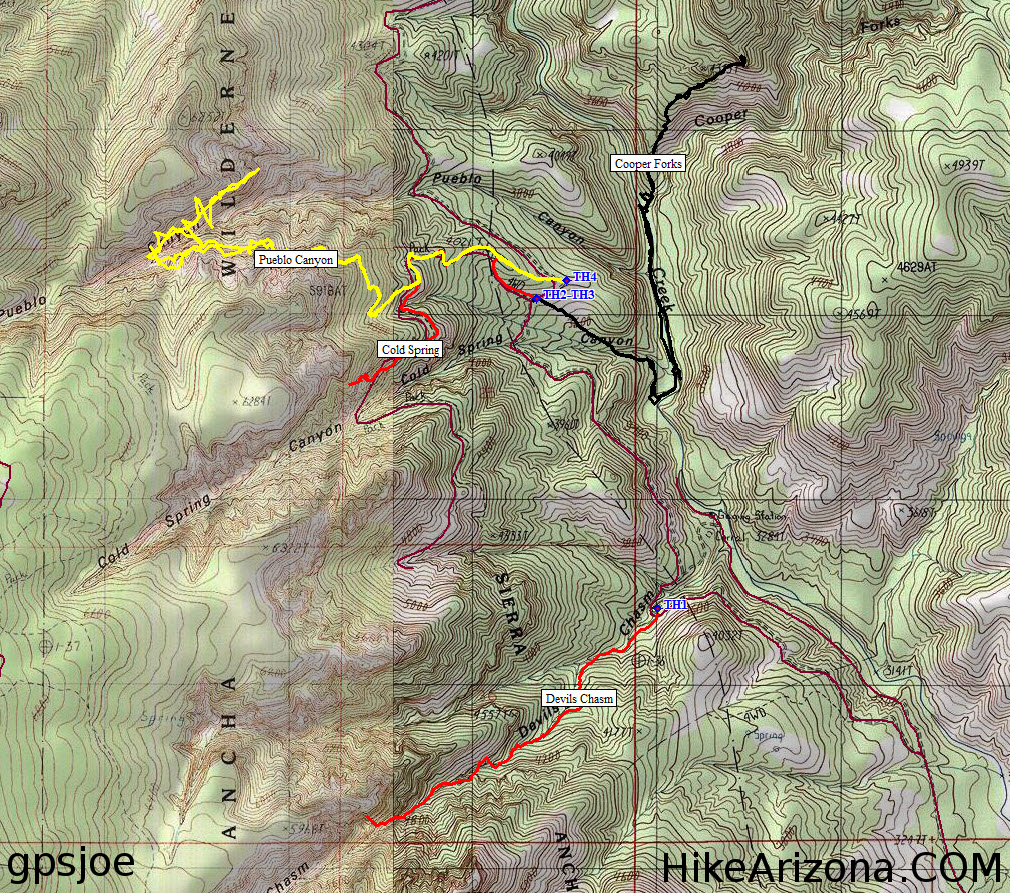
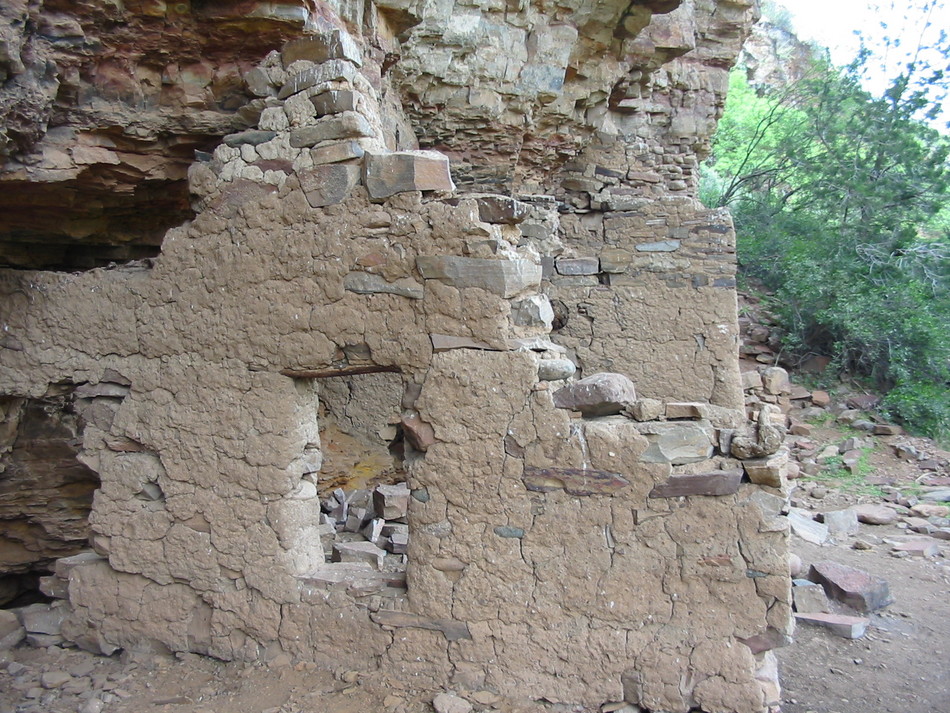
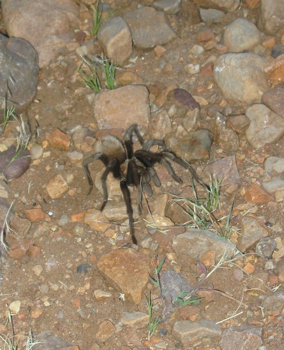
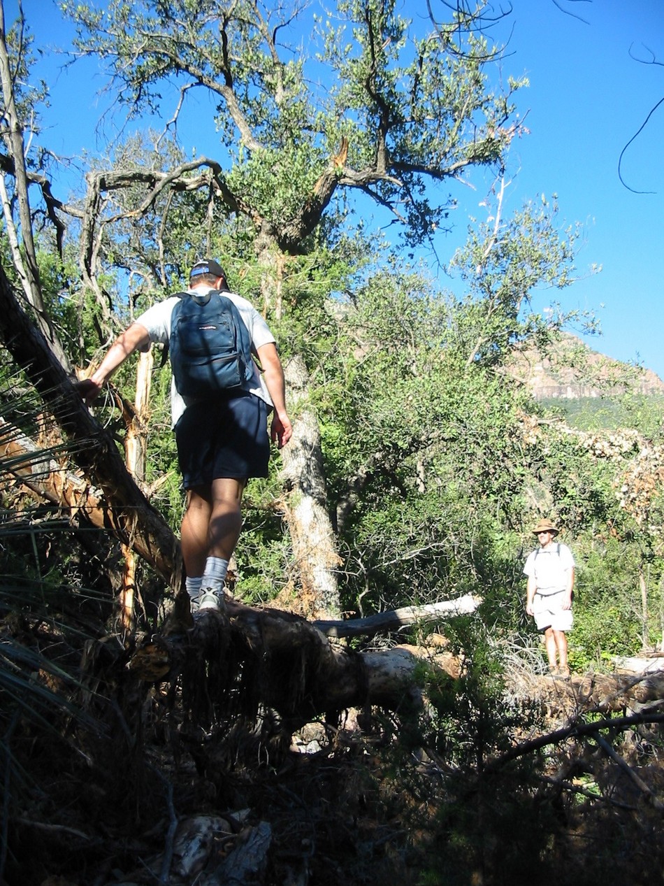
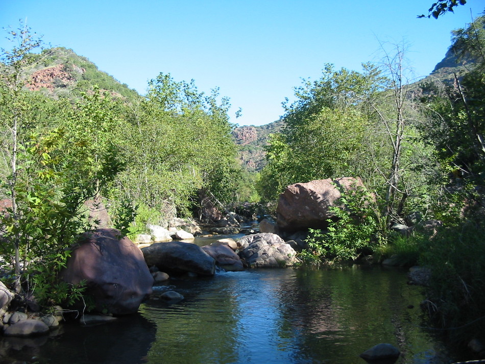
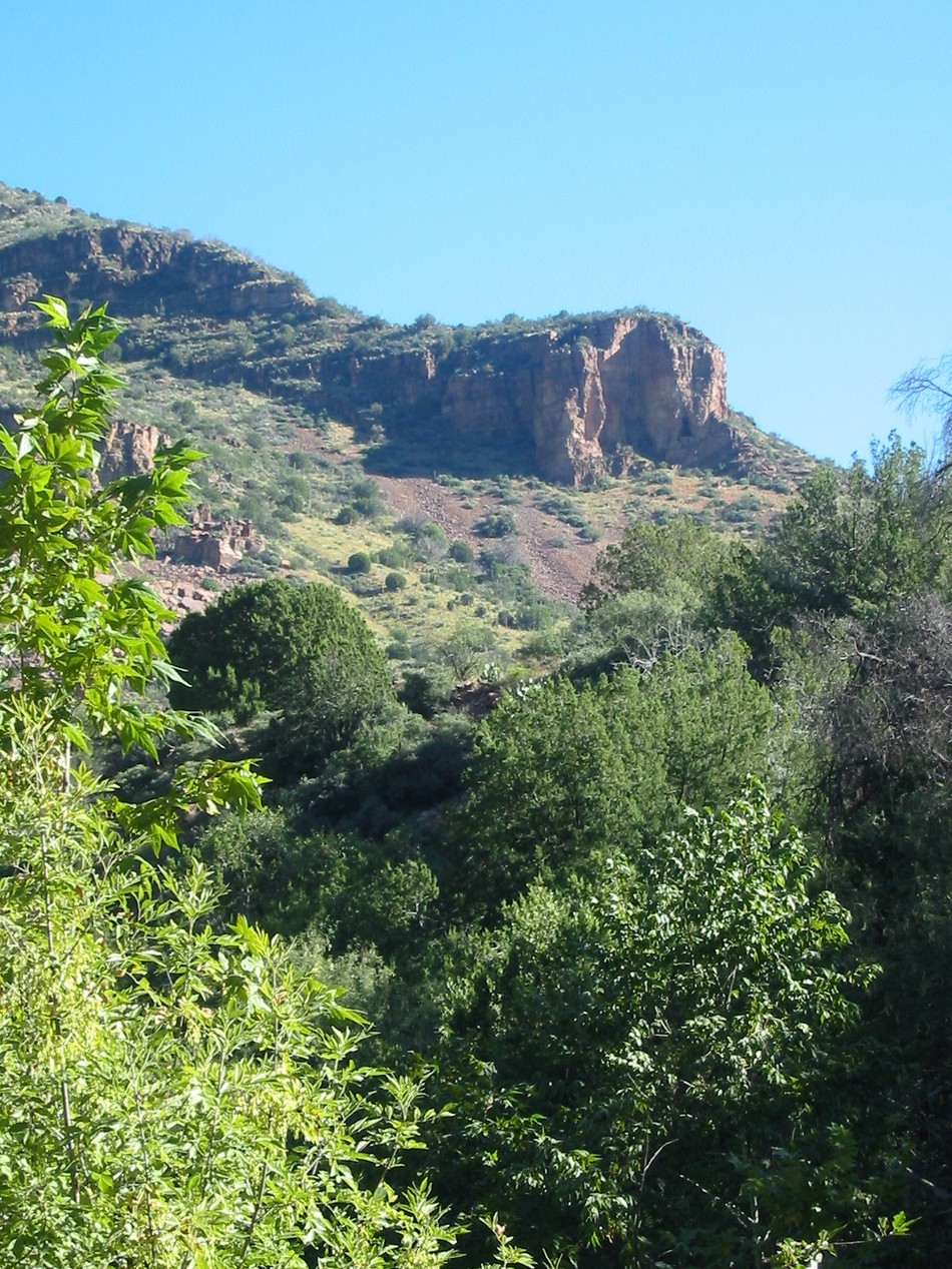
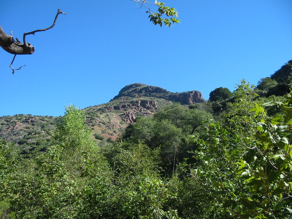
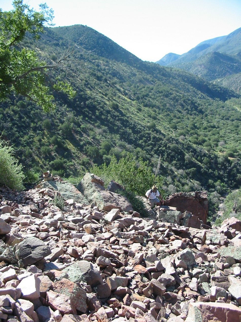
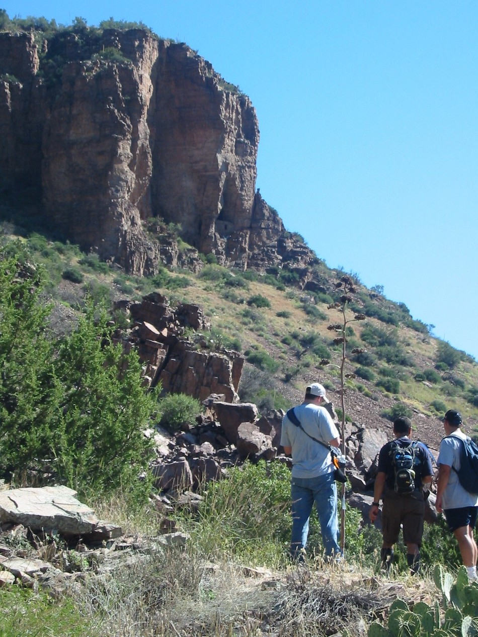
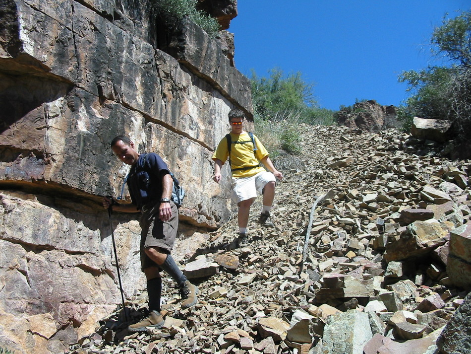
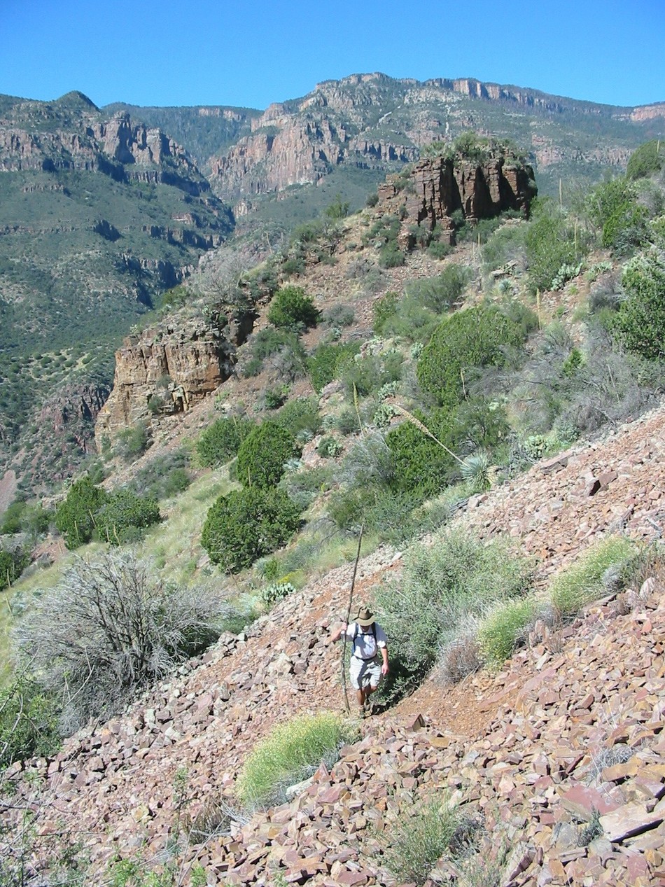
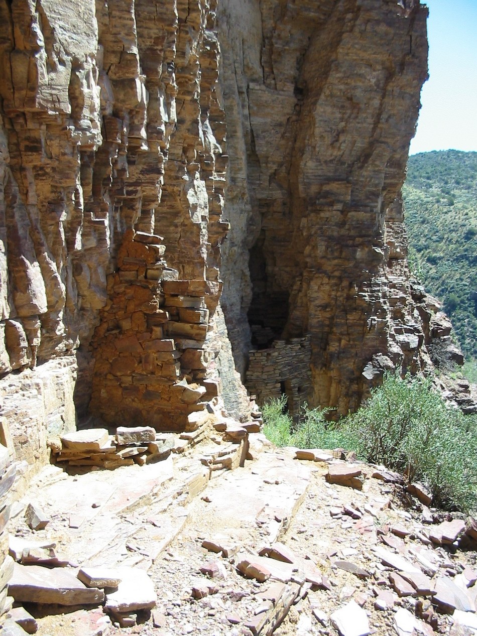
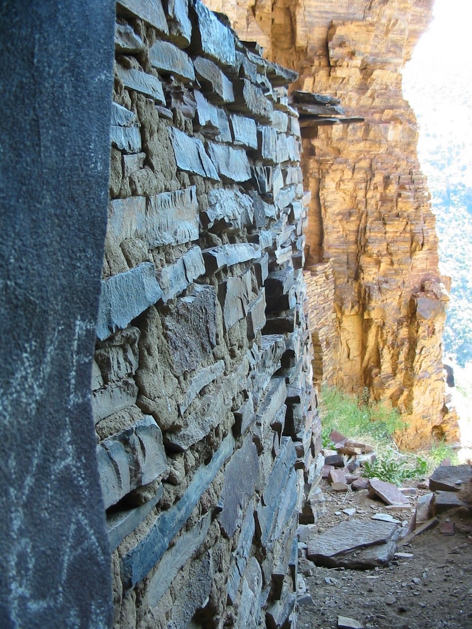
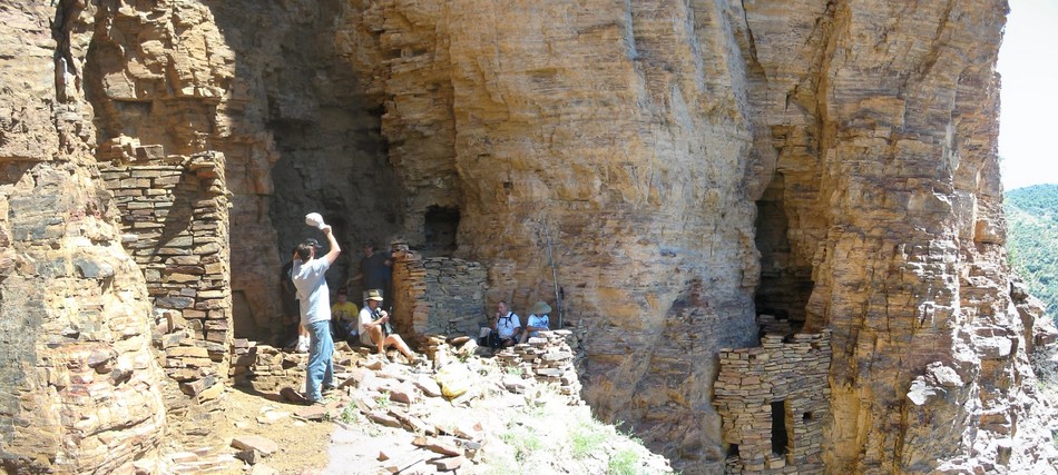
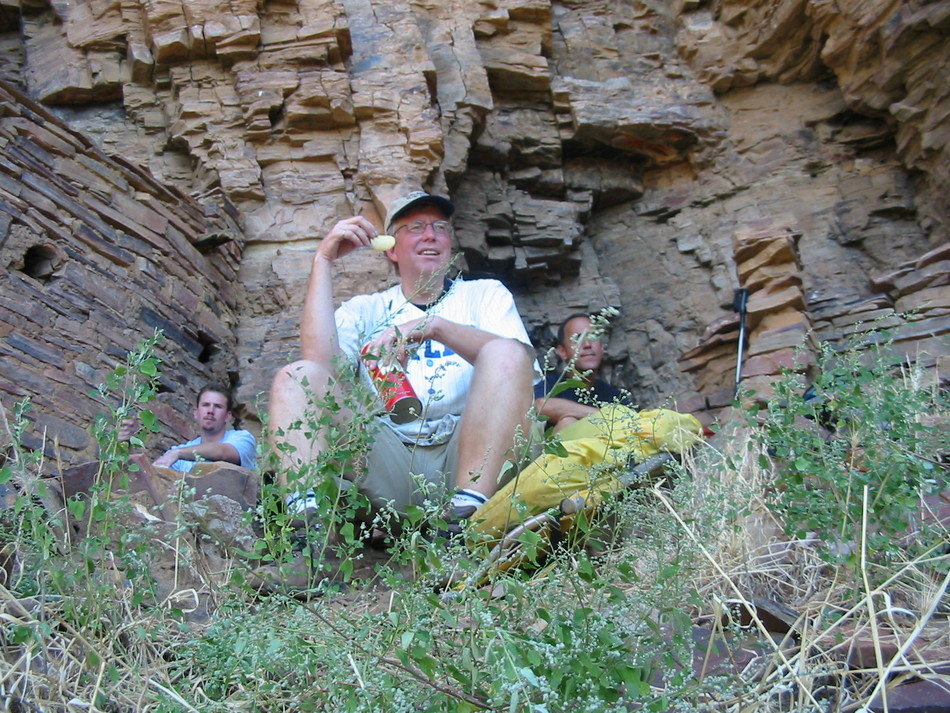
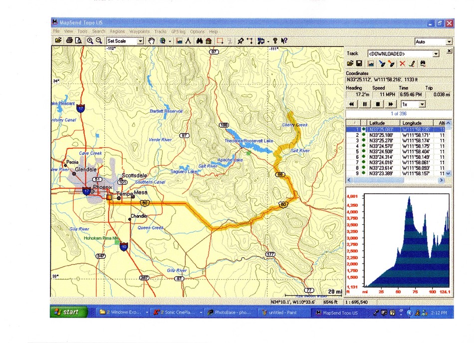
About halfway down to Cherry Creek, the mining road disappears and the path drops into Cold Spring Creek (GPS coordinates 33o 50.173 N, 110o 51.761 W, mile 0.42). Take note of the cairns for the return trip exit from the creek bed. Cold Spring Creek is a boulder hop with many twisted trees blocking the path. Make your way along the creek bed until you reach Cherry Creek. Take note of the unique boulders along the way. All shapes, colors, and compositions seem to be represented. The speckled conglomerate boulders are certainly unique! At the junction of Cold Spring Creek with Cherry Creek (GPS coordinates 33o 50.104 N, 110o 51.551 W, mile 0.42) a fine riparian setting unfolds. Follow Cherry Creek north. It is possible to travel on either side of Cherry Creek as we took the east side on the way to the ruins and followed the west side on the way back. Both sides will require some boulder hopping and potential bushwhacking! You will soon see Pueblo Creek on the west side (GPS coordinates 33o 50.379 N, 110o 51.600 W, mile 0.97). We encountered the remains of a deer skeleton at this point. The accumulation of flash flood materials... logs, boulders, and other debris, made us speculate that perhaps this deer was also a flood victim. Continue along Cherry Creek until the junction with Cooper Forks Creek (GPS coordinates 33o 50.582 N, 110o 51.650 W, mile 1.22). A clear view to the ruins is offered at the junction. The path from Cooper Forks Creek/Cherry Creek to the cliff dwellings can best be described as "follow the ridgeline". As Dave Wilson's book states, "The climb rises roughly 1,200 feet over a distance of about 0.75 miles". For some reason, the height looks twice that as stated! We tracked up Cooper Forks Creek a few hundred feet until we encountered a cairn (GPS coordinates 33o 50.662 N, 110o 51.580 W, mile 1.33) in the creek bed at a cow path/game trail scrambling up the creek sidewall to the north. Our route confidence increased when we spotted another cairn at the top of the steep scramble (GPS coordinates 33o 50.665 N, 110o 51.610 W, mile 1.36). Continue along this faint path that will contour to the top of a small plateau (GPS coordinates 33o 50.718 N, 110o 51.619 W, mile 1.43). Head straight for boulder outcroppings. You will begin to ascend a boulder field with loose skree (GPS coordinates 33o 50.813 N, 110o 51.578 W, mile 1.55). When you pop-up to the top of this boulder field (GPS coordinates 33o 50.892 N, 110o 51.544 W, mile 1.65), a view of the cliff dwellings helps to reassure you are on course! Make a heading towards a rock slide opening between two cliff walls. We dubbed this "the chute" for obvious reasons (GPS coordinates 33o 50.938 N, 110o 51.469 W, mile 1.74). Beyond "the chute" lies a lengthy rock slide area (GPS coordinates 33o 50.975 N, 110o 51.409 W, mile 1.81) requiring a parallel crossing along an obvious path. Traverse with due care... a misplaced step may result in 1000 ft rock slide to the bottom of Cooper Forks Canyon! You will soon reach the cliff dwellings (GPS coordinates 33o 51.023 N, 110o 51.289 W, mile 2.02). On this particular trip, we left our campsite at Pottery Point at 7:20 am and arrived at the ruins at 10:10 am. This should allow plenty of time for exploring... and that we did! To the extreme west side of the archeological site are the ruble remains of 2 rooms. The state of disrepair is probably a direct result of the maximum exposure this site has relative to the other rooms. The cliffs had minimal overhang at this point and the rooms have maximum sun exposure from sunrise until very late in the afternoon. Moving from west to east, you next encounter an interesting cluster of 2 story rooms with the floors partially intact. Inside the lower left hand structure is evidence of charcoal and soot from what we suspect were either cooking or heating fires. There is an additional room further back as the structure encloses a natural cave. Unbelievable people have carved their initials on the side of the entrance. The single story structure that is part of this cluster on the front and right is perhaps the best preserved with all walls and roof intact. The rooms next to this structure and to the east have partially collapsed. As we sit in the shade and ponder this lost civilization, we are offered an excellent view of the west side of Cherry Creek Canyon. The east wing rooms are joined together. This can be determined only by shuffling along a ledge and climbing up the cliff to the highest and most easterly room. We spent nearly 2 hours at this site... truly one of the archeological wonders of the American southwest. I can attest that the effort is proportional to the reward for this strenuous, technical, and remote hike. Enjoy!
Check out the Triplogs. Note This is a difficult hike. Arrive fit and prepared or this could get ugly. Leave No Trace and +Add a Triplog after your hike to support this local community. | |||||||||||||||||||||||||||||||||||||||||||||||||||||||||||||||||||||||||||||||||||||||||||||


