Skull Mesa is a prominent feature of the landscape north and east of Cave Creek. Rising 4426 feet above sea level, it appears from the Spur Cross Trail Head much closer than one finds once the hiking begins. The rewards of this long and roller coaster ride, however, are considerable. The solitude of the high Sonoran desert... Cottonwood Spring, a hidden oasis... a few Petroglyphs, and the view from the summit make the day worthwhile.
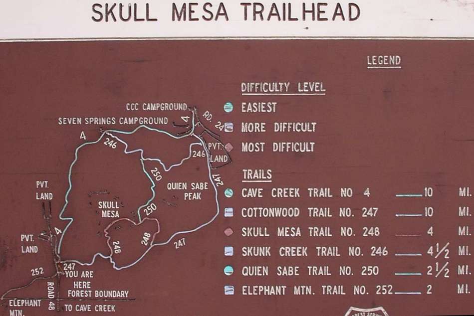
Hike: You begin your hike at the TH of the Spur Cross Ranch conservation area. The trail goes northward past two restrooms, and an administrative trailer then drops into the Cave Creek watershed. There are four creek crossings, the final of which takes you to the creek's east side. At this point, some 2.2 miles into the trip, there is a large sign of the trail system of the area. At the sign, go straight ahead, following Cave Creek trail #4 for 300 yards, then take a right onto trail Cottonwood Trail #247. Follow Cottonwood trail #247 past Cottonwood Springs to the junction of the Skull Mesa summit trail. There is a fence here... the Skull Mesa trail #248 turns sharply left. Pass some Petroglyphs on your left (within several hundred yards of the fence) and climb 1.1 miles (1100 feet elevation gain) to the summit.
At the summit, we immediately turned left off the trail. We walked about 300 yards to our lunch spot, a rocky outcropping on the edge of Skull Mesa, with magnificent views of Sugar Loaf, Black Mesa, Elephant Mountain, and the distant Valley of the Sun.
We noted that this year (November 2005), the trail had deteriorated considerably due to heavy rains in the area, and a flash flood had climbed the banks of Cave Creek in October.
WARNING! Hiking and outdoor related sports can be dangerous. Be responsible and prepare for the trip. Study the area you are entering and plan accordingly. Dress for the current and unexpected weather changes. Take plenty of water. Never go alone. Make an itinerary with your plan(s), route(s), destination(s) and expected return time. Give your itinerary to trusted family and/or friends.
Permit $$
Spur Cross Conservation Area $5 per person
Directions
Road
FR / Dirt Road / Gravel - Car Okay
To Spur Cross Trailhead I-17 North & Exit 233, which is SR-74 the Carefree Highway. Head east on Carefree Highway 9.9 miles to Cave Creek Road. Head North on Cave Creek Road 2.6 miles to Spur Cross Ranch Road. The road jogs a bit here but you go 4.0 miles to the parking lot.
It is a well-graded dirt road. As it nears the parking area, the road leads past a large green house, through a tall gatepost and past a corral. There is a large signed parking area. Along the road about 75 yards northeast of the parking area, there is a self-pay station and a small informational kiosk with rudimentary maps. Pay the fee and carry the stub with you.
From PHX (I-10 & AZ-51) 35.8 mi - about 57 mins From TUC (Jct 1-10 & Grant) 144 mi - about 2 hours 26 mins From FLG (Jct I-17 & I-40) 133 mi - about 2 hours 10 mins
 Route Editor

 Skull Mesa is a prominent feature of the landscape north and east of Cave Creek. Rising 4426 feet above sea level, it appears from the Spur Cross Trail Head much closer than one finds once the hiking begins. The rewards of this long and roller coaster ride, however, are considerable. The solitude of the high Sonoran desert... Cottonwood Spring, a hidden oasis... a few Petroglyphs, and the view from the summit make the day worthwhile.
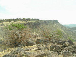


