 Route Editor

| Guide | ♦ | 42 Triplogs | 1 Topic |
details | drive | permit | forecast | 🔥 route |
stats |
photos | triplogs | topic | location |
| 428 | 42 | 1 |
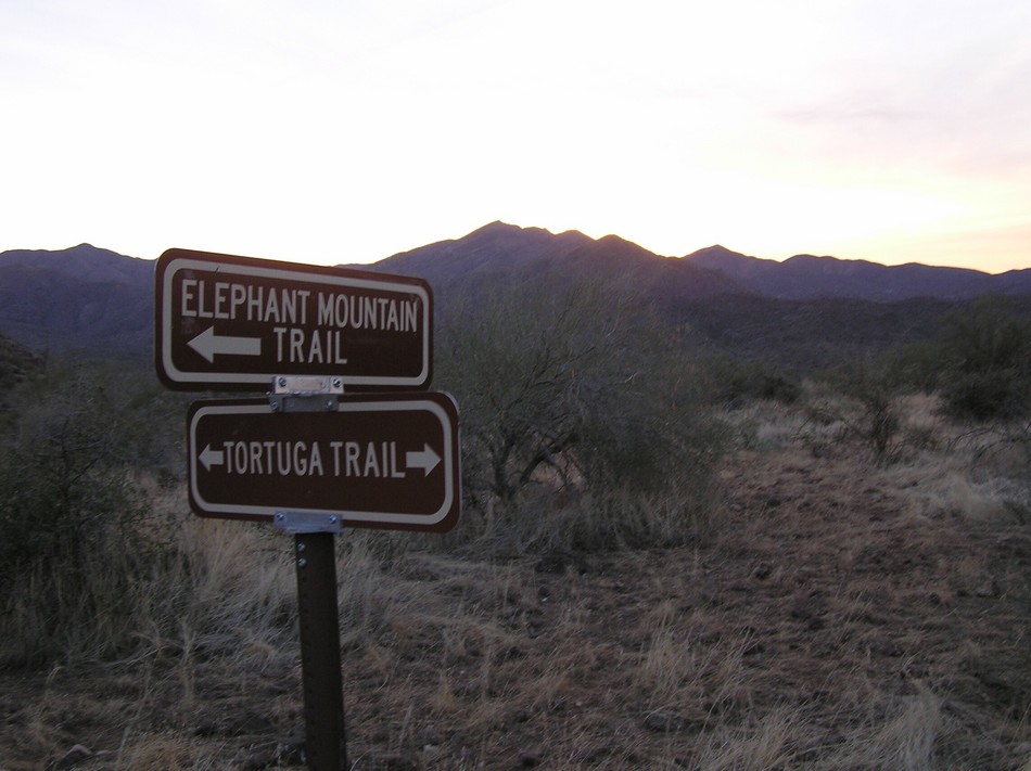
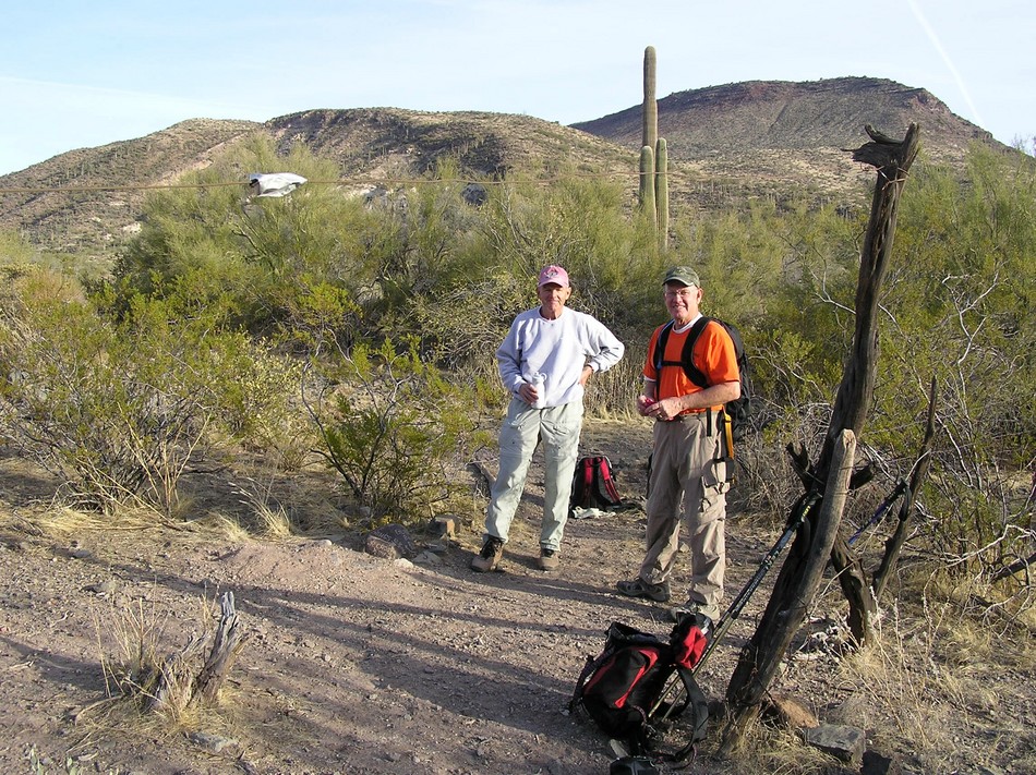
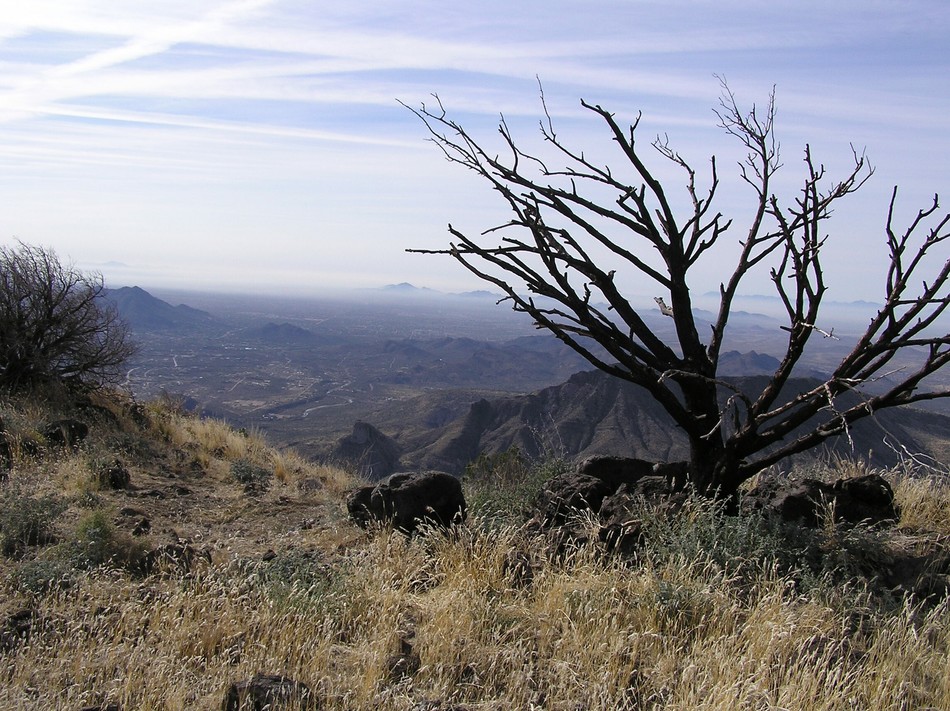
Strenuous Yet Rewarding by TerrySwicegood  Black Mesa rises 4479 feet north and west of Cave Creek, Arizona. A good trail leads from the Spur Cross Conservation area for 5.84 miles until you reach the summit. Dave Erickson, the North Dakota animal, Bob Bell, the would-be Chicago animal, and I, the Arizona super-animal hiked this trail on February 3, 2006. Black Mesa rises 4479 feet north and west of Cave Creek, Arizona. A good trail leads from the Spur Cross Conservation area for 5.84 miles until you reach the summit. Dave Erickson, the North Dakota animal, Bob Bell, the would-be Chicago animal, and I, the Arizona super-animal hiked this trail on February 3, 2006.Leaving the porta-potties and the Spur Cross Conservation area at the trail-head, the Tortuga trail follows a good road west-ward for 1.55 miles. Here there is a sign that reads Elephant Mountain/Tortuga Trail. Follow the Elephant Mountain Trail for another 0.17 of a mile and take a left. The Elephant Mountain trail drops very steeply into a wash. Make a note here because you will dread climbing out of this wash coming back! The trail follows the wash in a westerly direction, eventually climbing gradually upward with the Hohakam Indian Fortress to your left (southwestly) and Elephant Mountain a little higher to your left. Out in the distance you can see Black Mesa. It looks a long way away, and believe me, it is!
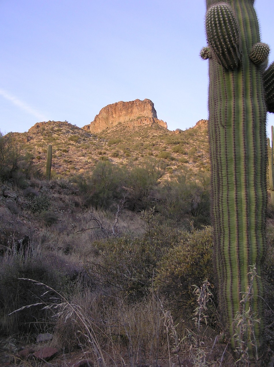
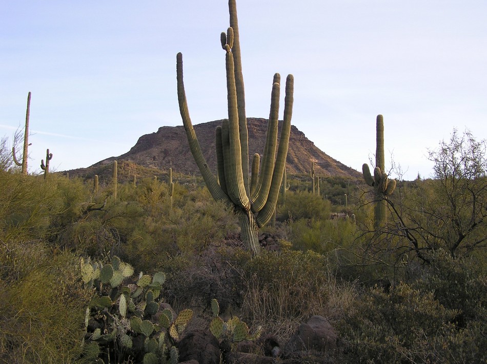
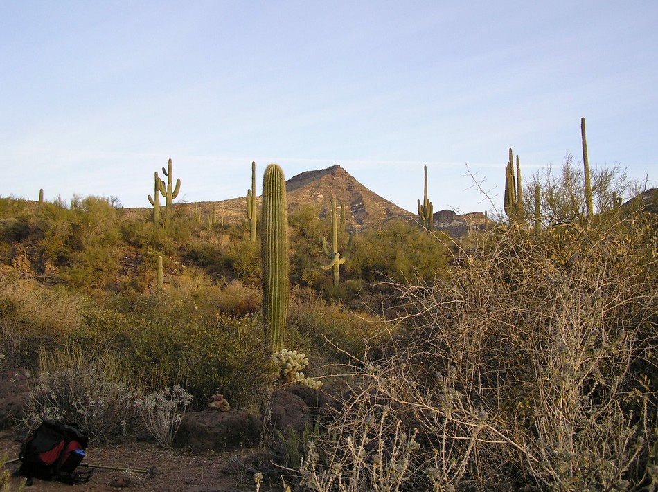
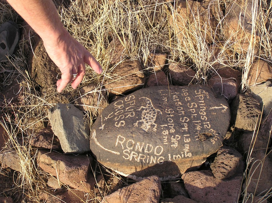
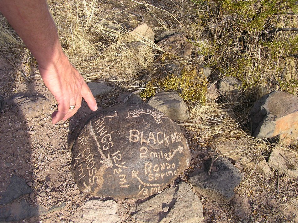
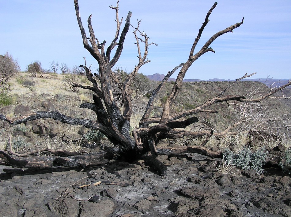
Leaving this trail junction you drop quickly into yet another wash, and then you climb back out. In 0.25 of a mile you come to another junction. I have missed this junction twice, so I'm 0 for 2. We placed cairns here, and there is a wonderful rock here with directions on it placed in the ground by local horseman, Terry Smith. At this junction take a LEFT. If you go straight you will head toward Sugar Loaf Mountain on a circuitous trail which takes you back to the Tortuga trail. (This would be another good loop for a short day.) Taking a left here you countour along a ridge with Elephant Mountain to your left and Black Mesa to your right. It still looks a long way ahead, and it is! At 3.4 miles you walk under a fence with Black Mesa straight in front of you. Terry Smith has placed another directional rock in the ground here. From here the trail heads directly toward Black Mesa, climbing pleasantly all the way. The downside of the climb are the ubiqutous rocks, which will leave your feet sore at the end of the day. As you near Black Mesa, you think you are almost there, but maddingly, the trail makers take you all along the western edge of the Mesa, until you come to the far (northern end). At this point the trail begins its final ascent to the summit, a very steep and sometimes loose climb. Hiking poles help. Reaching the summit, you have to backtrack in a southerly direction across the flat grasslands of the summit floor until you reach the true summit. The summit has been scarred by the Cave Creek Complex fire of 2005. (Last year when I did this hike, I determined it would be much faster and much easier to go "cross-country", to leave the trail and head directly for the summit. Animal Bob Bell and I liked this idea, while our buddy, the more-prudent Dave Erickson stayed on the trail. Let me make a painful story short: stay on the trail. The cross country is a steep beast of loose rocks, cholla, and prickly pear cactus, and what you save in time, you lose in heart muscle!!) As always from the summits of this area, the views are magnificent, although the Valley of the Sun on this day could have well be called the Valley of the Skuz. My GPS read 5.84 miles to the true summit and registered 4479'. The actual reading for the summit from USGS maps is 4698'.
Check out the Official Route and Triplogs. Note This is a more difficult hike. It would be unwise to attempt this without prior experience hiking. Leave No Trace and +Add a Triplog after your hike to support this local community. | ||||||||||||||||||||||||||||||||||||||||||||||||||||||||||||||||||||||||||||||||||||||||||||||||||||||||||||||||||||||||||||||||||||||||||||||||||||||||||||||||||||||||||||||||||||||||||||||||||


