Did you ever want to go to the highest point in the Superstition Mountains? Well, I have been talking about just that for several years now and finally, I did it.
Dense low desert plants in the Eastern Superstitions make off-trail hiking very tough. Last year I tried a direct path to the peak but quickly turned back because the off-trail hiking was too difficult. So this year I decided on a path that makes maximum use of existing trails. This time I hiked to Circlestone and went off trail there to do a 0.7 mile bushwhack hike to the peak.
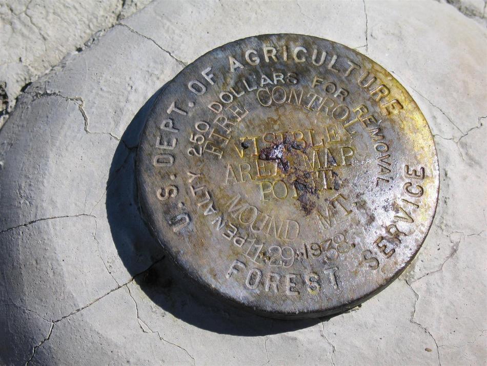
I did an 18 mile roundtrip day hike from the Campaign trailhead (aka Upper Horrell) using the Campaign, Fireline, and Circlestone access trails but there are several ways to get to Circlestone. Perhaps the most sensible is to backpack to Reavis Ranch for 2 nights and day-hike the 6 mile 4.5-hour roundtrip. See the excellent write-up for the Circlestone hike on this website. To this 6 miles add 1.4 miles and about 2 hours for the roundtrip bushwhack to Mound Mountain peak. I started by going east a short distance and then heading south for the rest of the trip always trying to stay close to a ridgeline and trying not to give up much elevation although the terrain forces you down about 100 feet before going up about 350 feet to the 6,266-foot peak. To the extent possible I hiked under tall pines because there is less dense low desert vegetation blocking the way. Shortly after sighting a rock outcropping near the top I picked a spot and powered my way through Manzanita and cat claw to reach the rocks. After that, it was rock hopping and bushwhacking across the top for about 200 yards to reach the rock with the embedded bronze Forest Service (circa 1938) peak marker.
GPS was very helpful for staying on course both ways since the peak and Circlestone are not visible for most of the trip. Long pants and a long sleeve shirt are a must for this part of the hike.
Surprisingly there is a sign-in bottle lodged at the bottom of the peak rocks. It was put there in April 2000. There were about 12 people who signed in since then, the last one before me was April 2005. That makes about 2 people per year that have signed in at this peak.
From the top, there are unimpeded 360-degree views of Four Peaks, the Miami copper mines, and surrounding mountains and valleys. It's problematic to rate this hike for difficulty and trail finding. Starting from Reavis Ranch it's probably a 4 for difficulty and starting from Campaign or Roger's Trough or any other trailhead it's surely a 5. Trail finding is relatively easy except for the final 0.7 miles where there is no trail and I guess that part is a 5.
WARNING! Hiking and outdoor related sports can be dangerous. Be responsible and prepare for the trip. Study the area you are entering and plan accordingly. Dress for the current and unexpected weather changes. Take plenty of water. Never go alone. Make an itinerary with your plan(s), route(s), destination(s) and expected return time. Give your itinerary to trusted family and/or friends.
Permit $$
None
Directions
Road
Strictly 4x4
To Upper Horrell Trailhead From SR 188 turn off onto 449 (also called J-B) just past milepost 235 Follow 449 about two miles to the junction with Cross P Ranch. FR449A is located through the white fence to the left of the Ranch. FR449A is said to be possibly used by high clearance vehicles. I wouldn't recommend. There are some deep sections of sand as well as a couple creek crossings. This is no place to get stuck, no cell phone signal and a long day hike back to SR88. Follow FR449A about six miles to the Upper Horrell(Campaign) Trailhead parking. Along FR449A notice the awesome slot canyon passed along the way.
From PHX (I-10 & AZ-51) 112 mi - about 2 hours 25 mins From TUC (Jct 1-10 & Grant) 154 mi - about 3 hours 28 mins From FLG (Jct I-17 & I-40) 178 mi - about 4 hours 18 mins
 Route Editor


 Did you ever want to go to the highest point in the Superstition Mountains? Well, I have been talking about just that for several years now and finally, I did it.
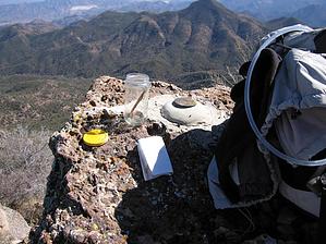


