 Route Editor

| Guide | ♦ | 11 Triplogs | 1 Topic |
details | drive | no permit | forecast | 🔥 route |
stats |
photos | triplogs | topic | location |
| 220 | 11 | 1 |
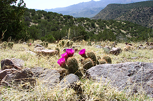
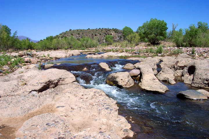
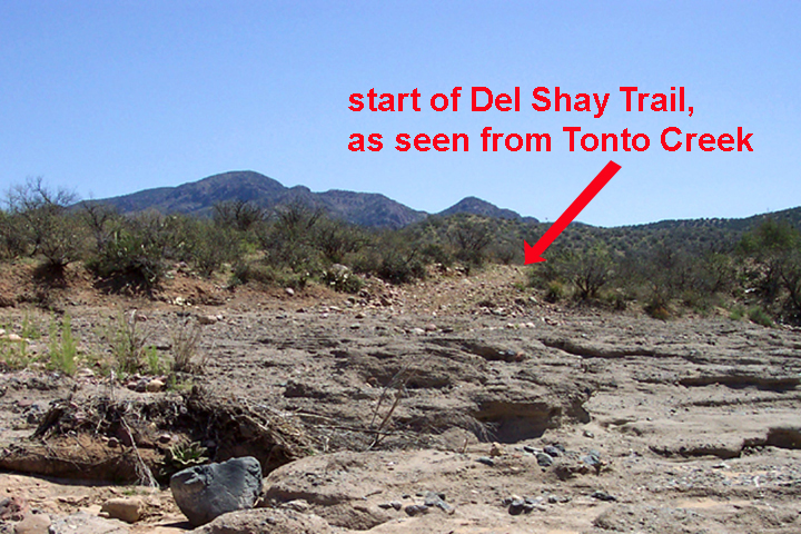
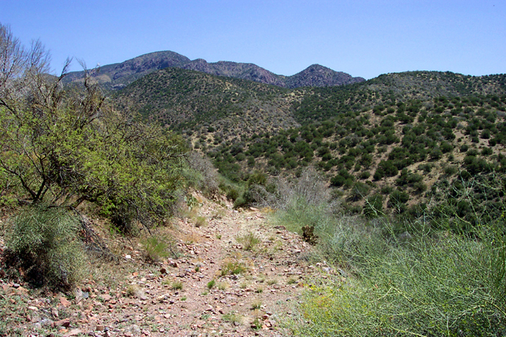
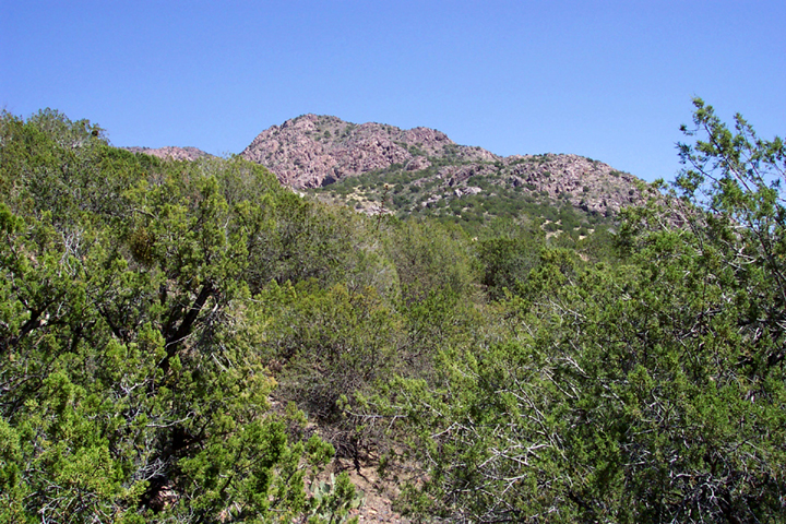
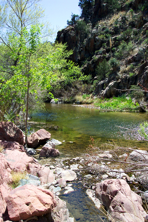
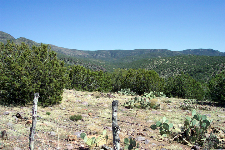
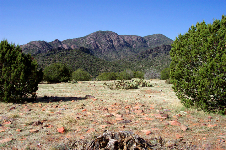
Apache Stronghold by PrestonSands   History HistoryNamed for the Tonto Apache chief Del Shay, who made this basin his home. In February 1870, after many battles with the cavalry, Del Shay accepted an invitation to Fort Reno in Tonto Basin to discuss peace. While there, he was shot and killed by a soldier. (2009-06-09 anonymous states Del Shay was killed by his nephew) Del Shay's band were the last Tonto Apaches to surrender to the U.S. cavalry. Overview The Del Shay Trail takes you to Del Shay Basin in the Sierra Ancha mountains. I recommend that anyone who decides to hike this trail have some experience in route finding, as most of the trail is overgrown and hard to follow. A topo map of the area is essential. The 7.5-minute topo maps show the trail's route quite accurately. Avoid this hike during summer, as there is little shade along the trail. This trail also crosses Tonto Creek, which is prone to flooding after heavy rains. Warnings aside, this is beautiful, rugged country.
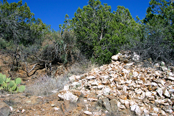
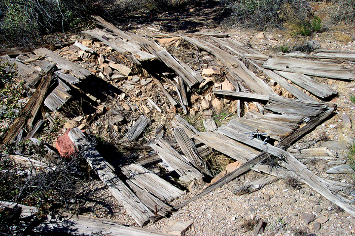
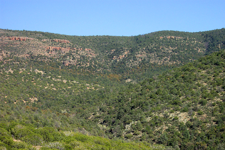
The trail begins near the 76 Ranch on Tonto Creek, at the northwest end of the Sierra Anchas. After parking at the end of spur road 1446 at the lower end of Rye Creek, I began following the power lines towards Tonto Creek. (The Gisela topo map shows the trail beginning right on the 76 Ranch, which is private property.) I tried to stay a few hundred feet south of Rye Creek, while following it through mesquite brush down to Tonto Creek, to stay off the ranch property. Once I got to Tonto Creek, I crossed over to the east side and followed it downstream, until I saw what looked like an old road on the east bank of the creek. I had finally found the Del Shay Trail. (I should mention that there are two old roads heading east into the Sierra Anchas from here. The Coffeepot Road, which leads to Young, heads northeast from the 76 Ranch. It is more obvious than the Del Shay Trail, which heads east downstream of the Coffeepot Road, and is only visible on the east side of Tonto Creek.) The trail soon begins climbing the mesquite-covered foothills of the Sierra Anchas. At about the two-mile point, the trail left Alkali Canyon, and began ascending a brushy ridge. Upon reaching the divide overlooking Gun Creek canyon, the trail has left the desert country behind and enters a juniper grassland. There are some nice views of Sheep Basin Mountain here, a 6200' ridge of purple rock that towers above the trail. Now the trail works its way south, down a pretty side drainage of Gun Creek The last one hundred vertical feet dropping into Gun Creek canyon has been built on the side of the canyon wall. It was nice to see something here that resembled a real trail. The sound of running water greeted me as I neared the bottom. Here I saw a nice swimming hole, some willow and ash trees, and a metate (Indian grinding bowl) in a boulder. This would make a fine turnaround point if you have had enough of bushwhacking in remote country. The trail now leaves the pleasant confines of Gun Creek and begins a 1000-foot climb up a juniper, grass, and hedgehog cactus covered ridge. At the top, you are greeted with a view of Del Shay Basin, with pine and oak-covered mountainsides in the distance. Now the trail drops into a little side canyon of Del Shay Creek. Oak brush and catclaw make the trail difficult to find and follow in here. Below a ridge of black rock, I came across an old mine, with a big pile of white quartz next to it. Nearby were the remains of an old building. Having reached my turnaround time at this point, I decided to make a quick bushwhack up the 4648' hill, in search of the Indian ruin on top. (One of six ruins that the topo map shows in Del Shay Basin). I spooked a white-tailed deer, and soon emerged on top in a flat, grassy meadow dotted with junipers. I looked for the ruin, but couldn't find it. I was only one mile from the end of the trail, but I had to turn around and head back The last mile of the trail follows Del Shay Creek (the topo map shows it as perennial) into forest country. I could see white oaks and what appeared to be Arizona cypress along the creek in the distance. At the end of the trail, there is Del Shay Cabin on a little piece of private land (I wish I could live there), which is accessed by what appears to be an absolutely hideous four-wheel drive road, coming down from the mountain above. After a little over 9 hours of hot hiking, I finally got back to my truck at 8:00 that night. I was exhausted, but I had finally been to the stronghold of the Apache chief Del Shay. Check out the Official Route and Triplogs. Note This is a moderately difficult hike. Leave No Trace and +Add a Triplog after your hike to support this local community. One-Way Notice This hike is listed as One-Way. When hiking several trails on a single "hike", log it with a generic name that describes the hike. Then link the trails traveled, check out the example. | ||||||||||||||||||||||||||||||||||||||||||||||||||||||||||||||||||||||||||||||||||||||||||||||||||||||||||||||||||||||||||||||||||||||||||||||||||||||||||||||||||||||||||||||||||||||||||||||||||||||


