 Route Editor

| Guide | ♦ | 41 Triplogs | 0 Topics |
details | drive | no permit | forecast | 🔥 route |
stats |
photos | triplogs | topics | location |
| 545 | 41 | 0 |
Battle for the saddle by PrestonSands   Overview OverviewThe McFadden Horse Trail #146 takes one across the flattened, horseshoe-shaped top of McFadden Horse Mountain, at the northern end of the Sierra Ancha Wilderness. A challenge in route finding, this trail rewards you with a prehistoric ruin and a spectacular view of the rugged Cherry Creek area. This description begins at the bottom end of the trail along Highway 288. One can also access this hike via the Cienega Trail #145, which joins up from Forest Road #235. That option adds another 4.5 round trip miles to the statistics listed for this hike. History McFadden Horse Mountain derives its name from William McFadden, who had been a part of a vigilante group during the Pleasant Valley War. McFadden later settled in the Sierra Ancha, founding the Circle Ranch on McFadden Creek, at the western foot of the mountain that bears his name.
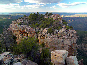
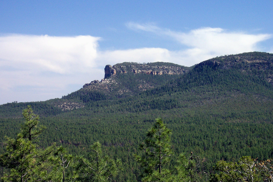
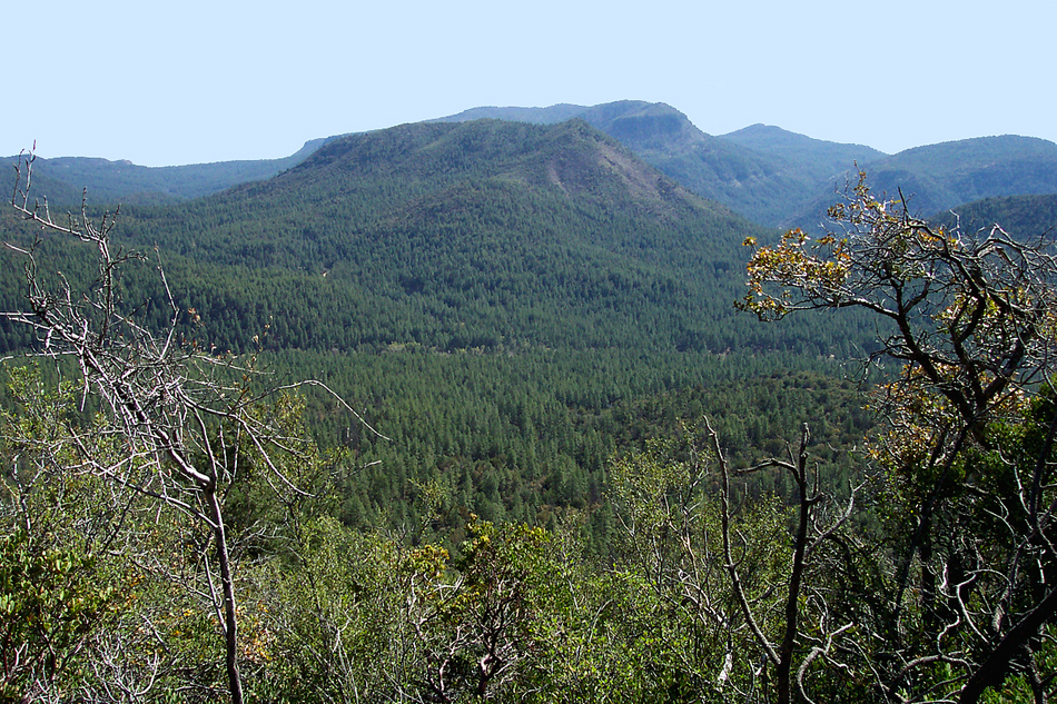
Hike From the trailhead pull-off spot at milepost 288 on state highway 288, the McFadden Horse Trail passes a small trail sign while charging up a steep ponderosa slope, following an eroded jeep trail. Quickly gaining elevation, the trail reaches a ridge top at one-half mile, which it follows to a junction with the Cienega Trail in a small saddle at one mile. A sign for the McFadden Horse Trail marks the junction, and the trail renews its vigorous climb by switchbacking up the ridge, where one can look across to the Armer Mountain area. Grey limestone along this stretch, composed of stromatolites (fossilized algae) soon gives way to orange quartzite. The ridge quickly transitions into a sloping bench of ponderosa and juniper, and the trail passes a sign for the Sierra Ancha Wilderness. Leaving the bench, the McFadden Horse Trail zigzags up the increasingly steep western rim of McFadden Horse Mountain, finally reaching the top at about 1.9 miles (33.88639 N, 110.94503 W), where there is a fine view to the west of the entire Mazatzal range. The previously distinct footpath now disappears, and one must now rely completely on cairns for the remainder of the hike. Fortunately, the cairns are numerous and well placed. The McFadden Horse Trail heads east from the top of the rim and soon turns south, gently climbing among tall pines. The trail arrives at a sign for the summit at 2.4 miles, where there is a summit cairn and register (33.88011 N, 110.94213 W). The trail continues heading southeast from the summit, gradually curving northeast, and then north, as it rolls along a rocky mountain top of agaves and junipers. At just over 3 miles, the McFadden Horse Trail suddenly drops off the mountain top (33.88279 N, 110.93558 W), and heads straight downhill through tall pines to cross the head of a small drainage at the 7200-foot contour. Turning north again at the drainage, the trail climbs atop the ridge that forms McFadden Horse Mountain's eastern arm. The trail follows the gentle ridge northward and occasionally offers a peek over the massive cliffs to the right. By 4 miles, the ridge has narrowed considerably, and the trail appears to come to an end at a rocky overlook. Keep heading down the spine of the ridge, and you will come to the very end of the trail in one-tenth of a mile, at a spectacular and somewhat terrifying overlook (33.89519 N, 110.93253 W). A notch in the ridge separates you from Elephant Rock. One can look across the gap at the crumbled walls of Elephant Rock Fortress, behind which lies the vast expanse of the Mogollon Rim. The best view, perhaps, is below, where the eastern edge of the mountain falls away into Cherry Creek's abyss. Massive cliffs and jagged formations of colorful Precambrian quartzite make for a truly unforgettable view. There is only one way back. Just follow those cairns. (Page updated on 2009-09-01) Check out the Official Route and Triplogs. Leave No Trace and +Add a Triplog after your hike to support this local community. | |||||||||||||||||||||||||||||||||||||||||||||||||||||||||||||||||||||||||||||||||||||||||||||||||||||||||||||||||||||||||||||||||||||||||||||||||||||||||||||||||||||||||||||||||||||||||||||||||||||||||


