 Route Editor

| Guide | ♦ | 5 Triplogs | 2 Topics |
details | drive | no permit | forecast | map |
stats |
photos | triplogs | topics | location |
| 43 | 5 | 2 |
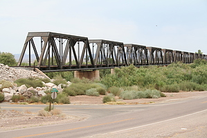
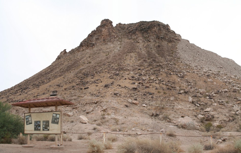
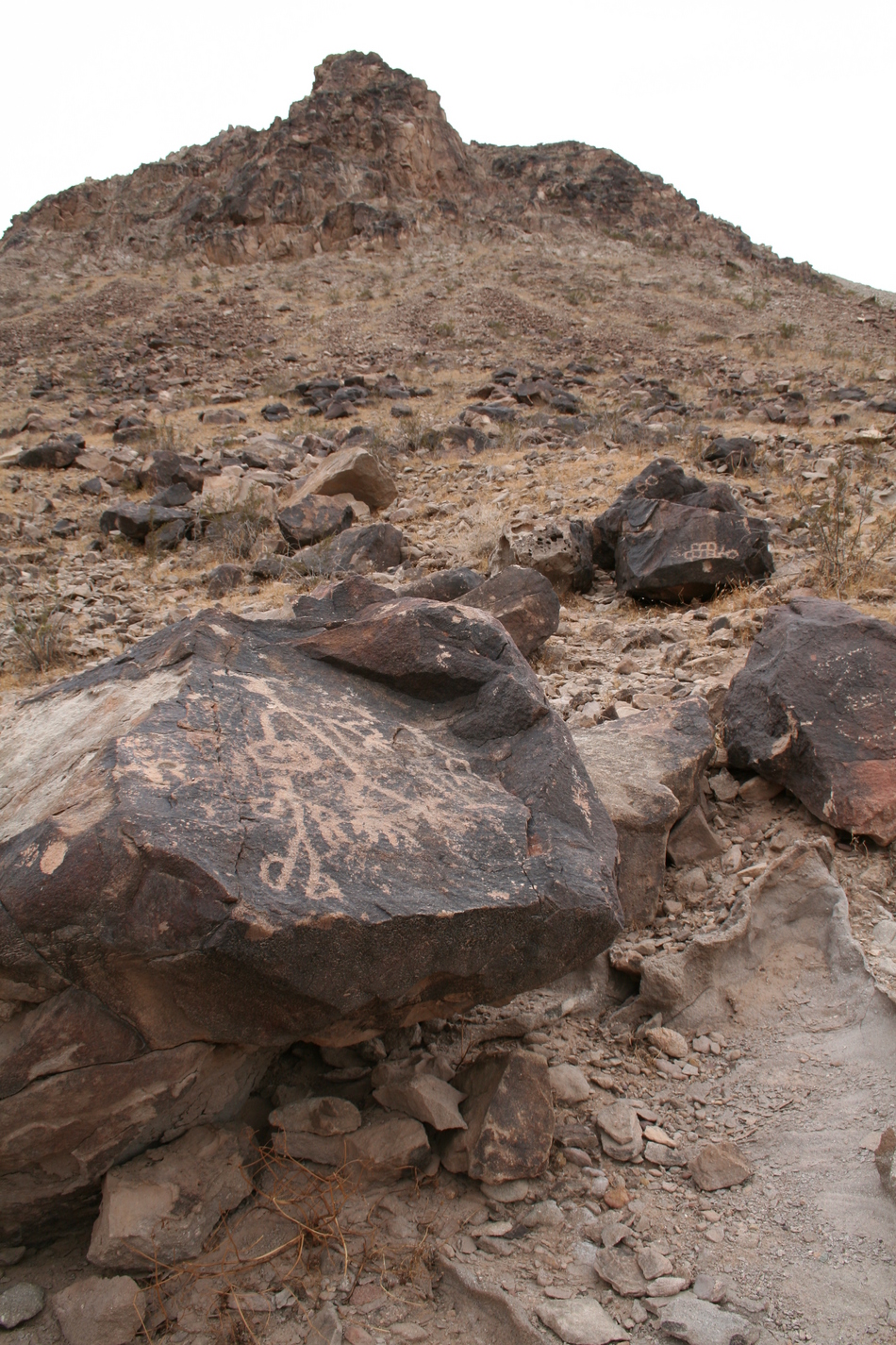
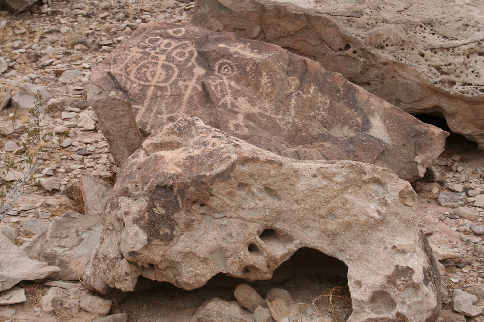
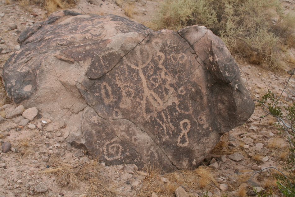
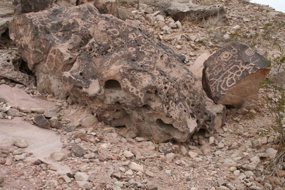
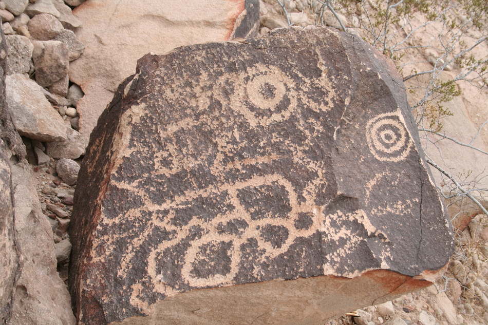
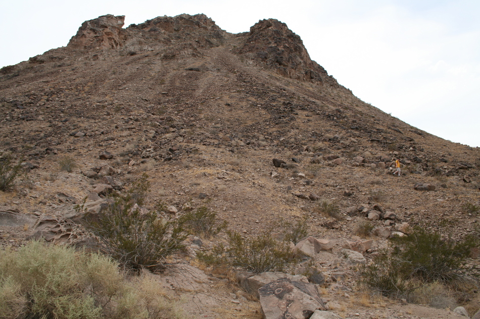
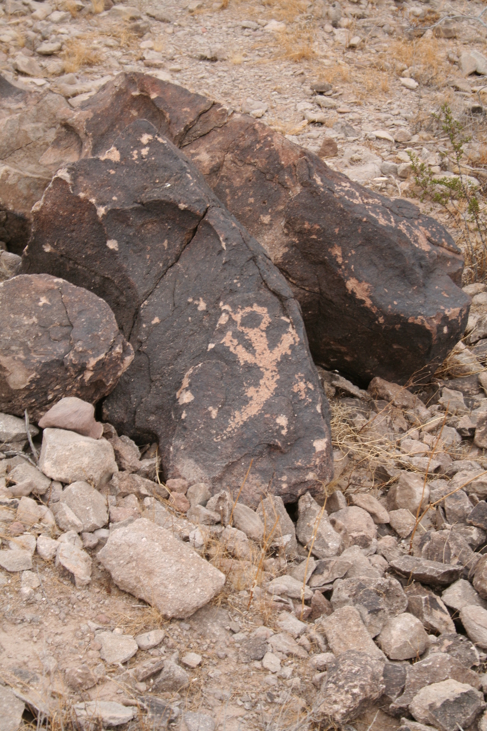
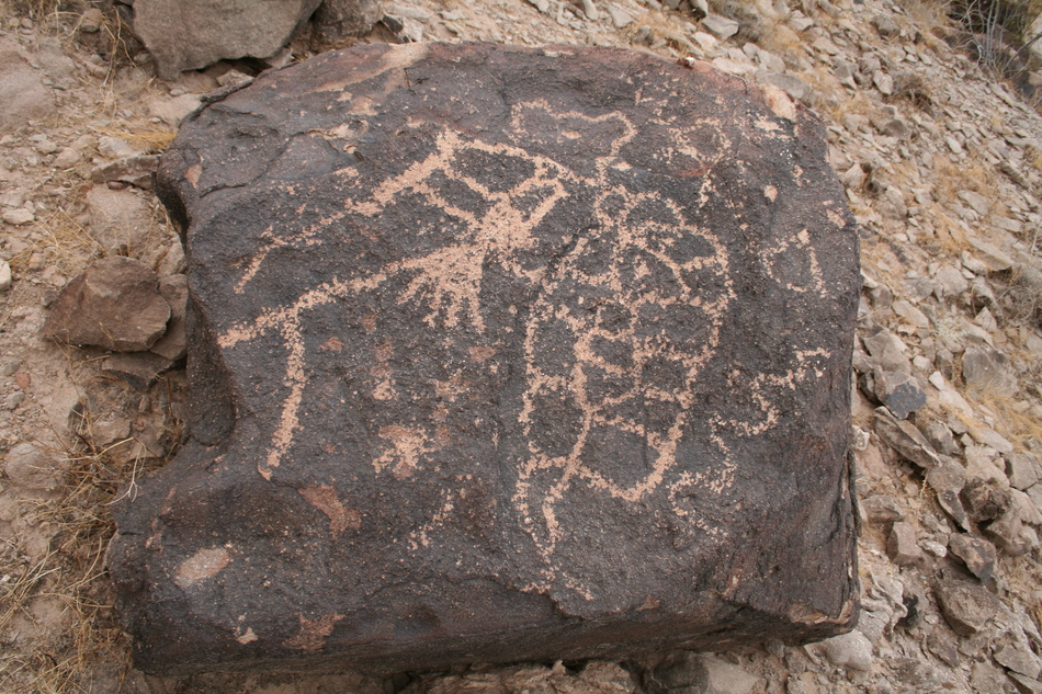
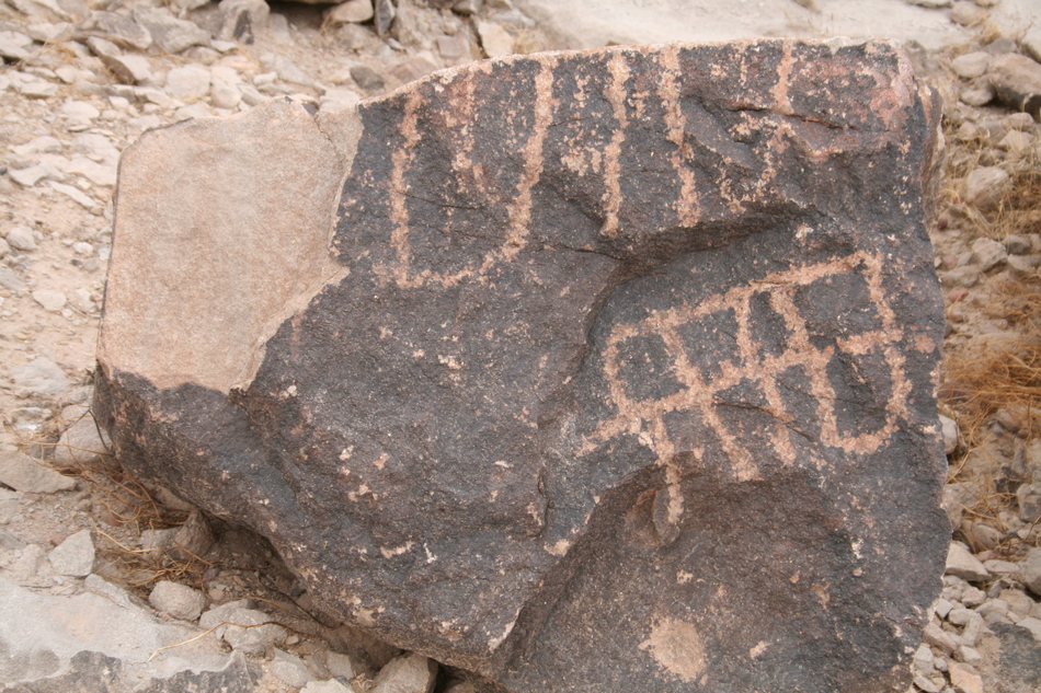
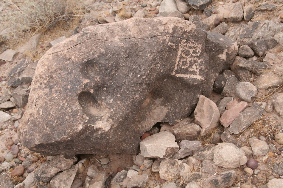
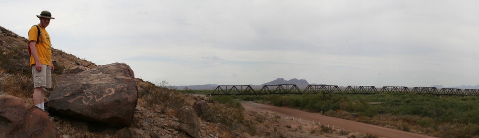
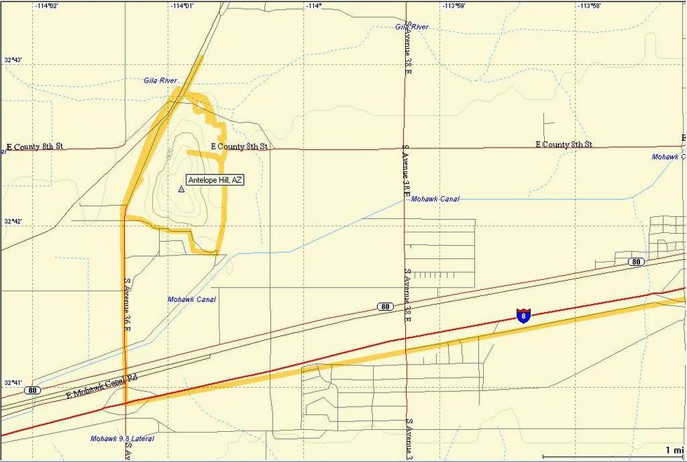
Quarry Irony by Randal_Schulhauser  I've become familiar with several petroglyph sites along the Gila River corridor. One site frequently mentioned in the literature is Antelope Hill. Its significance is due to the presence of ground stone quarries. Ground stone quarries are where the Ancients fashioned their "manos" and "metates" used to grind grains and seeds. It should be noted that the arkosic sandstone used in many of these tools found throughout the southwest has been traced back to this quarry site. It's somewhat ironic that this ancient quarry site has been significantly diminished in cultural value by a modern quarry site located on the northwest side of the hill. I've become familiar with several petroglyph sites along the Gila River corridor. One site frequently mentioned in the literature is Antelope Hill. Its significance is due to the presence of ground stone quarries. Ground stone quarries are where the Ancients fashioned their "manos" and "metates" used to grind grains and seeds. It should be noted that the arkosic sandstone used in many of these tools found throughout the southwest has been traced back to this quarry site. It's somewhat ironic that this ancient quarry site has been significantly diminished in cultural value by a modern quarry site located on the northwest side of the hill.I've previously noticed a mountain on the north side of I-8 with a large white "A" on its south slope. I've always presumed this to be Antelope Hill and as we approached the site with maps in hand, our presumption was confirmed. Our approach from the southwest side of Antelope Hill passes a new housing development and the remains of a shooting range. We soon pass the modern-day quarry, currently not in use. This site owned by the Wellton-Mohawk Irrigation and Drainage District has been quarried extensively to produce rip-rap to armor the banks of the Gila River. Unfortunately, the cultural value of this section has been destroyed.
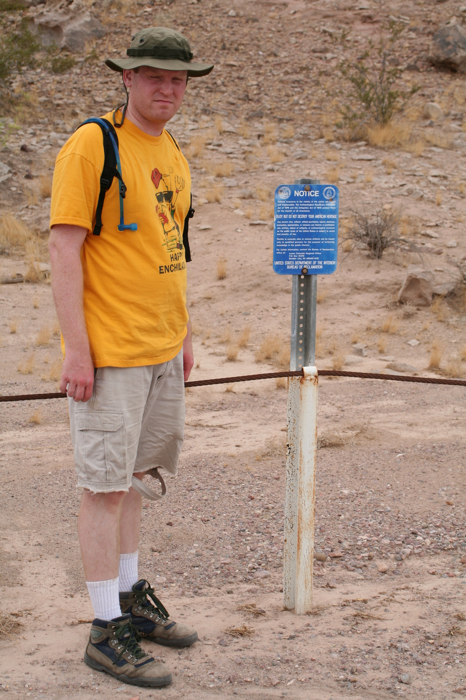
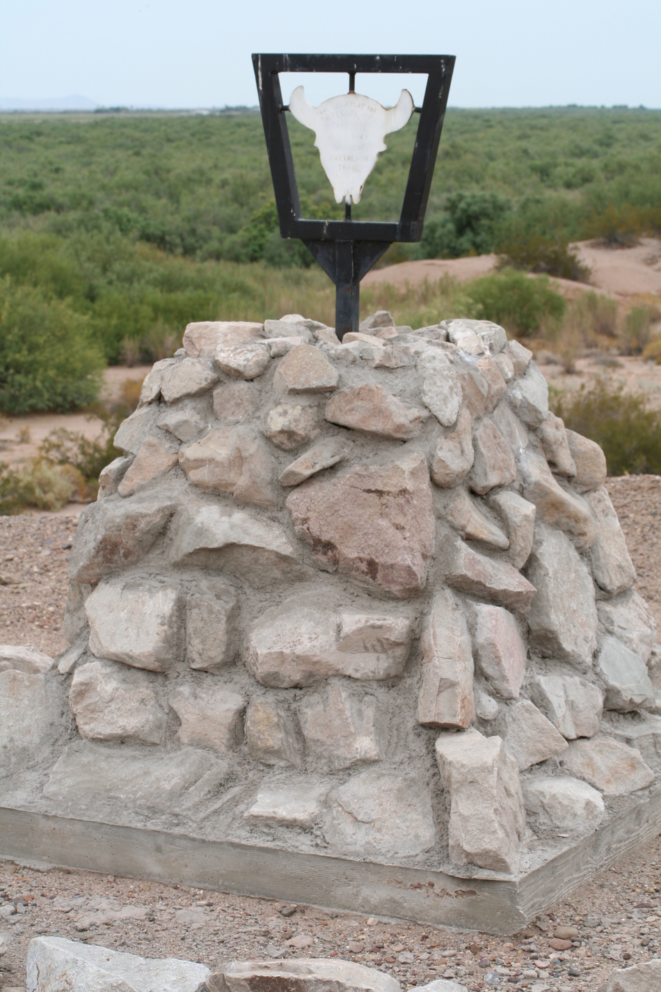
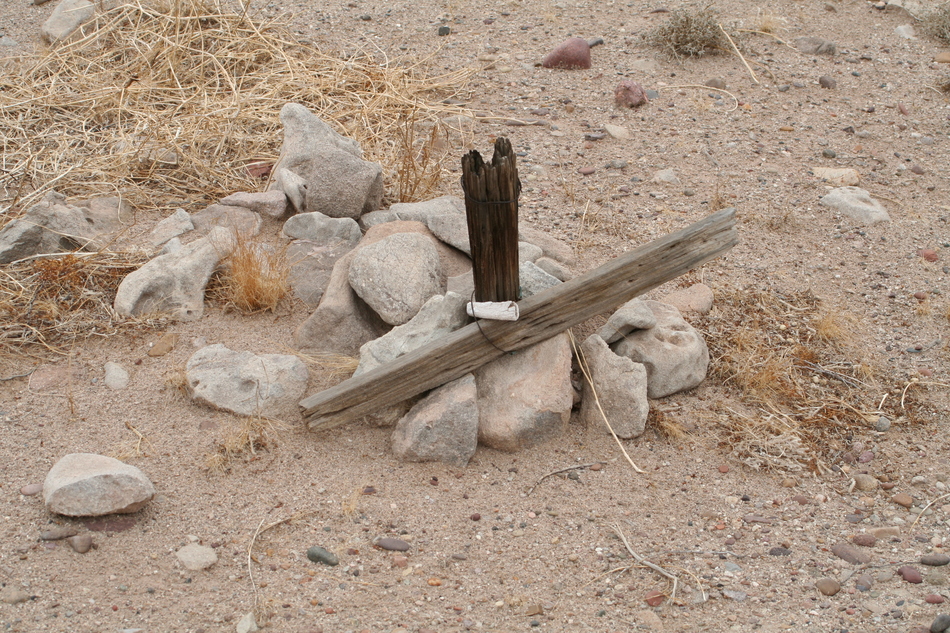
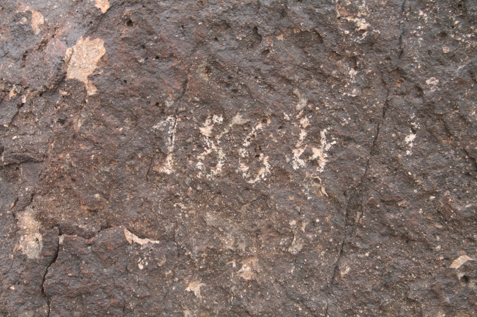
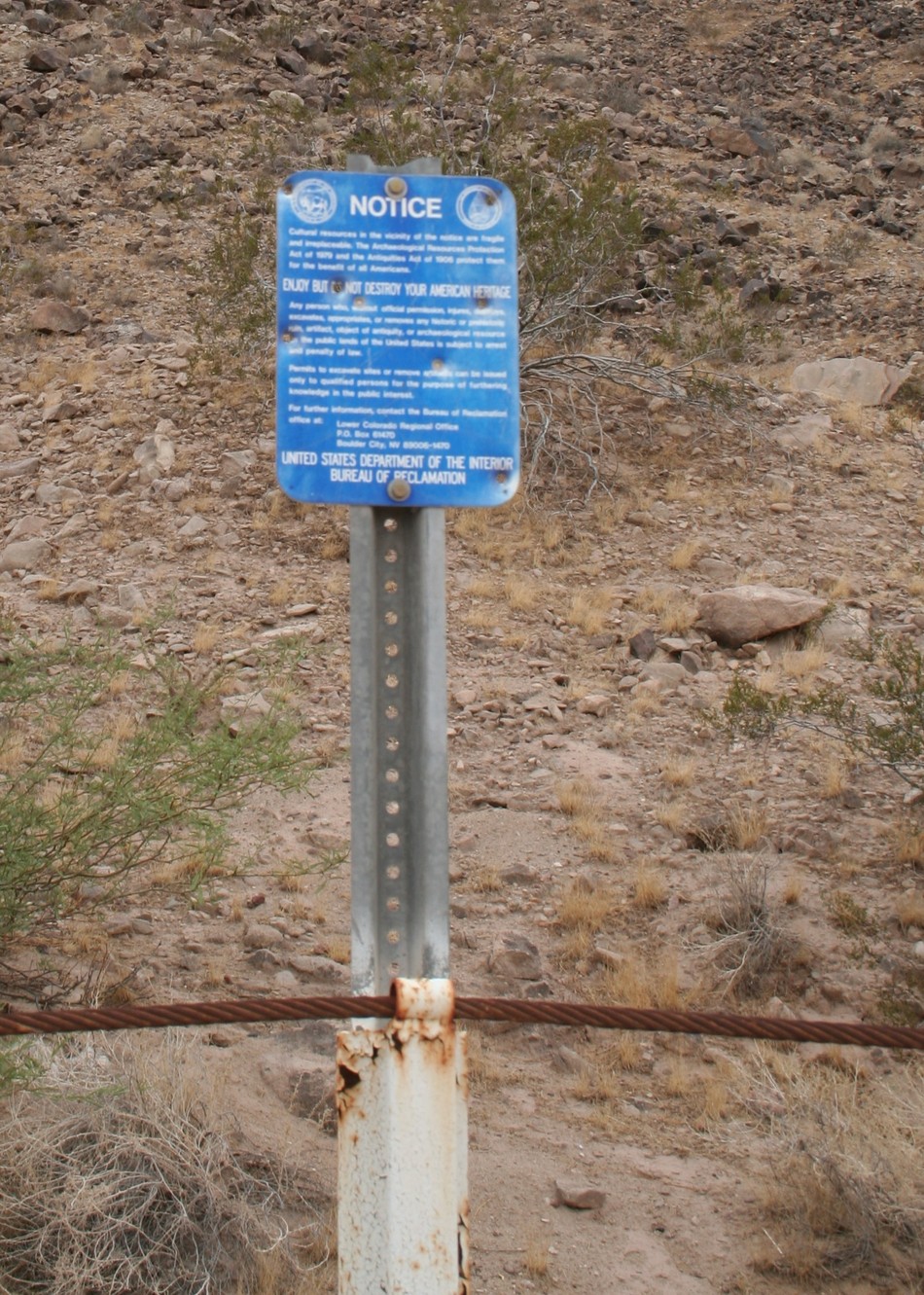
There appears to be many faint trails on the slopes of Antelope Hill, each leading to a petroglyph site. Keep your eyes open, almost every boulder with black desert varnish has rock art on it! Matt and I contoured up the slope near the summit of Antelope Hill. Interestingly, we didn't see any petroglyphs outside the vicinity of the steel cable barriers with blue signage. We also trekked the complete perimeter of Antelope Hill and didn't notice anything of significance. We returned to the sections marked by the steel cable barriers and blue signage and were soon rewarded by many rock art examples. Some History: Archeologists know the hill as the largest and most productive milling implement quarry in the southwest, with tools made from Antelope Hill sandstone found at sites stretching up and down the Gila and Colorado rivers. According to Native American oral history, the hill was a "no-man's-land" in a hotly contested region. This explains the diversity of rock art samples. In more recent times, Spanish explorers camped at Antelope Hill and scaled the summit to survey the land. There are reports they left their mark near the summit. Military companies from the American-Mexican war passed along this route. Early pioneers buried their dead near the foot of the hill. Other passers-by left their mark in the rocks. Summary: The Gila River corridor has been utilized by the Ancients, early Spanish explorers, and 1800's settlers as an important travel route. The Antelope Hill Petroglyph Site left me somewhat appalled that such a significant archeological site could be partially consumed by a modern quarry! The apparent bullet holes in much of the signage and some of the boulders left me sad. Ancient rock art continues to be a significant hiking attraction for me. I'm aware of a couple of more sites within the Gila River corridor and plan to visit them in the future. For further reading I recommend "Of Stones and Spirits - Pursuing the Past of Antelope Hill" by Joan S. Schneider and Jeffery H. Altschul. Enjoy! Check out the Triplogs. Leave No Trace and +Add a Triplog after your hike to support this local community. | ||||||||||||||||||||||||||||||||||||||||||||||||||||||||||||||||||||||


