 Route Editor

| Guide | ♦ | 95 Triplogs | 9 Topics |
details | drive | no permit | forecast | 🔥 route |
stats |
photos | triplogs | topics | location |
| 1.3k | 95 | 9 |
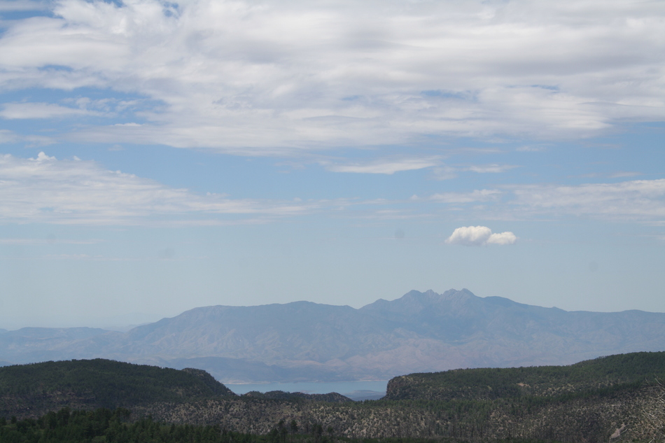
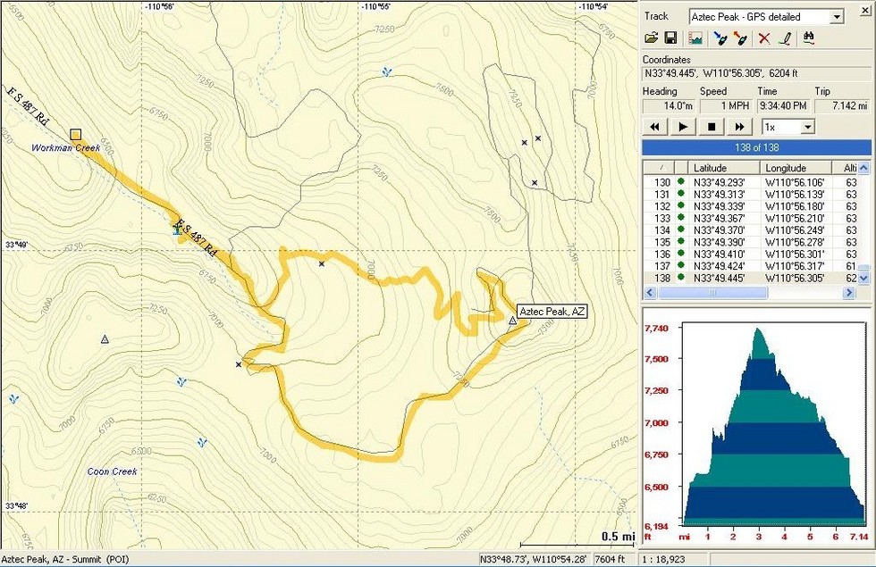
Edward Abbey pilgrimage by Randal_Schulhauser  History HistoryI am a frequent visitor to the Sierra Anchan Range located east of Lake Roosevelt. The numerous archeological sites have been a primary attraction for me, but I haven't ascended a single peak in this range for some reason. Located within the Tonto National Forest, Aztec Peak at 7,748 feet elevation (or 7,694 feet by some sources) ranks as the 41st highest prominence in Arizona. Although I haven't located any direct evidence of prehistoric occupation near Aztec Peak, the eastern drainage into Cherry Creek and the southern drainage into Coon Creek is dotted with multiple archeological sites, some noted within HAZ hike descriptions. The western drainage near Gisela also has numerous sites. Given the proximity of Aztec Peak to these known sites only suggests they haven't been discovered (or disclosed).
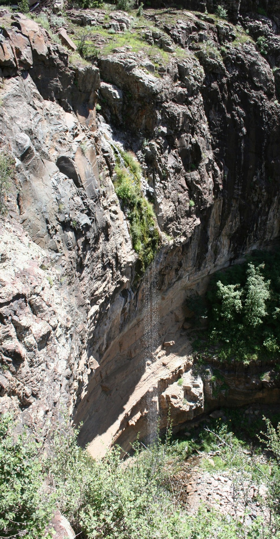
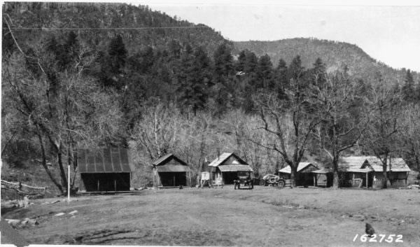
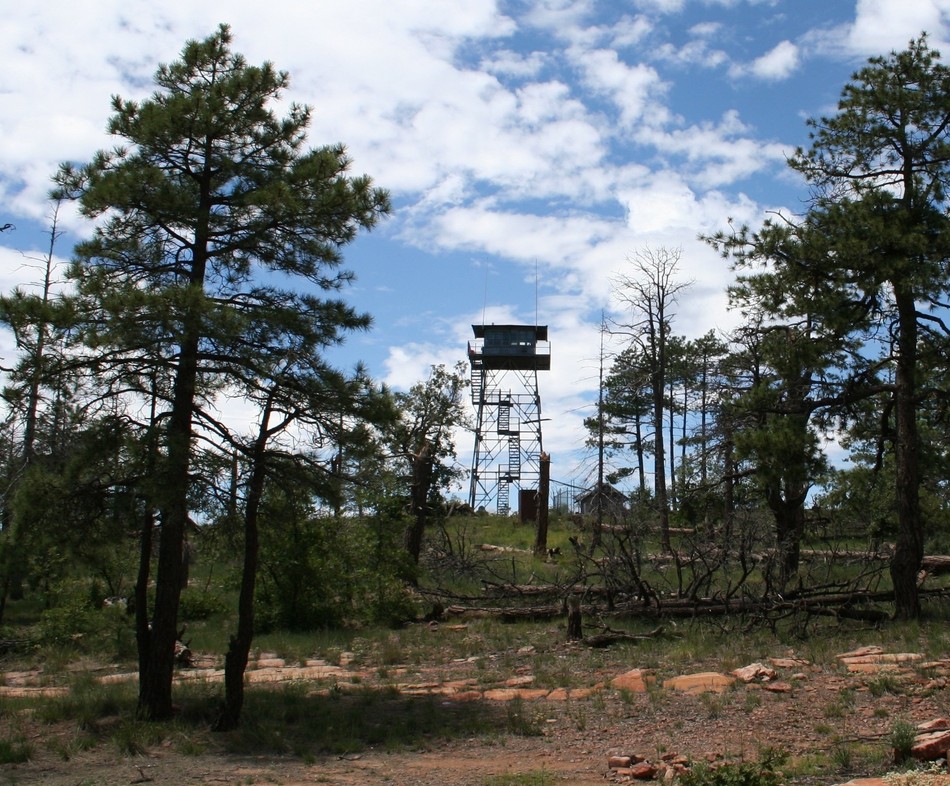
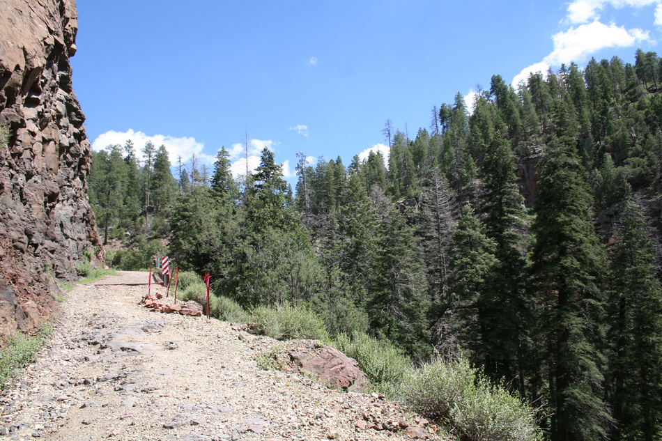
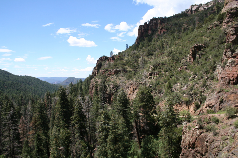
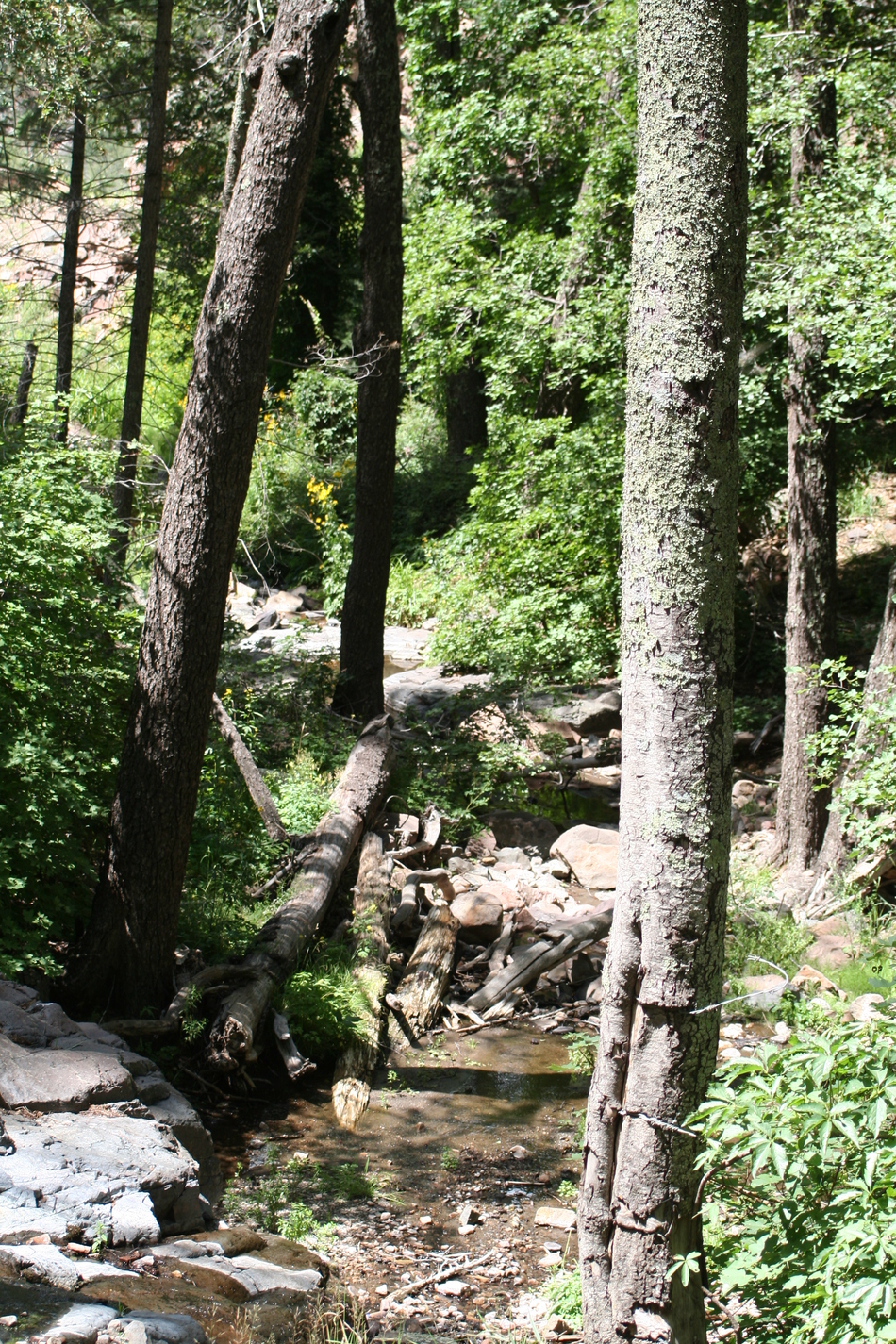
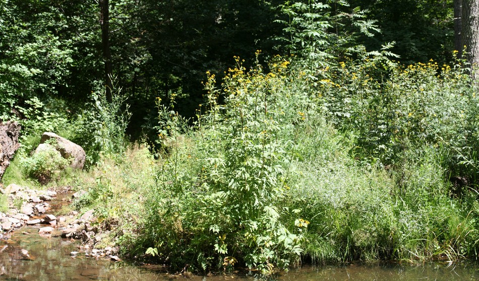
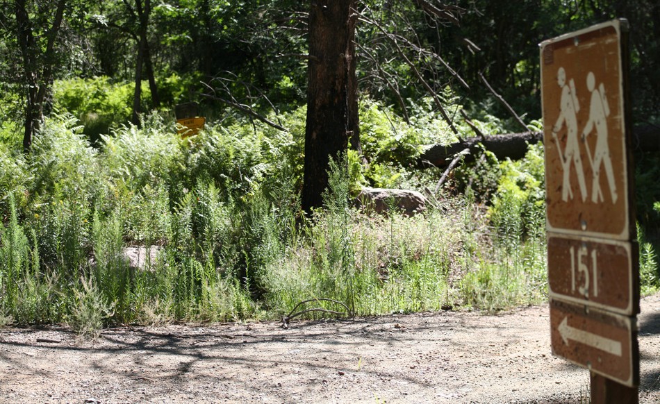
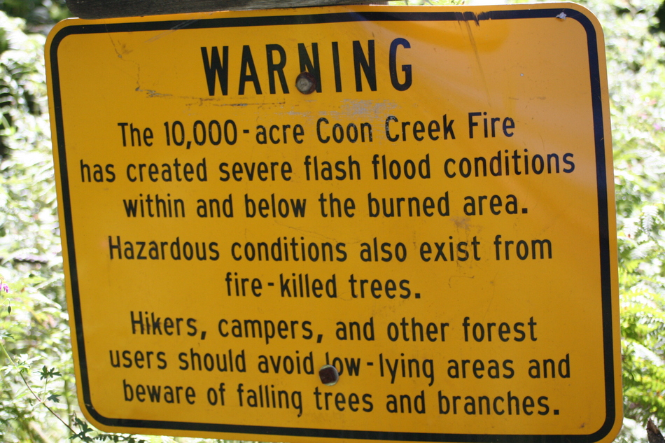
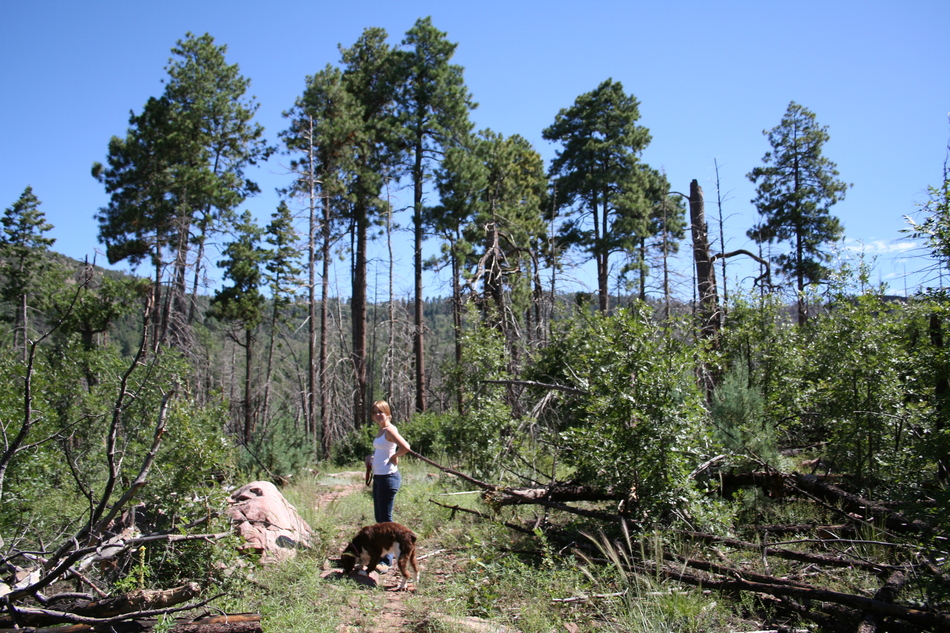
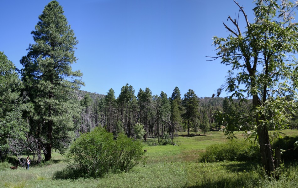
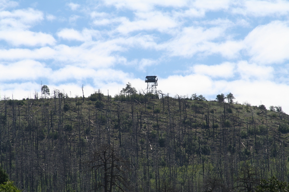
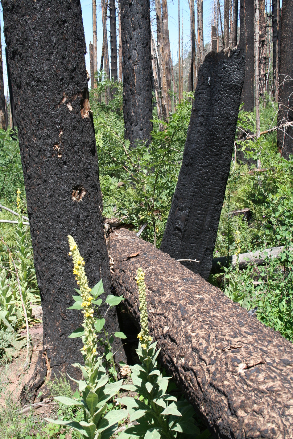
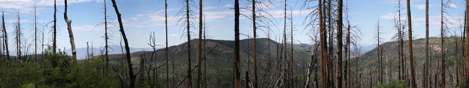
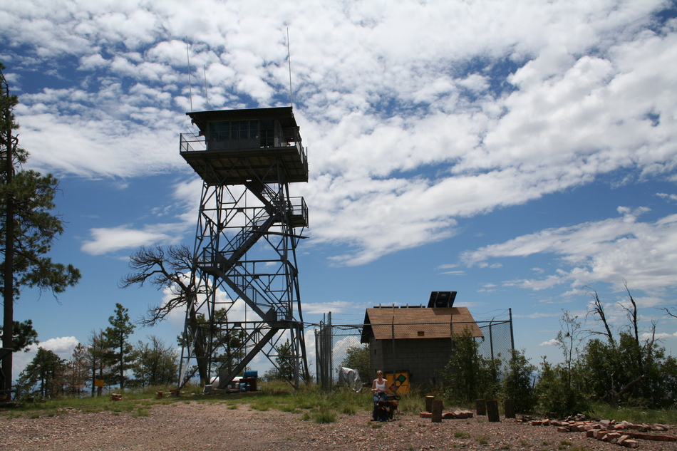
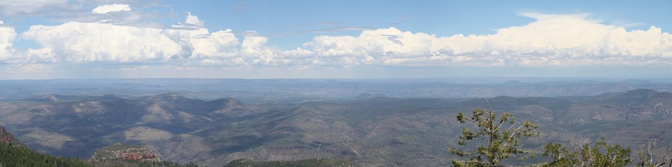
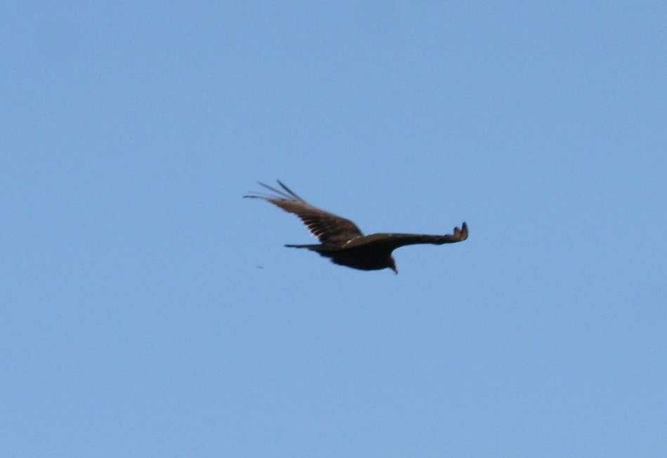
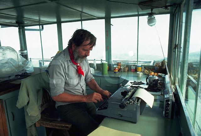
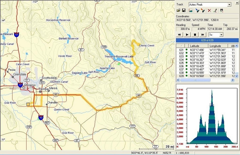
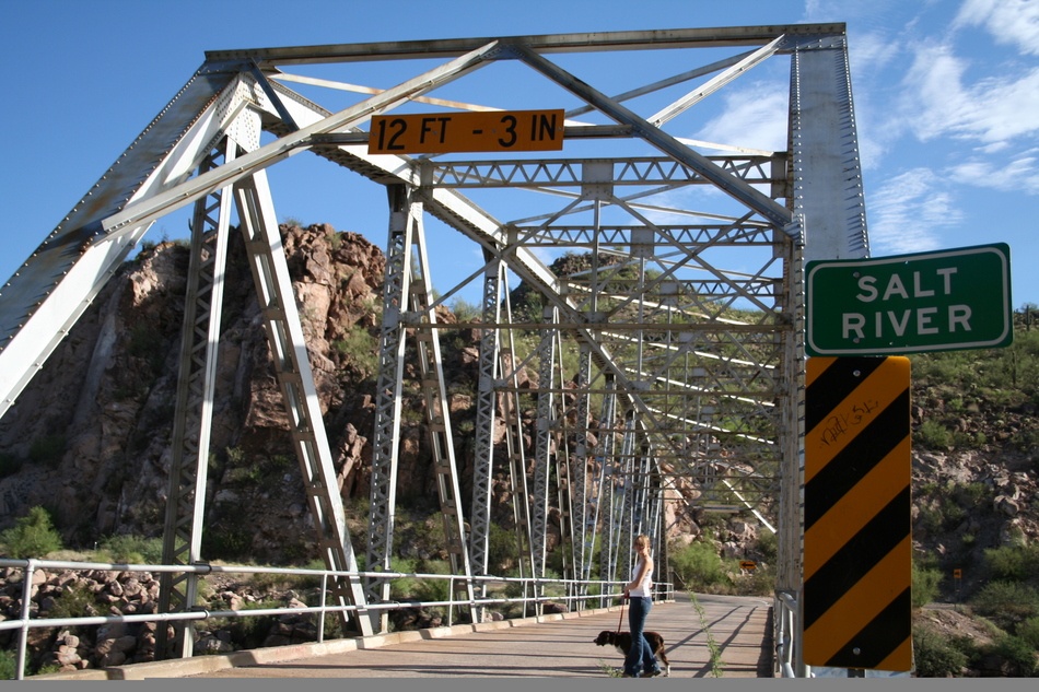
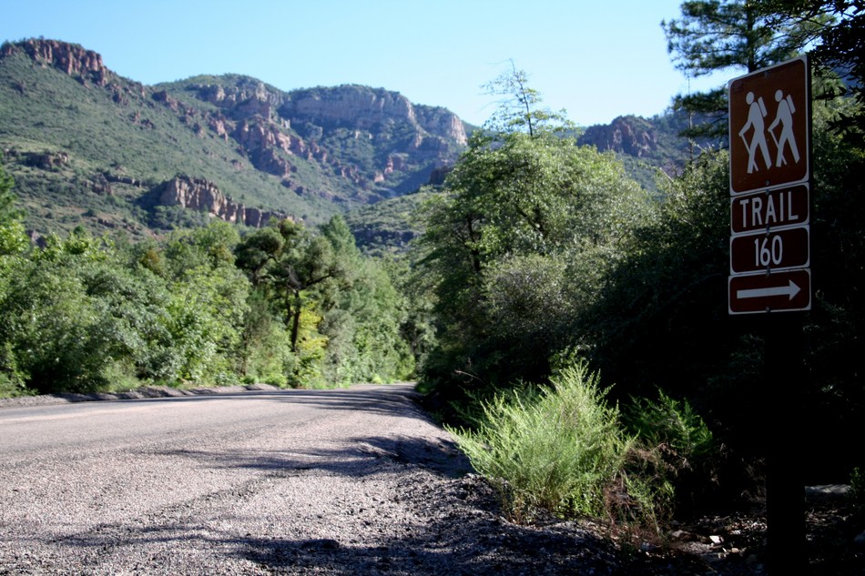
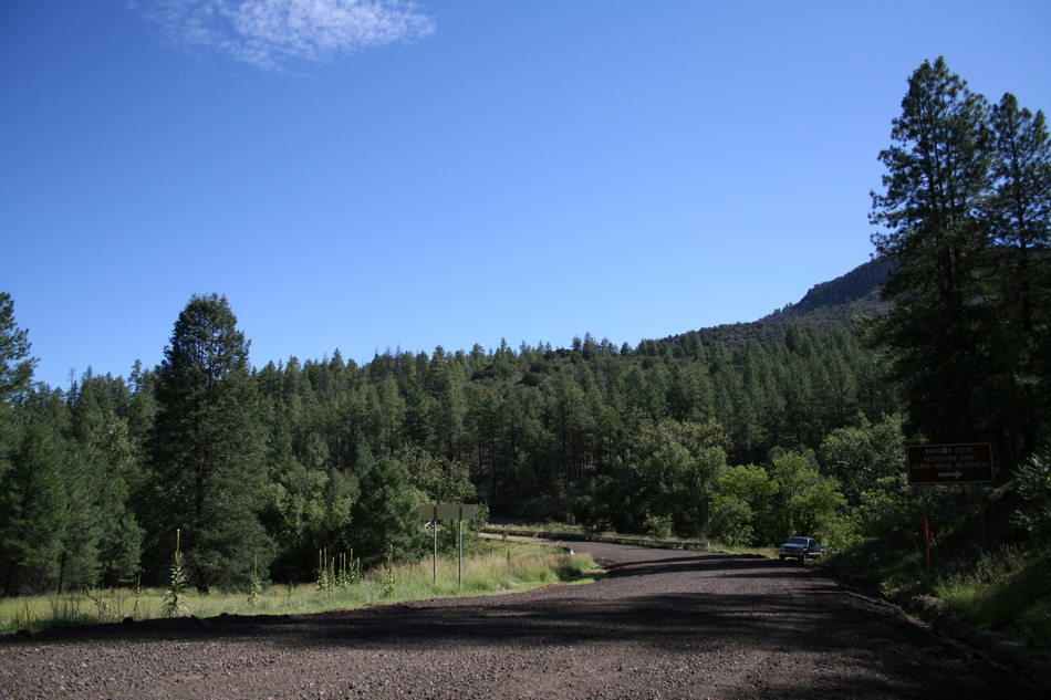
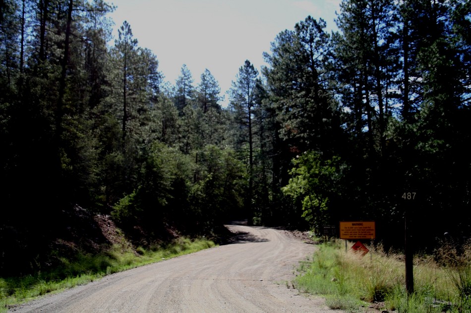
The Pleasant Valley War, primarily centered near and north of Young, also spilled over into the region. Made famous by Zane Grey's western novel "To The Last Man", one of the combatants was shot in 1887 near a high waterfall assumed to be Workman Creek Falls. Nearby McFadden Horse Trail is also linked to this frontier feud. Another attraction along the way is Workman Creek Waterfalls. At 180 feet, these falls offer spectacular views and a unique challenge to rock climbers. Named for one of the area's late 1880's pioneers, Harry Wertman, the spelling has evolved just as it sounds. Remnants from other early pioneers can be found at the Peterson Ranch and the Carr Ranch. Check out the apple orchard on the Peterson Meadow. This is remarkably similar to Reavis Ranch orchard in the Superstitions. I was surprised to find out that the Carr Ranch also served as a summertime resort during the 1920s. The lookout tower located at the Aztec Peak summit has gained some notoriety due to its famous inhabitant during the summers of 1977, 1978, and 1979. Edward Abbey worked as a Forest Service Fire Spotter stationed at the Aztec Peak Lookout Tower. This work experience becomes a source of multiple references within "Confessions of a Barbarian". This lookout tower was constructed in 1956 and listed on the National Historic Lookout Register at US#192 and AZ#02. The April 2000 Coon Creek Fire has left its scars throughout much of the Sierra Ancha Wilderness area. Interesting that Preston Sand's hike description for Parker Creek Trail 160 originates from a pre-fire backpack. I'm happy to report that restoration and regeneration are progressing, although I'm sure it will never be the same! Hike Start your hike from the road closure barrier at FR487 near the Falls camp ground. A steady ascent of 405 feet for 0.65 miles along the closed Forest Road and you will arrive at the precipice for Workman Creek Waterfall. Gaze back to the northwest to view a pine covered Workman Creek Canyon. FR487 will track along the headwaters of Workman Creek. This riparian area attracts a variety of wildlife. We saw many species of birds, particularly hummingbirds. A lone deer bounded across the road, and some trees had scratching evident of bear activity. At mile 1.2 and 760 feet above the road closure barrier, we came to the Abbey's Way 151 west trailhead. A passing Forest Service vehicle stopped, and we were informed that although the trail is passable, it has not been maintained this year, and route finding may be a challenge. We were told to expect many wind fallen trees and areas of extreme overgrowth. We were also cautioned about hazards from fire-killed trees should we encounter wind or rain. Showing our trusty GPS and a copy of the online Forest Service map, the Rangers felt confident that we'd be able to tackle the challenge. Through some initial dense fern growth, we were able to locate a series of cairns marking the Abbey's Way 151 trail. The trail soon passed through a burned area. Route finding isn't difficult in this area as the trail seems to have been cleared. At mile 1.4 a lush open meadow appears. This demarks the old Peterson Ranch as well as the source of the Workman Creek. The trail hugs the northern perimeter of the meadow. Our first glimpse of the Aztec Peak Lookout Tower can be seen from this vantage. At mile 1.7 the trail begins a steady ascent up Aztec Peak. Route finding can be tricky at this point. On two occasions, the trail appeared to vanish with multiple wind fallen trees blocking any apparent route. Scan the area looking for chain saw cuts or rock cairns to pick up the trail again. If completely "stumped", spot the Lookout Tower and climb up. Through a series of switchbacks, you are soon rewarded with some spectacular views as you near the summit. At mile 2.9 we are at the base of the Aztec Peak Lookout Tower. It's time for a break and a chance to talk with Ranger Red who is the Lookout Tower Fire Spotter for the 2006 season. Red is spending the day cutting and clearing some new campsites near the top of Aztec Peak and extends an open invitation to future campers. I may take him up on that offer, maybe as a combined mountain bike and camp adventure. My GPS indicates coordinates 33o 24.959'N, 110o 49.741'W, and an elevation of 7,740 feet leading me to believe the 7,748 claims to be valid. We continue to linger soaking in the sights. The 360 degree view from the summit is nothing less than fantastic and you certainly get a bird's eye outlook... The return loop follows FR487 down Aztec Peak. At mile 3.6, the road joins the Murphy Ranch cut-off near the Moody Point Trail 140. Near mile 5.4, you pass the Carr Trail Head marking a jumping-off point for Parker Creek Trail 160 and Rim Trail 139. At mile 5.8, you pass the Abbey's Way 151 trailhead. Retrace your steps back down FR487 from earlier in the day. At mile 7.1, you should find your vehicle close to the road closure barriers. FR487 Gate Typically closed December 1th thru April 1st. Check with Tonto FS if you are looking to skip the 1.3 miles of 487 each way. Summary I'm often asked my opinion on Edward Abbey. His mystique is comparable to Twain or Thoreau, or Whitman. Many HAZ members have come to revere this desert anarchist... witness the many Abbey tagline quotes of wisdom closing a post. Enough said, but if you are curious to find out more about Edward Abbey, check out one of his books. We know he spent three summers atop Aztec Peak, and they had a profound effect. Having spent a summer's day atop Aztec Peak, I now have the profound urge to read Desert Solitaire... Enjoy! Check out the Official Route and Triplogs. Note This is a moderately difficult hike. Leave No Trace and +Add a Triplog after your hike to support this local community. | ||||||||||||||||||||||||||||||||||||||||||||||||||||||||||||||||||||||||||||||||||||||||||||||||||||||||||||||||||||||||||||||||||||||||||||||||||||||||||||||||||||||||||||||||||||||||||||||||||||||||||||||||||||||||


