|
tap row or icons for details
|
| Route Finding |
|
3 of 5 |
| Distance Round Trip |
|
0 miles |
| Trailhead Elevation |
|
1,726 feet |
| Dogs not allowed |
| | |
|
|
11 |
2015-11-19 | jameslcox44 |
|
|
11 |
2014-12-08 | jameslcox44 |
|
|
10 |
2012-04-23 | jameslcox44 |
|
|
11 |
2011-01-17 | ASUAviator |
|
|
5 |
2011-01-16 | LittleKnee |
|
|
8 |
2006-11-25 | AZLOT69 |
|
| |
|
|
|
list |
map |
done |
Phoenix Region |
| | |
|
| |
|
|
Historical Weather |
| Trailhead Forecast | | |
|
 |
|
|
| Preferred Jan, Feb, Dec, Mar |
|
|
|
Seasons Autumn to Early Spring |
|
|
| | |
| |
Named Locations Coordinate Links
| |
|
| help future hikers |
| post a gps route now |
| | |
| |
|
|
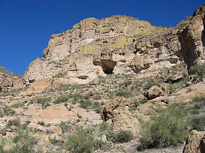
This page is open to authors as a full hike in or by kayak/boat access to Skull Cave as marked on 1975 topo. See Skeleton Cave for the historical massacre nearby. Pg 243 Ferg/Tessman Essay Barnes states that Apache Cave was the name used until around 1919 when the name was changed to Skull Cave by Southern Pacific Railroad (SPRR) for publicity purposes. Apparently, upon completing the SPRR's Bowie-to-Globe track, the term "Apache Trail" was unilaterally applied to what had been known for years by locals as the Tonto Trail. A professor, Abner Drury of Berkeley, California, was hired by SPRR to "reconstruct" place names (which would appeal to travelers), resulting in brand new names usurping the historical ones and institutionalizing any number of romantic tales about what had supposedly occurred at those places. Skull Cave is the site's name on 1937 and 1975 USDA Tonto National Forest Maps, as well as the 1964 "Mormon Flat Dam, Ariz." USGS 7.5-minute map... Despite originally having been called Apache Cave and being officially rechristened and still shown on maps as Skull Cave, the majority of non-Yavapai writers discussing the site in recent years have been using "Skeleton Cave," and the name recorded on the National Register of Historic Places is "Skeleton Cave Massacre Site". |
 Route Editor