 Route Editor

| Guide | ♦ | 18 Triplogs | 0 Topics |
details | drive | permit | forecast | 🔥 route |
stats |
photos | triplogs | topics | location |
| 23 | 18 | 0 |
  2019 2019The guide below from Aspen Creek does not align with what the Forest Service declares as #366. The stats on this guide are for Trail #366. The following is intriguing. Overview The Sierra Prieta Trail, described in Ron Smith's book Prescott And Central Highlands Trails, is an old, closed road that follows the ridgeline of the Sierra Prieta Mountains east from Aspen Creek. This description is of the western half of the book's hike, as the eastern half seems to be a popular 4x4 drive.
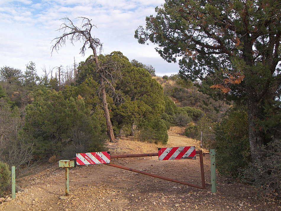
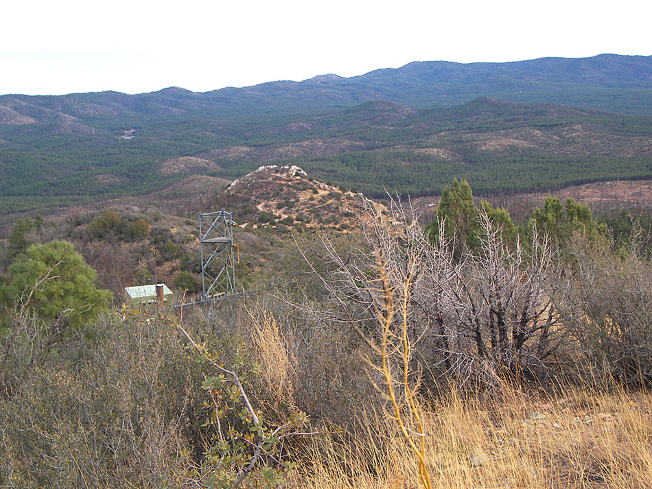
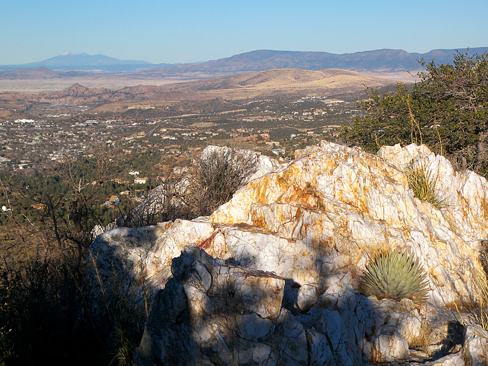
At the trailhead on Copper Basin Road, begin hiking up the Aspen Creek Trail #48, or gated road 9401L (both will join together in a short distance). After a steep quarter-mile climb out of ponderosa blanketed Aspen Creek canyon, the trail flattens out and provides a glimpse of Wolverton Mountain to the east. At 0.3 miles, the Aspen Trail splits off to the right (turn left onto trail 9415, this is the Sierra Prieta Trail). From the junction in the saddle, the trail stays high up on ridges and mountaintops for the rest of its length. The Prescott area and Thumb Butte are visible to your left, with the Bradshaw Mountains to your right. A short distance later, the trail forks; take the left fork, and continue following it up the forested ridge. At about 1.2 miles, you will arrive at a trail junction where a metal gate blocks the trail. A half-mile round trip hike up the old road to your left will bring you to a weather station near the top of 6704 foot Wolverton Mountain. My dad and I have tried to get to the actual top of Wolverton from the end of the road, but the brush is just too nasty. Anyway, the views from the weather station are fantastic. Prescott is spread out below you, and there are views of the Mingus Mountain area, the San Francisco Peaks, and the Bradshaw Mountains. Directly to the south is a barren area that looks like a gigantic lawnmower went through it: the path of May 2002's Indian Fire that almost took out the city of Prescott. Once you have seen the views from Wolverton Mountain, continue back to the trail junction at the gate. Back at the junction, the Sierra Prieta Trail heads downhill to the east, steadily dropping along the brushy hillsides, and heading for the rocky peak of white quartz known as White Spar (also known as Quartz Mountain). After about 0.85 miles, the trail meets up with a dirt road in a saddle at the foot of White Spar peak. There are some old collapsed mines or quarries on the southwest side of the peak, and many old mine roads switchback up it. (The old mine tipple that was on the south side of the peak is gone, sadly) The top of the peak is worth a visit, and the 360 views from its rocky summit are the best on the whole hike. Just follow one of the old mine roads up the west side of the mountain to its end (the last 50 feet to the top is an easy bushwhack). When you have seen all you want to see, head back to the Aspen Creek Trailhead, or continue down the old White Spar Road to where it joins up with highway 89, on the south side of Prescott. Gate Policy: If a gate is closed upon arrival, leave it closed after you go through. If it is open, leave it open. Leaving a closed gate open may put cattle in danger. Closing an open gate may cut them off from water. Please be respectful, leave gates as found. The exception is signage on the gate directing you otherwise. Check out the Official Route and Triplogs. Leave No Trace and +Add a Triplog after your hike to support this local community. One-Way Notice This hike is listed as One-Way. When hiking several trails on a single "hike", log it with a generic name that describes the hike. Then link the trails traveled, check out the example. | ||||||||||||||||||||||||||||||||||||||||||||||||||||||||||||||||||||||||||||||||||||||||||||||||||||||||||||||||||||||||||||||||||||||||||||||||||||||||||||||||||||||||||||


