 Route Editor

| Guide | ♦ | 10 Triplogs | 1 Topic |
details | drive | no permit | forecast | 🔥 route |
stats |
photos | triplogs | topic | location |
| 147 | 10 | 1 |
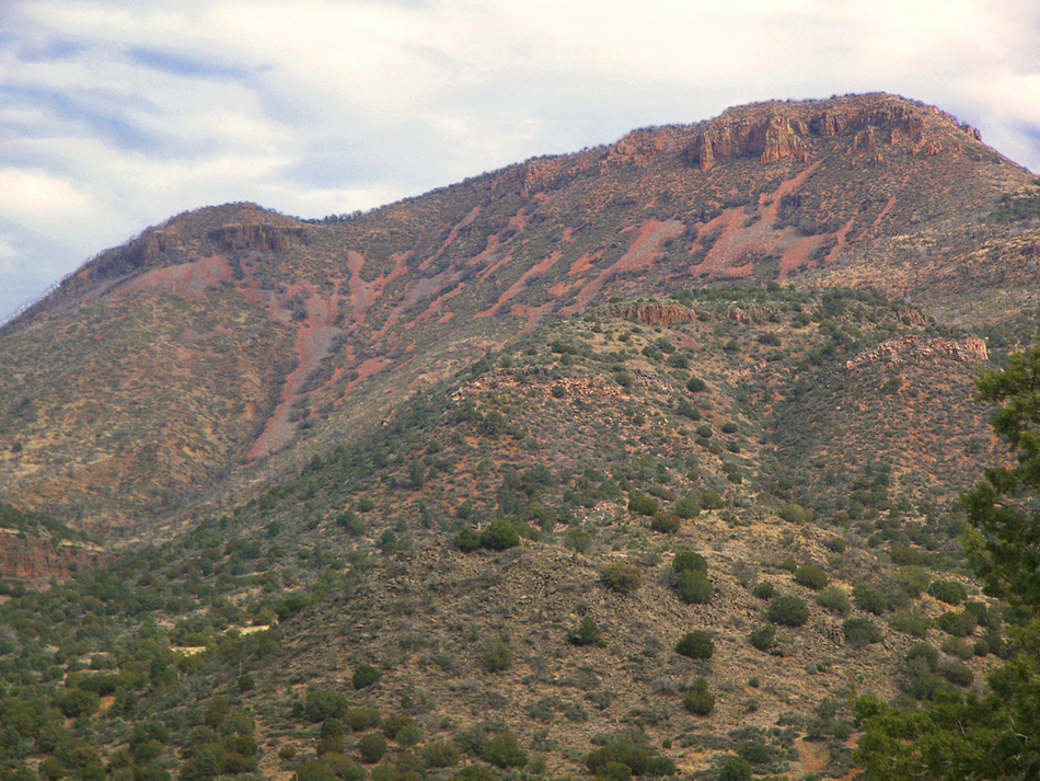
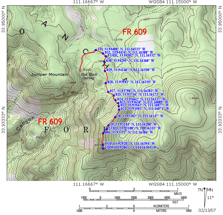
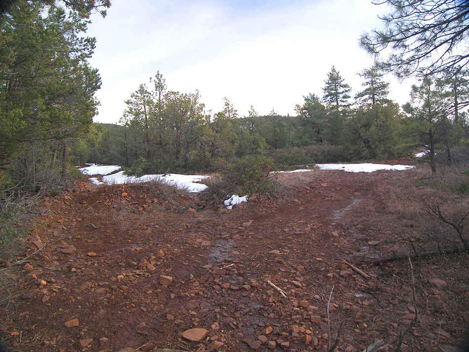
Picture perfect by PrestonSands   Dominating the skyline east of Tonto Basin is 6451 foot Picture Mountain, so named for the rock slides on its face that resembles a horseback rider with weapon raised, riding towards some sort of animal. Picture Mountain forms the southern corner of a forested plateau in the northern Sierra Anchas where Pleasant Valley War participant Jake Lauffer, and later legendary cattleman George Cline once ran cattle. Evidence of the 2003 Picture Fire is minimal in this area and is mostly manifested on the face of Picture Mountain, which is recovering nicely. Traveling the precipitous, rocky road up to where the trail starts is an adventure in itself! Usually, the road is high clearance, bordering on 4x4. Please see my gps map. Dominating the skyline east of Tonto Basin is 6451 foot Picture Mountain, so named for the rock slides on its face that resembles a horseback rider with weapon raised, riding towards some sort of animal. Picture Mountain forms the southern corner of a forested plateau in the northern Sierra Anchas where Pleasant Valley War participant Jake Lauffer, and later legendary cattleman George Cline once ran cattle. Evidence of the 2003 Picture Fire is minimal in this area and is mostly manifested on the face of Picture Mountain, which is recovering nicely. Traveling the precipitous, rocky road up to where the trail starts is an adventure in itself! Usually, the road is high clearance, bordering on 4x4. Please see my gps map.Beginning at a large pull-off area on the south side of forest road 609, start following an old unmarked jeep trail as it heads southeast into the forest. This is actually forest road 875, which is not really a road at all anymore. (seriously, don't try to drive this-you'll see why later!) At the 0.15 mile point, the old road forks. Turn right here, onto the west fork (GPS coordinates: 33.94382 N 111.16332 W). The old road/trail turns south here and continues its gentle climb up through the scrub oak and ponderosas. The trail soon begins a steep climb straight up the northern slope of Picture Mountain. As you ascend higher, the Sierra Anchas, Mazatzals, and the Mogollon Rim rise behind you over the treetops.
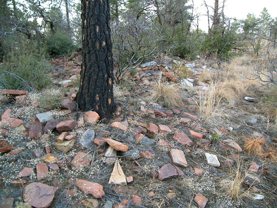
Back at the trailhead, a 0.75-mile round trip hike to the west down the 609 road will bring you to the ruins of a Salado or Anchan dwelling next to the south side of the road. The walls have collapsed into piles of rocks in this approximately 100 foot by 300-foot ruin, but it is still worth checking out before heading home. Enjoy! Check out the Official Route and Triplogs. Leave No Trace and +Add a Triplog after your hike to support this local community. | ||||||||||||||||||||||||||||||||||||||||||||||||||||||||||||||||||||||||||||||||||||||||||||||||||||||||||||||||||||||||||||||||||||||||||||||||||||||||||||||||||||||||||||||||||||||||||||||||||||||||||||||||||


