Silver Falls State Park, OR • Hike
  

Silver Falls State Park, OR

Guide 10 Triplogs Mine 0 0 Topics
 
5 of 5 
Fav
Wish
0
details
drive
permit
forecast
route  
stats
photos
triplogs
topics
location
161 10 0
Statistics
tap icons for details
Difficulty 2 of 5
Route Finding 1 of 5
Distance Loop 7.55 miles
Trailhead Elevation 1,310 feet
Elevation Gain 400 feet
Accumulated Gain 1,200 feet
Avg Time Round Trip 2.5 hours
Kokopelli Seeds 13.55
 Interest Perennial Waterfall & Perennial Creek
 Dogs not allowed
feature photo
Photos Viewed All MineFollowing
Inaugural Calculation on Button Tap!
23  2022-05-13 Stoic
15  2020-07-23 Stoic
19  2019-04-06 Lucyan
25  2018-09-30 Lucyan
34  2018-06-03 Lucyan
10  2017-09-25 keepmoving
13  2014-07-17 skatchkins
4  2011-04-03 Dano
Page 1,  2
Author
author avatar Guides 12
Routes 0
Photos 479
Trips 247 map ( 901 miles )
Age 59 Male Gender
Location Vancouver, WA
Associated Areas
list map done
North Central Region
Historical Weather
Trailhead Forecast
Radar Map
Expand Map
Preferred Sep, Jun, May, Jul
Seasons   ALL
Sun  6:16am - 6:22pm
Official Route
 
0 Alternative
 
 Water
Nearby Area Water
[ View More! ]
Flora  Nearby
Meteorology  Nearby
Named place  Nearby
no photo labels yet
+Add > Photos to this Guide
then label as applicable
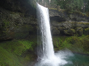
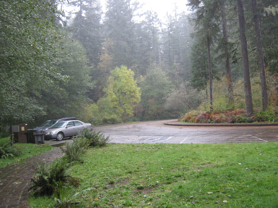
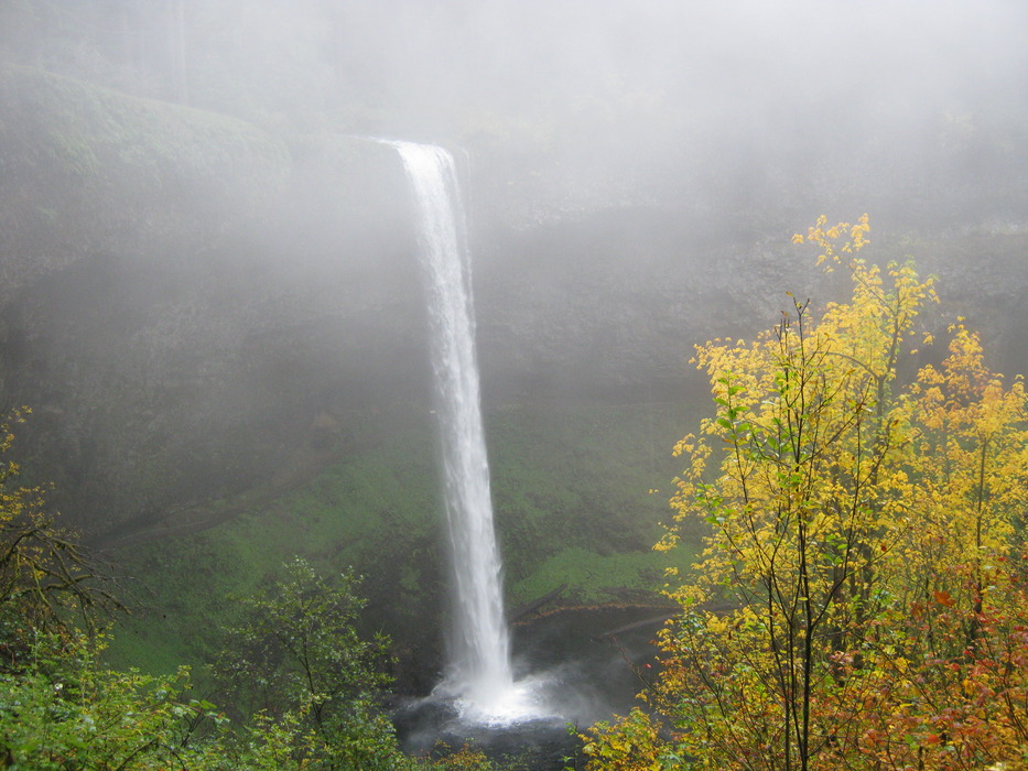
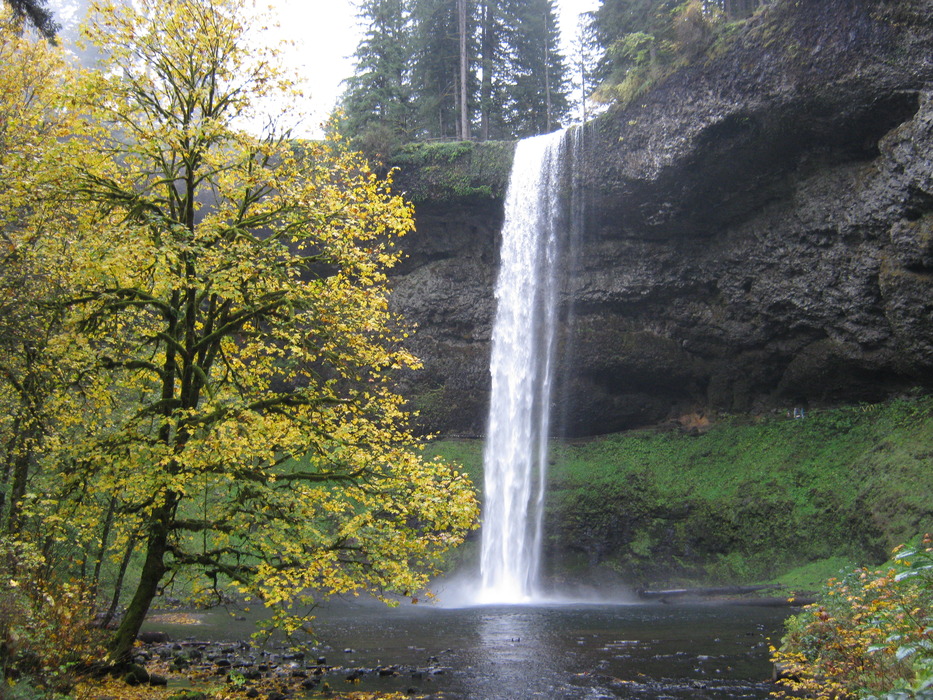
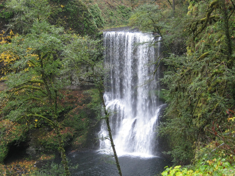
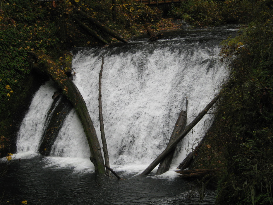
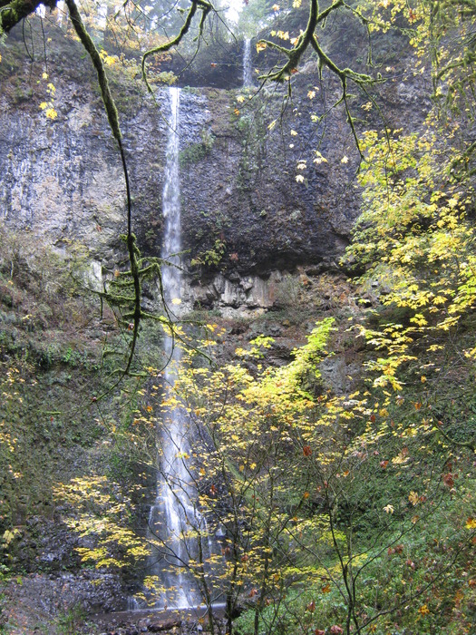
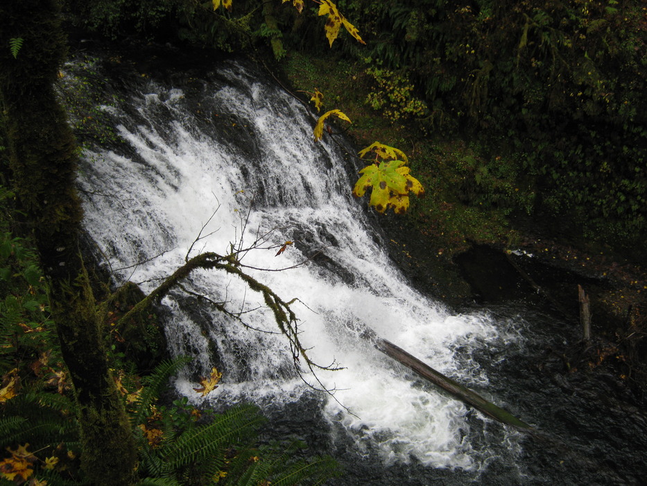
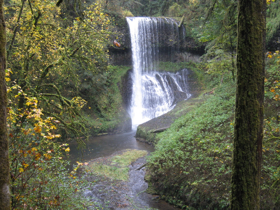
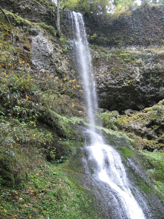
In this case, Silver is better than Gold
by Dano

This hike ranks up there as one of my favorite hikes ever. What makes a great hike? A well-maintained loop trail for variety; more than one trail option; a big payoff (this one has ten unique waterfalls); a great workout. This one has them all in spades. If you are EVER in the Portland/Salem area and have several hours to spare, do this hike; you will not regret it. Though it does not have the highest falls in the region, this contains the greatest concentration of beautiful waterfalls.
Here is a copy of the Park brochure. I parked in Lot F at the Southwestern portion of the park and proceeded around the "Trail of Ten Falls" loop clockwise. You can also do it in the opposite direction if you want to get the hike's busier portion, which is near the highway and bike path. I proceeded toward the tallest of them, South Falls. The view from above is interesting. Proceed downhill along the paved path, and they come into view. Proceed behind the falls, and down to another great view from downstream. Note that an old Canon digital camera took these pictures, and they look professionally done simply because of the stunning views.

Proceed along the The West side of the creek for about a mile to the Lower South Falls . I'm running out of words to describe the variety and beauty of each waterfall, so I'll let the pictures tell the story. Another mile ahead and heading East is the Lower North Falls. A short while later is a short side trail to Double Falls, well worth the extra few minutes. Then comes Drake Falls and Middle North Falls . The trail behind the falls is closed as of October 2010, but you can get close enough for a good view. A quarter-mile or so along the trail is a bridge to the right. This is the first place I saw anyone else, though it was a rainy October day, and summertime is likely much busier.

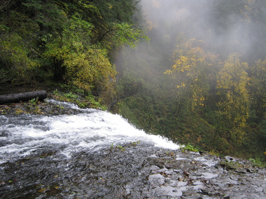
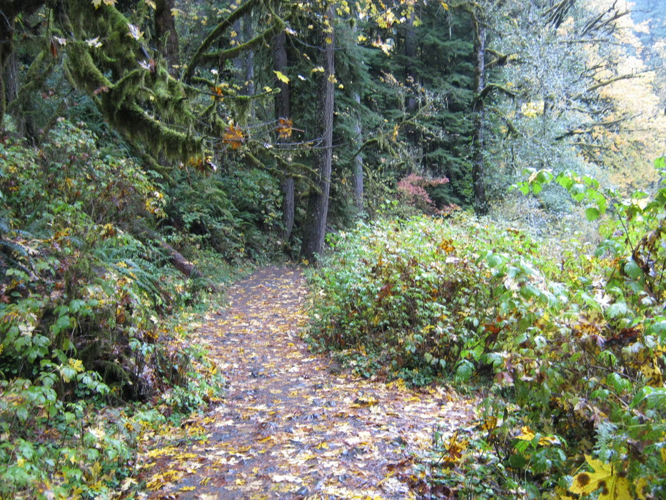
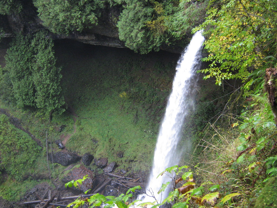
Here you have a choice--continue straight along the trail another 1 1/2 miles to North Falls , making the overall loop about 8.7 miles. I was in a time crunch and decided that I'd visit those falls by car. I went across the bridge and uphill to the Winter Falls, returning along the Rim Trail back to my car. Interestingly, I started thinking about that crummy vampire movie "Twilight" and its opening scene, filmed in this park, and behold what I saw. Thankfully there were no vampires nearby to sparkle and devour the deer (or separate me from my hemoglobin).

A nearby nice place to visit is the Oregon Garden in Silverton.

Check out the Official Route and Triplogs.

Leave No Trace and +Add a Triplog after your hike to support this local community.

2010-11-10 Dano
    WARNING! Hiking and outdoor related sports can be dangerous. Be responsible and prepare for the trip. Study the area you are entering and plan accordingly. Dress for the current and unexpected weather changes. Take plenty of water. Never go alone. Make an itinerary with your plan(s), route(s), destination(s) and expected return time. Give your itinerary to trusted family and/or friends.


     Directions
    or
    or
     Road
    Paved - Car Okay

    To hike
    From Portland, travel South on Interstate 5 (do not do this if there is a UofO or OSU home football game, as the whole interstate becomes a party/parking lot from Portland to Eugene). Just South of Salem, Exit east on route 22, then East along route 214 to the park. There is a pay station off the highway as you head toward the parking lot. BRING A $5 BILL as that is sometimes the only money the machine will accept. Get a copy of the brochure, which will show your parking options.
    page created by Dano on Nov 10 2010 10:00 pm
    helpcorrectionissue

    end of page marker