 Route Editor

| Guide | ♦ | 8 Triplogs | 0 Topics |
details | drive | no permit | forecast | route |
stats |
photos | triplogs | topics | location |
| 86 | 8 | 0 |
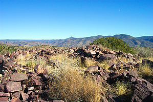
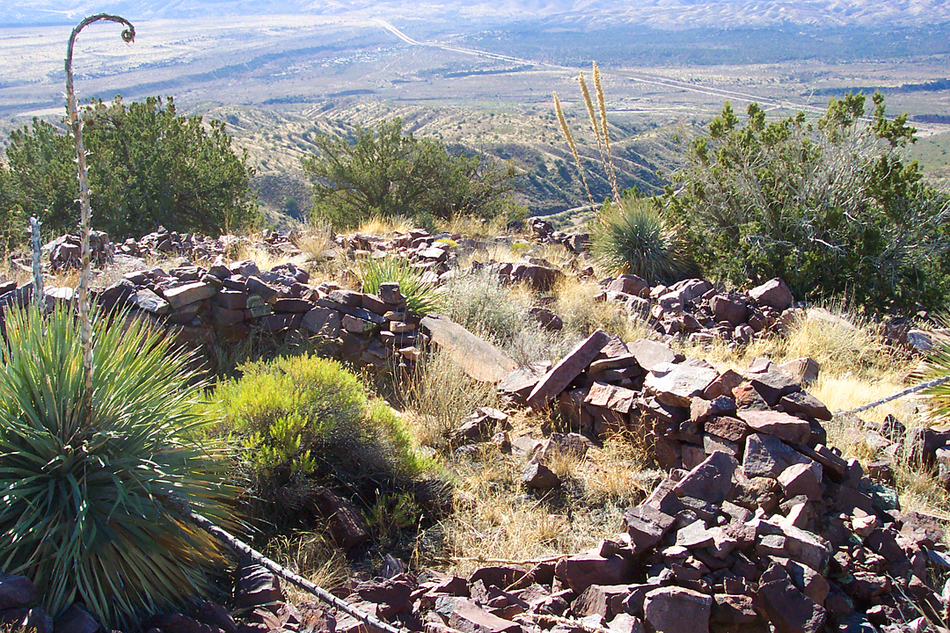
City in the sky by PrestonSands   Sitting by itself among the desert hills south of Payson is Black Mountain, a dome of black volcanic rock that can be seen for miles. On top of this natural fortress is a 13th century Salado ruin, described in Dave Wilson's book "Hiking Ruins Seldom Seen." The ruins atop Black Mountain are one link in a long chain of hilltop ruins stretching from the East Verde River on the north to the Salt River on the south. This short hike consists of off-trail scrambling through the desert vegetation on steep terrain, making an enjoyable outing during the cooler months of the year. Choose a parking spot alongside the Gisela Road near the base of Black Mountain to begin your hike. Sitting by itself among the desert hills south of Payson is Black Mountain, a dome of black volcanic rock that can be seen for miles. On top of this natural fortress is a 13th century Salado ruin, described in Dave Wilson's book "Hiking Ruins Seldom Seen." The ruins atop Black Mountain are one link in a long chain of hilltop ruins stretching from the East Verde River on the north to the Salt River on the south. This short hike consists of off-trail scrambling through the desert vegetation on steep terrain, making an enjoyable outing during the cooler months of the year. Choose a parking spot alongside the Gisela Road near the base of Black Mountain to begin your hike.From my parking spot along the road, I began following a 4x4 track downslope to the bottom of Black Mountain Wash. A brief hunt for petroglyphs or other signs of ancient cultures along the low rocky walls of Black Mountain Wash yielded nothing, so I moved on to the hike itself. After a brief visual study of the topography, I began bushwhacking up Black Mountain's southwestern side.
I spent some time exploring the various rooms of the ruin, enjoying the views of the surrounding mountains, and trying to find a location to capture a good image of the ruin in its entirety (no luck for me-bring a wide-angle lens!) Soon it was time to go, so I began the hike back to my truck. After a 600 foot descent of sliding and stumbling down the loose rock, I arrived at my vehicle with another fine adventure under my belt. Check out the Official Route and Triplogs. Leave No Trace and +Add a Triplog after your hike to support this local community. | ||||||||||||||||||||||||||||||||||||||||||||||||||||||||||||||||||||||||||||||||||||||||||||


