 Route Editor

| Guide | ♦ | 109 Triplogs | 0 Topics |
details | drive | no permit | forecast | 🔥 route |
stats |
photos | triplogs | topics | location |
| 999 | 109 | 0 |
go east to west and take the easy way out by DarthStiller  Note NoteStats reflect sole one-way segment #283. This trail in its entirety is rarely done either as a shuttle or an out-and-back due to its overall length and the amount of driving required on FR143. This means that normally the upper (eastern) end of it (the best part) is the section that sees the least amount of traffic. This is one of several (but not too many) trails in AZ where a hiker will encounter both pine trees and saguaros. While it might be considered the easy way out, starting at the upper end of the trail and working your way west (and down, except for a short ascent at the start) has its advantages. The drive up and back down bumpy FR143 is left for later, but you'll still have to drive down later if you go the other direction. It's also an advantage to get an earlier start, which might be somewhat of an issue if you're attempting this one in late spring or early fall.
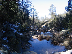
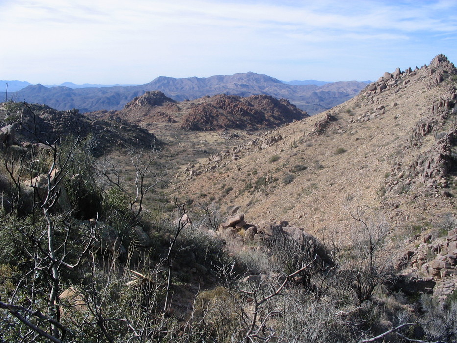
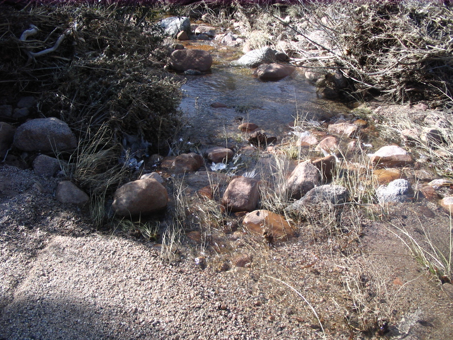
The start of the trail here is an old, unmaintained jeep road. This road lasts about 2 miles as it ascends 1600' up Pine Mountain. About a half-mile or so before you get to the high point, at a saddle below Pine Mountain, the trail will have narrowed to a single track. At the saddle, the desert scrub has given way more to pinyon pines and vegetation better suited to colder temps. At the saddle, there are also some boulders, which will be a mainstay throughout the rest of the hike. If you're hiking in the winter months, at this point you will likely have encountered some snow. About half the way up to the saddle, you can see Four Peaks. To the south are nice views of Superstition Mountain. From the saddle, the trail continues NE through some very tall pines. You will also be on a north-facing slope, making it likely that there will be significant snow leftover from any previous snow events during the winter. This snow and the lack of traffic in this area can make finding the trail challenging if you don't have a GPS and a loaded track from HAZ. The trail will descend through the pines towards a stream (again, in winter). This area is probably one of the best areas of the trail since it's so remote and extremely different from what you see every day in metro Phoenix. After the stream, the tall pines will give way to manzanita and other typical bushy scrub plants as the trail bends westward and downhill. In this section, the trail also gets a bit rocky and steep. Just to the east as the trail turns west is FR422. During my hike, I wasn't able to find the junction for the spur trail that is supposed to connect this trail to FR422. The trail will take turns making steep descents, followed by a stroll across a flatplain. At this point, the desert vegetation has taken over and all the shade previously provided by the pines is gone. At 5.3 miles in, the trail goes by a sandy stream area. Water was there in the winter when I hiked this but is likely seasonal. Rock Creek will soon be visible on your left, being quite far and/or below you at times. Sections of the trail here may be a bit overgrown (typically in spring), but it is very easy to follow, and route finding is not much of an issue. This may depend on the time of year, however. Springtime at these "tweener" elevations tends to produce a lot of brush. Winter, meantime, can make for an easier hike with less brush and dead and brittle existing brush. At the top of the descent, the Superstitions are visible but disappear as you drop behind Pine Mountain and the surrounding hills. Some of the mountains in the metro Phoenix area are visible at times as are some of the southern Mazatzals and area south of that. At about 6.5 miles, there is a junction with a very faint trail from the north. This trail comes from the Ballantine Cabin. This is NOT the trail at Boulder Flat, but a separate one that continues east from the cabin and then turns south and connects here with the Ballantine Trail. This junction may be marked with cairns but is very easy to miss. I have previously uploaded a GPS from my hike to Ballantine Cabin in May 2008 in which this trail was done as a lasso loop. If you download that track, you'll have a better idea of when and where to look for this junction. From here, the trail continues to descend, quickly and then slowly, down to Boulder Flat and then make the final descent to the Ballantine TH. Rock Creek on your left disappears before you reach Boulder Flat, but you'll be able to see Pine Creek on your right once you get to the Pine Creek Loop portion of the hike at the very end. Check out the Official Route and Triplogs. Leave No Trace and +Add a Triplog after your hike to support this local community. | |||||||||||||||||||||||||||||||||||||||||||||||||||||||||||||||||||||||||||||||||||||||||||||||||||||||||||||||||||||||||||||||||||||||||||||||||||||||||||||||||||||||||||||||||||||||||||||||||||||||||||||


