username
X
password
register
for free!
help


Gisela Ruins, AZ

Guide 10 Triplogs  0 Topics
  4 of 5  
Fav
Wish
8
details
drive
no permit
forecast
map
stats
photos
triplogs
topics
location
68 10 0
HAZ reminds you to respect the ruins. Please read the Archaeological Resources Protection Act of 1979 & Ruins Etiquette
Statistics
tap row or icons for details
Difficulty 1 of 5
Route Finding 2 of 5
Distance Round Trip 2.5 miles
Trailhead Elevation 2,850 feet
Elevation Gain 240 feet
Accumulated Gain 240 feet
Avg Time Round Trip 1.5 hours
Kokopelli Seeds 3.7
 Interest Ruins
 Backpack Possible - Not Popular
feature photo
Photos Viewed All MineFollowing
15  2024-11-16 scout22
6  2020-01-17 MountainMatt
6  2018-05-30
The Ruins Near Gisela Ruins
kenjacobsen
3  2014-06-01 neilends
1  2012-09-08 TheNaviG8R
5  2011-01-22 Wild Bill
5  2010-10-25 Charger55
Page 1,  2
Author
author avatar Guides 170
Routes 148
Photos 5,914
Trips 2,097 map ( 11,156 miles )
Age 48 Male Gender
Location Tucson, AZ
Associated Areas
list map done
Payson Region
Historical Weather
Trailhead Forecast
Expand Map
Preferred Nov, Mar, Feb, Jan
Seasons   ALL
Sun  6:01am - 6:47pm
0 Route
 
0 Alternative


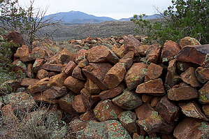
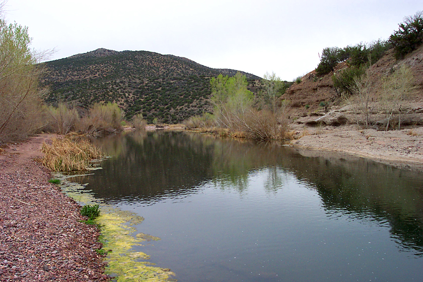
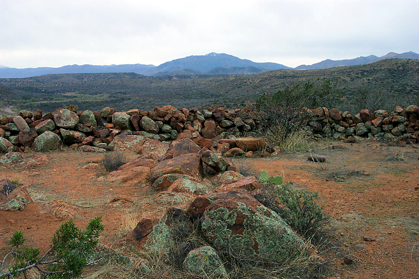
Walls of rocks at The Box
by PrestonSands

 
These Salado ruins along Tonto Creek just downstream of Gisela are described in Dave Wilson's book "Hiking Ruins Seldom Seen". Access to these ruins will not be possible if Tonto Creek is in the flood stage.


Starting at the end of Tonto Creek Drive in the little village of Gisela, (just south of Buckboard Trail), follow the dusty 4x4 path through the cottonwoods and mesquite trees. Soon you will arrive at Tonto Creek, where, if it has not gone dry, you will find a nice swimming hole next to an unusual conglomerate rock formation. Look for a place where you can cross over to the east side of the creek (you may get wet), and go for it. On the east bank of the creek, there is a jeep trail that you can follow through the mesquite flats. Many small roads crisscross this area, probably due to weekend parties. Soon the mesquite flat narrows, and eventually ends at a shelf of rock along Tonto Creek. Along here I came across the recent work of a beaver: a cottonwood tree cut down by teeth. Head downstream along the eastern bank for a short way, and cross a dry wash coming in from the east (Cocomunga Canyon) until you reach the base of a hill on the east side of the creek. At the top of this hill is the ruin.
remove free decal offer
While hiking up the hillside, I came across several old rock-walled terraces, with no apparent purpose. I wondered if these terraces were built by the Salado for dry farming. I continued the short climb up to the top of the hill through the jojoba bushes and junipers, and over to the rocky outcropping overlooking "The Box" on Tonto Creek. On top of this rocky granite hilltop, you will see chest-high walls built of the red granite rocks that surround you. There is little to see here in the way of relics, but I did see a couple of rocks that could have been cutting tools. The big oval wall is the main attraction at these ruins, it is about sixty feet in diameter. After you have seen all you want, return the way you came. If there is water in Tonto Creek, this is a great hike to enjoy a way home swim.

2006-08-11 PrestonSands


    Check out the Triplogs.
    Leave No Trace and +Add a Triplog after your hike to support this local community.
    WARNING! Hiking and outdoor related sports can be dangerous. Be responsible and prepare for the trip. Study the area you are entering and plan accordingly. Dress for the current and unexpected weather changes. Take plenty of water. Never go alone. Make an itinerary with your plan(s), route(s), destination(s) and expected return time. Give your itinerary to trusted family and/or friends.

     Permit $$
    None


     Directions
    or
     Road
    FR / Dirt Road / Gravel - Car Okay

    To hike
    From Payson, head south on AZ Highway 87 approximately 11 miles to the signed Gisela turnoff. Follow the paved Gisela road east about 4.4 miles to Tonto Creek Drive (the sign at the junction says Tonto Creek Shores), and turn right. Follow Tonto Creek Drive about 1.2 miles to its end, just past Buckboard Trail. Now you have left private land, so park where you wish. Begin hiking down the increasingly primitive Tonto Creek Drive as it heads towards Tonto Creek.
     90+° 8am - 6pm kills
    helpcorrectionissue

    end of page marker