 Route Editor

| dks |
|
|
| ||||||||||||||||||||||||||||||


Profile | Trips | Photos | Areas | 0 Water Reports | Wish |


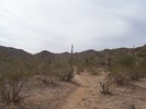 | 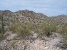 |  | 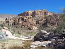 |  |
April 2006 Hiked yesterday for the first time the Pipeline Canyon Trail. From Glendale, it was only a 65 mile round trip which is a perfect get away with the current gas prices.
Started at the North end. 3/4 down the hike, the canyon was recently filled w

