 Route Editor

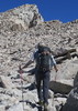
Humphreys info
Moderator: HAZ - Moderators
Linked Guides none
Linked Area, etc none
-
 syoungGuides: 6 | Official Routes: 4Triplogs Last: 2,953 d | RS: 0Water Reports 1Y: 0 | Last: 3,014 d
 - Joined: May 23 2012 9:31 pm
- City, State: Mesa, AZ
Humphreys info
Has anyone been up there recently? I am thinking about giving it a go this weekend with my Whitney gear but am curious of trail conditions.
contribute to this member driven resource
ie: RS > Save/Share after hikes 

-
 toddakGuides: 13 | Official Routes: 7Triplogs Last: 4 d | RS: 0Water Reports 1Y: 0 | Last: 1,726 d
 - Joined: Nov 15 2005 8:46 pm
- City, State: Jackson, CA
Re: Humphreys info
I drove through Flag late Saturday night and it was snowing pretty good. Based on the webcam linked below, there's probably a decent amount of snow up there.
http://www.wrh.noaa.go...
http://www.wrh.noaa.go...
contribute to this member driven resource
ie: RS > Save/Share after hikes
-
 rcorfmanGuides: 1 | Official Routes: 4Triplogs Last: 673 d | RS: 2Water Reports 1Y: 0 | Last: 1,124 d
 - Joined: Oct 17 2008 11:19 pm
- City, State: Phoenix, AZ
- Contact:
Re: Humphreys info
Sunday afternoon we drove from Grand Canyon to Phoenix and the snow level was right to the highway in places though it was raining when we passed through. We couldn't see much of Humphrey's due to the cloud cover but it looked like it was getting a bunch of snow.
Go find a LonelyCache
contribute to this member driven resource
ie: RS > Save/Share after hikes
-
 JimGuides: 76 | Official Routes: 39Triplogs Last: 5 d | RS: 94Water Reports 1Y: 7 | Last: 5 d
 - Joined: Sep 08 2006 8:14 pm
Re: Humphreys info
Just had 10+ inches up there per the NWS, at 9300', but it compresses and melts fast. I want to do Humphrey later this month and have been wondering what conditions are like, but they change so fast this time of year it can be a hard guess to make.
Totals were not impressive this winter, so my expectation, as a complete guess, is that a hard ice or snow layer exists at present, underneath of a layer of new snow. Probably some exposed muddy trail on the SW slopes, near and above the alpine zone, too.
I want to do the IB route, so as to not just keep hiking the Summit Trail, and that will hold snow longer on north aspects. The trail, usually melts faster.
Anyway, what do you mean by Whitney Gear? Snowshoes are typically useless on the trail this late in the season. An ice, maybe nice as a cane, but it's much more. However, it can be used to cut steps in some big intact drifts. Crampons, I never felt necessary, but micro spikes could be in May. It is May, isn't it? Ahh.....
contribute to this member driven resource
ie: RS > Save/Share after hikes
-
 chumleyGuides: 94 | Official Routes: 239Triplogs Last: 11 d | RS: 73Water Reports 1Y: 92 | Last: 10 d
 - Joined: Sep 18 2002 8:59 am
- City, State: Tempe, AZ
Re: Humphreys info
Snowbowl reported 18" new at 11,500 on Sunday. Looked to be at least 2-3" more yesterday above 8,000. Wouldn't be surprised if it was 6"+ on the peak
I'm not sure what my spirit animal is, but I'm confident it has rabies.
contribute to this member driven resource
ie: RS > Save/Share after hikes
-
syoungGuides: 6 | Official Routes: 4Triplogs Last: 2,953 d | RS: 0Water Reports 1Y: 0 | Last: 3,014 d
- Joined: May 23 2012 9:31 pm
- City, State: Mesa, AZ
Re: Humphreys info
I want to haul my Whitney overnight gear so I can convince myself to cut a few more ounces.Jim_H wrote: Anyway, what do you mean by Whitney Gear? .
contribute to this member driven resource
ie: RS > Save/Share after hikes