 Route Editor

Waterfalls?
Moderator: HAZ - Moderators
Linked Guides none
Linked Area, etc none
-
 allanalxndrGuides: 0 | Official Routes: 0Triplogs Last: 4,949 d | RS: 0Water Reports 1Y: 0 | Last: never
 - Joined: Jun 23 2003 7:03 pm
- City, State: Phx, AZ
Waterfalls?
With all the rains we have been getting, we were forced to cancel our trip to Charlebois this weeked. Are there any day hikes that would be worth checking out to see waterfalls from all of the flooding and run off?
contribute to this member driven resource
ie: RS > Save/Share after hikes 

-
 snakemarksGuides: 0 | Official Routes: 0Triplogs Last: 3,042 d | RS: 0Water Reports 1Y: 0 | Last: 3,707 d
 - Joined: Oct 31 2007 12:55 pm
- City, State: Middle-of-Nowhere, AZ
Re: Waterfalls?
First Water Road is now passable - lots of people at the trailhead today.
Tortilla Creek is still whitewater and Apache Trail is closed there. I'll post photos later. The recent roadwork seems to be holding up. I guess the test will be when cars start crossing it... maybe not for a couple days.
Tortilla Creek is still whitewater and Apache Trail is closed there. I'll post photos later. The recent roadwork seems to be holding up. I guess the test will be when cars start crossing it... maybe not for a couple days.
I'm at home in the wilderness... it's civilization I have problems with! ](./images/smilies/eusa_wall.gif "Brick wall")
contribute to this member driven resource
ie: RS > Save/Share after hikes
-
 azhiker96Guides: 0 | Official Routes: 0Triplogs Last: 1,181 d | RS: 2Water Reports 1Y: 0 | Last: never
 - Joined: Feb 03 2002 10:17 am
- City, State: Gilbert, AZ
Re: Waterfalls?
I'd love to check out Reavis Falls but it would probably be impossible to get there even if the road was open to the trailhead.
"Sometimes I wonder whether the world is being run by smart people who are putting us on or by imbeciles who really mean it."
~ Mark Twain
~ Mark Twain
contribute to this member driven resource
ie: RS > Save/Share after hikes
-
 AZLOT69Guides: 177 | Official Routes: 164Triplogs Last: 7 d | RS: 2Water Reports 1Y: 0 | Last: 5,959 d
 - Joined: Feb 12 2002 7:43 pm
- City, State: Gold Canyon, AZ
Re: Waterfalls?
I was at Reavis N trailhead today, quite a few ruts from erosion a few rock slides on Fish Creek Hill but well worth it to see Some falls above Fish Creek bridge.
It's best for a man to remain silent and be thought a fool, than to open his mouth and remove all doubt.
--Mark Twain
--Mark Twain
contribute to this member driven resource
ie: RS > Save/Share after hikes
-
AZLOT69Guides: 177 | Official Routes: 164Triplogs Last: 7 d | RS: 2Water Reports 1Y: 0 | Last: 5,959 d
- Joined: Feb 12 2002 7:43 pm
- City, State: Gold Canyon, AZ
Re: Waterfalls?
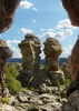
Difficult light-cheap camera
- Attachments
-
-
It's best for a man to remain silent and be thought a fool, than to open his mouth and remove all doubt.
--Mark Twain
--Mark Twain
contribute to this member driven resource
ie: RS > Save/Share after hikes
-
 big_loadGuides: 0 | Official Routes: 1Triplogs Last: 515 d | RS: 3Water Reports 1Y: 0 | Last: 2,718 d
 - Joined: Oct 28 2003 11:20 am
- City, State: Andover, NJ
Re: Waterfalls?
It sounds like 88 might be navigable again before long. FIngers crossed.
contribute to this member driven resource
ie: RS > Save/Share after hikes