 Route Editor

I pick GRCA's Kaibab - South and North - and that's not cheating, because I am the one who asked the question!
If you had to choose ...
Moderator: HAZ - Moderators
Linked Guides none
Linked Area, etc none
-
 cactuscatGuides: 0 | Official Routes: 3Triplogs Last: 164 d | RS: 26Water Reports 1Y: 2 | Last: 336 d
 - Joined: Oct 15 2002 12:08 pm
- City, State: Rimrock, Arizona
If you had to choose ...
If you had to choose only one trail to hike on for the rest of your life, what would it be?
I pick GRCA's Kaibab - South and North - and that's not cheating, because I am the one who asked the question!
I pick GRCA's Kaibab - South and North - and that's not cheating, because I am the one who asked the question!
contribute to this member driven resource
ie: RS > Save/Share after hikes 

-
 big_loadGuides: 0 | Official Routes: 1Triplogs Last: 515 d | RS: 3Water Reports 1Y: 0 | Last: 2,718 d
 - Joined: Oct 28 2003 11:20 am
- City, State: Andover, NJ
Re: If you had to choose ...
That's a tough question. There are trails I hike over and over again because they're local favorites, but I'd go nuts being limited to just one.
contribute to this member driven resource
ie: RS > Save/Share after hikes
-
 RockadoodleGuides: 0 | Official Routes: 0Triplogs Last: 4,249 d | RS: 0Water Reports 1Y: 0 | Last: never
 - Joined: Aug 11 2012 11:15 pm
Re: If you had to choose ...
My current choice would probably seem weird to most, which doesn't even have a trail, but I would choose my Malapais Mountain route I think. Why I don't know, I just love it. Maybe because it's so accessible and remote.
contribute to this member driven resource
ie: RS > Save/Share after hikes
-
 TrishnessGuides: 14 | Official Routes: 0Triplogs Last: 4,318 d | RS: 0Water Reports 1Y: 0 | Last: 5,009 d
 - Joined: May 21 2003 9:33 pm
- City, State: Apache Junction, AZ
Re: If you had to choose ...
Appalachian Trail...Georgia to Maine
Trish-Kabob
"May your trails be crooked, winding, lonesome, dangerous, leading to the most amazing view. May your mountains rise into and above the clouds" Ed Abbey
"May your trails be crooked, winding, lonesome, dangerous, leading to the most amazing view. May your mountains rise into and above the clouds" Ed Abbey
contribute to this member driven resource
ie: RS > Save/Share after hikes
-
cactuscatGuides: 0 | Official Routes: 3Triplogs Last: 164 d | RS: 26Water Reports 1Y: 2 | Last: 336 d
- Joined: Oct 15 2002 12:08 pm
- City, State: Rimrock, Arizona
Re: If you had to choose ...
@Trishness
Nice choice with a long trail!
I might have to reconsider after I have done the JMT - hopefully next summer!
Or I could say the AZT, which encompasses my current choice and much more ...
Nice choice with a long trail!
I might have to reconsider after I have done the JMT - hopefully next summer!
Or I could say the AZT, which encompasses my current choice and much more ...
contribute to this member driven resource
ie: RS > Save/Share after hikes
-
 PatrickLGuides: 7 | Official Routes: 36Triplogs Last: 50 d | RS: 0Water Reports 1Y: 1 | Last: 242 d
 - Joined: Jan 10 2010 4:25 pm
- City, State: Pomona, CA
- Contact:
Re: If you had to choose ...
Out of everything I've done, Lemmon from Catalina SP might be the one. So much scenery, and it's a great, big hike. The loop in the Chisos Mountains in Texas also comes to mind.
contribute to this member driven resource
ie: RS > Save/Share after hikes
-
 azbackpackrGuides: 34 | Official Routes: 30Triplogs Last: 42 d | RS: 0Water Reports 1Y: 8 | Last: 52 d
 - Joined: Jan 21 2006 6:46 am
- City, State: Eagar AZ
Re: If you had to choose ...
I have favorites, but cmon, in the WORLD? How much do we really know about what's out there? I probably wouldn't pick a popular one. If I were going to pick one, maybe the Pacific Crest, because it goes through all kinds of country. So does the AZT. I probably would not pick a trail where a permit is required.
As for a short trail, I have my memories of Fish Creek Trail #60, 12 miles long, from just south of Hannagan Meadow Lodge on down to the Black River. I used to tell backpacker friends about this trail over the years, and urged them to skip Bear Wallow, forget about Bear Wallow and go to Fish Creek #60 instead. And most of them ignored me and went to heavily beaten Bear Wallow because it's very well-known, it's in a designated wilderness (although only a couple of miles from Fish Creek, which isn't in a designated wilderness.) You know, it's so important to hike trails because they are famous.
But it's too late now. That area was just about the most heavily burned in the Wallow Fire in 2011. Unlike most other trails which have reopened since the fire, that one has not, and it will remain closed for many years, I've been told.
I'm glad I went there, though. It was my favorite trail. You could have set up camp down there all summer and you would have seen just a few people. Plus, again much better than Bear Wallow, it went to the Black River without having to cross onto the Apache reservation. When you got to the river you could turn upstream and be at a nice deep swimming hole in half a mile or so. You had a good chance while there to see elk, deer, bears, mountain lions, wolves, Rocky Mountain bighorns, and a host of smaller fauna. And a good chance of not seeing people. The trail was there, but it was kind of faint due to lack of traffic...
http://hikearizona.com/decoder.php?ZTN=327
http://hikearizona.com/photo.php?ZIP=43714
There is a point of no return unremarked at the time in most lives. Graham Greene The Comedians
A clean house is a sign of a misspent life.
A clean house is a sign of a misspent life.
contribute to this member driven resource
ie: RS > Save/Share after hikes
-
 BobPGuides: 2 | Official Routes: 17Triplogs Last: 5 d | RS: 58Water Reports 1Y: 0 | Last: 463 d
 - Joined: Feb 26 2008 3:43 pm
- City, State: Scottsdale, AZ
Re: If you had to choose ...
Mt. Princeton via Grouse Canyon...
Cheops Plateau , Motherlode, and Salt Trail Canyon being close seconds.
Cheops Plateau , Motherlode, and Salt Trail Canyon being close seconds.
https://www.seeitourway.org
Always pronounce Egeszsegedre properly......
If you like this triplog you must be a friend of BrunoP
Always pronounce Egeszsegedre properly......
If you like this triplog you must be a friend of BrunoP
contribute to this member driven resource
ie: RS > Save/Share after hikes
-
azbackpackrGuides: 34 | Official Routes: 30Triplogs Last: 42 d | RS: 0Water Reports 1Y: 8 | Last: 52 d
- Joined: Jan 21 2006 6:46 am
- City, State: Eagar AZ
Re: If you had to choose ...
I like it that you chose places I have never been. I always want to try something new.
There is a point of no return unremarked at the time in most lives. Graham Greene The Comedians
A clean house is a sign of a misspent life.
A clean house is a sign of a misspent life.
contribute to this member driven resource
ie: RS > Save/Share after hikes
-
 SAMBAGuides: 0 | Official Routes: 2Triplogs Last: 2,579 d | RS: 0Water Reports 1Y: 0 | Last: never
 - Joined: Oct 02 2009 12:59 pm
- City, State: Tucson, AZ
Re: If you had to choose ...
To eliminate all the "hemming and hawing" about trails, I'll take the liberties to restate cactuscat's original question to "If you had to choose only one trail to strew your ashes, what would it be"?
contribute to this member driven resource
ie: RS > Save/Share after hikes
-
 outdoor_loverGuides: 7 | Official Routes: 6Triplogs Last: 118 d | RS: 2Water Reports 1Y: 29 | Last: 131 d
 - Joined: Aug 19 2011 7:49 pm
- City, State: Scottsdale, AZ
Re: If you had to choose ...
@SAMBA
That's too easy. Part of me will be fishing in Alamo Lake with Dad, and the rest of me will be swimming with the hordes of Dolphins, Porpoises, Whales and Sea Otters in Monterey Bay, CA. It's already in writing...
That's too easy. Part of me will be fishing in Alamo Lake with Dad, and the rest of me will be swimming with the hordes of Dolphins, Porpoises, Whales and Sea Otters in Monterey Bay, CA. It's already in writing...
Life is not a journey to the grave with the intention of arriving safely in a pretty & well preserved body, but rather to skid in broadside, totally worn out & proclaiming, "Wow What a Ride!"
contribute to this member driven resource
ie: RS > Save/Share after hikes
-
big_loadGuides: 0 | Official Routes: 1Triplogs Last: 515 d | RS: 3Water Reports 1Y: 0 | Last: 2,718 d
- Joined: Oct 28 2003 11:20 am
- City, State: Andover, NJ
Re: If you had to choose ...
That's still a tough call. I think I'd like somewhere near the intersection of the Rock Creek and Flint Creek drainages in the Weminuche Wilderness. I have a multitude of great alternatives, though. Cathedral Lake or Ostrander Lake in Yosemite would be nice. Among AZ places, maybe somewhere in the Galiuros or along Two Bar Ridge in the Superstitions.
contribute to this member driven resource
ie: RS > Save/Share after hikes
-
azbackpackrGuides: 34 | Official Routes: 30Triplogs Last: 42 d | RS: 0Water Reports 1Y: 8 | Last: 52 d
- Joined: Jan 21 2006 6:46 am
- City, State: Eagar AZ
Re: If you had to choose ...
Since where my ashes are might only matter to my offspring, I guess I don't really care. One thing, though, I really hope I don't die out there. We've had this debate before in another thread. I want to see my loved ones faces, not the cold hard ground. I want to hold their hands and tell them I love them.
There is a point of no return unremarked at the time in most lives. Graham Greene The Comedians
A clean house is a sign of a misspent life.
A clean house is a sign of a misspent life.
contribute to this member driven resource
ie: RS > Save/Share after hikes
-
 RedRoxx44Guides: 5 | Official Routes: 0Triplogs Last: 3 d | RS: 0Water Reports 1Y: 0 | Last: 6,527 d
 - Joined: Feb 15 2003 8:07 am
- City, State: outside, anywhere
Re: If you had to choose ...
Well, one trail would be the West Divide/East Divide system in the Galiuros. I want my ashes divided into thirds. One third in the Galiuros, one third in the Wind Rivers, and one third on an old farm in Tennessee.
contribute to this member driven resource
ie: RS > Save/Share after hikes
-
 mazatzalGuides: 0 | Official Routes: 6Triplogs Last: 17 d | RS: 1Water Reports 1Y: 0 | Last: 853 d
 - Joined: Jul 28 2004 2:18 pm
- City, State: Scottsdale, AZ
Re: If you had to choose ...
Arizona Trail
contribute to this member driven resource
ie: RS > Save/Share after hikes
-
TrishnessGuides: 14 | Official Routes: 0Triplogs Last: 4,318 d | RS: 0Water Reports 1Y: 0 | Last: 5,009 d
- Joined: May 21 2003 9:33 pm
- City, State: Apache Junction, AZ
Re: If you had to choose ...
Otter Cliff......Acadia National Park, MaineSAMBA wrote:To eliminate all the "hemming and hawing" about trails, I'll take the liberties to restate cactuscat's original question to "If you had to choose only one trail to strew your ashes, what would it be"?
Trish-Kabob
"May your trails be crooked, winding, lonesome, dangerous, leading to the most amazing view. May your mountains rise into and above the clouds" Ed Abbey
"May your trails be crooked, winding, lonesome, dangerous, leading to the most amazing view. May your mountains rise into and above the clouds" Ed Abbey
contribute to this member driven resource
ie: RS > Save/Share after hikes
-
 DarthStillerGuides: 27 | Official Routes: 29Triplogs Last: 3 d | RS: 154Water Reports 1Y: 0 | Last: 4,483 d
 - Joined: Jul 05 2006 12:36 pm
- City, State: Mesa, AZ
contribute to this member driven resource
ie: RS > Save/Share after hikes
-
RockadoodleGuides: 0 | Official Routes: 0Triplogs Last: 4,249 d | RS: 0Water Reports 1Y: 0 | Last: never
- Joined: Aug 11 2012 11:15 pm
Re: If you had to choose ...
I take it back, this is the ultimate trail for me, I miss it so much:
https://www.youtube.com/watch?v=8p-sen6QKYQ
https://www.youtube.com/watch?v=8p-sen6QKYQ
contribute to this member driven resource
ie: RS > Save/Share after hikes
-
SAMBAGuides: 0 | Official Routes: 2Triplogs Last: 2,579 d | RS: 0Water Reports 1Y: 0 | Last: never
- Joined: Oct 02 2009 12:59 pm
- City, State: Tucson, AZ
Re: If you had to choose ...
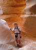
Yada, yada, yada! It's obvious none of yooz guys have ever been to Utah. The caption of this photo, http://hikearizona.com/photo.php?ZIP=292257 , says it all. And here's a pic of 1A, http://hikearizona.com/photo.php?ZIP=196316 .
contribute to this member driven resource
ie: RS > Save/Share after hikes
-
RedRoxx44Guides: 5 | Official Routes: 0Triplogs Last: 3 d | RS: 0Water Reports 1Y: 0 | Last: 6,527 d
- Joined: Feb 15 2003 8:07 am
- City, State: outside, anywhere
Re: If you had to choose ...
Been to Utah a bunch of times over 15 years and done both of those trails--would like to go back to Dark Canyon ---would like to do from Woodenshoe and out Sundance. However, only so many places to put my ashes! Death Valley and Anza Borrego would be high on the list too. If it was Utah the Hackberry Canyon, Yellow Rock and Upper Paria would be near the top. Maybe we can do it by State?? ;)
contribute to this member driven resource
ie: RS > Save/Share after hikes