 Route Editor

Never been to the Supes, thought i should check it out before it starts getting too hot, in the past i mostly backpacked the Payson, Heber and Showlow areas, would i enjoy the Supes coming from backpacking where its mostly forest type backpacking.
Looking for an over nighter , between 15 and 20 miles, preferably a loop route, what i liked about hiking/backpacking up North is that most times you have the trail to yourself especially if you go on a weekday is this also the case in the Supes.
Looking for short scenic Supes route
Moderators: Backpack Specialist, HAZ - Moderators
Linked Guides none
Linked Area, etc none
-
 sajor75Guides: 0 | Official Routes: 0Triplogs Last: none | RS: 0Water Reports 1Y: 0 | Last: 3,481 d
 - Joined: Dec 26 2015 12:59 pm
- City, State: Phoenix
contribute to this member driven resource
ie: RS > Save/Share after hikes 

-
wildwesthikesGuides: 0 | Official Routes: 0Triplogs Last: 2,063 d | RS: 0Water Reports 1Y: 0 | Last: 1,920 d
- Joined: Nov 23 2010 9:41 am
Re: Looking for short scenic Supes route
If there was one overnighter to rule them all in the superstitions, this would be my pick: [ Route Editor ]
In the next two weeks most of the flowing water will be dried up, limiting your camping options unless you want to carry a bunch of water. However, you will find water at Charlebois Spring year round. 2nd Water Spring is also pretty reliable.
Just be aware that the campsites right next to the springs can be pretty competitive any time of year; they are also where the big groups tend to go, so you may have a noise problem to deal with. You will probably get visitors walking up who have the same idea as you, probably there to get water as well. What I do normally in the dry season is do my hiking with a couple liters of water, walk up to the spring - top off and collect for a total of 5 liters and then camp another mile or so down the trail where I won't be bothered.
Last edited by wildwesthikes on Mar 29 2019 12:50 pm, edited 1 time in total.
contribute to this member driven resource
ie: RS > Save/Share after hikes
-
 ALMALGuides: 0 | Official Routes: 0Triplogs Last: 240 d | RS: 0Water Reports 1Y: 0 | Last: 1,156 d
 - Joined: Oct 17 2010 8:02 pm
- City, State: GILBERT
Re: Looking for short scenic Supes route
@sajor75
The [ Marsh Valley Loop ] from First Water should fit the bill. About 16 miles depending on how you wander around. You'll see people out but not many once you turn off on [ Cavalry Trail #239 ] . Nice campsites along Cavalry trail, water o' plenty right now. I prefer to hike this one clockwise.
And, luckily no fire restrictions yet...
You aren't late if you don't show up!
contribute to this member driven resource
ie: RS > Save/Share after hikes
-
 chumleyGuides: 94 | Official Routes: 239Triplogs Last: 2 d | RS: 71Water Reports 1Y: 93 | Last: 29 d
 - Joined: Sep 18 2002 8:59 am
- City, State: Tempe, AZ
Re: Looking for short scenic Supes route
isnt the superstitions desert like terrain with mountains, if that is your cup of tea go for it but i much prefer the green pine trees of up north.
I'm not sure what my spirit animal is, but I'm confident it has rabies.
contribute to this member driven resource
ie: RS > Save/Share after hikes
-
 hikeazGuides: 6 | Official Routes: 0Triplogs Last: 1,221 d | RS: 0Water Reports 1Y: 0 | Last: 1,221 d
 - Joined: May 13 2002 10:07 am
- City, State: Tempe, AZ
- Contact:
Re: Looking for short scenic Supes route
The eastern Sups are much less-traveled and have more trees (although not up to the Rim's crop). Loop hikes are possible. You may consider heading there.
"The censorship method ... is that of handing the job over to some frail and erring mortal man, and making him omnipotent on the assumption that his official status will make him infallible and omniscient."
George Bernard Shaw
George Bernard Shaw
contribute to this member driven resource
ie: RS > Save/Share after hikes
-
 SAMBAGuides: 0 | Official Routes: 2Triplogs Last: 2,555 d | RS: 0Water Reports 1Y: 0 | Last: never
 - Joined: Oct 02 2009 12:59 pm
- City, State: Tucson, AZ
Re: Looking for short scenic Supes route
IMHO, trees are simply view killers. It's nothing a good wild fire or an Agent Orange strike can't cure, but barring those two gifts from God, I like my hikin' "desert style". The western portion of the Supes definitely qualifies.
contribute to this member driven resource
ie: RS > Save/Share after hikes
-
 herdbullGuides: 0 | Official Routes: 0Triplogs Last: none | RS: 0Water Reports 1Y: 0 | Last: never
 - Joined: Jan 31 2016 6:38 am
- City, State: Apache Junction, AZ / Quemado, NM
Re: Looking for short scenic Supes route
Being from Wisconsin with limited time in the area I have managed to cover a lot of ground trail running out there the last 3-4 years. I like the end result of elleryjk's trip, IMO a better start point would be from the north at the marina. I think it's trail 103. Some of the best scenery I've come across once you get in a few miles.elleryjk wrote: ↑Mar 29 2019 12:45 pm If there was one overnighter to rule them all in the superstitions, this would be my pick: [ Route Editor ]
In the next two weeks most of the flowing water will be dried up, limiting your camping options unless you want to carry a bunch of water. However, you will find water at Charlebois Spring year round. 2nd Water Spring is also pretty reliable.
Just be aware that the campsites right next to the springs can be pretty competitive any time of year; they are also where the big groups tend to go, so you may have a noise problem to deal with. You will probably get visitors walking up who have the same idea as you, probably there to get water as well. What I do normally in the dry season is do my hiking with a couple liters of water, walk up to the spring - top off and collect for a total of 5 liters and then camp another mile or so down the trail where I won't be bothered.
I ran it from Peralta Trailhead and once I got through Boulder canyon and "up top" I couldn't stop turning back to see the view. It was so neat I returned the next day with the other half and we hiked in from the marina. Plenty of parking at the trailhead in the Marina and decent food once you return to your car at the end of the trip. Not to mention a nice ride out to scout for the next adventure.
If I can track down a pic or 2 I'll post later.
contribute to this member driven resource
ie: RS > Save/Share after hikes
-
wildwesthikesGuides: 0 | Official Routes: 0Triplogs Last: 2,063 d | RS: 0Water Reports 1Y: 0 | Last: 1,920 d
- Joined: Nov 23 2010 9:41 am
Re: Looking for short scenic Supes route
@herdbull
I love the hike from the Marina - through [ Boulder Canyon Trail #103 ] from there would be great this time of year with water still running but not as deep.
I love the hike from the Marina - through [ Boulder Canyon Trail #103 ] from there would be great this time of year with water still running but not as deep.
contribute to this member driven resource
ie: RS > Save/Share after hikes
-
herdbullGuides: 0 | Official Routes: 0Triplogs Last: none | RS: 0Water Reports 1Y: 0 | Last: never
- Joined: Jan 31 2016 6:38 am
- City, State: Apache Junction, AZ / Quemado, NM
Re: Looking for short scenic Supes route
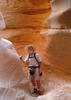
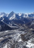
pics as promised.
contribute to this member driven resource
ie: RS > Save/Share after hikes
-
herdbullGuides: 0 | Official Routes: 0Triplogs Last: none | RS: 0Water Reports 1Y: 0 | Last: never
- Joined: Jan 31 2016 6:38 am
- City, State: Apache Junction, AZ / Quemado, NM
Re: Looking for short scenic Supes route
well that didn't work 
whats the key to adding pics on this site? I'll never understand why it's so hard to upload pics on certain forums lol
whats the key to adding pics on this site? I'll never understand why it's so hard to upload pics on certain forums lol
contribute to this member driven resource
ie: RS > Save/Share after hikes
-
 joebartelsGuides: 264 | Official Routes: 224Triplogs Last: 1 d | RS: 2055Water Reports 1Y: 24 | Last: 41 d
 - Joined: Nov 20 1996 12:00 pm
contribute to this member driven resource
ie: RS > Save/Share after hikes
-
herdbullGuides: 0 | Official Routes: 0Triplogs Last: none | RS: 0Water Reports 1Y: 0 | Last: never
- Joined: Jan 31 2016 6:38 am
- City, State: Apache Junction, AZ / Quemado, NM
Re: Looking for short scenic Supes route
I only have 2 of them I was going to post to this thread but I don't think it likes the shape/ratio. It won't upload them.
I get this error when attempting to add this post. "It was not possible to determine the dimensions of the image. Please verify that the URL you entered is correct."
I get this error when attempting to add this post. "It was not possible to determine the dimensions of the image. Please verify that the URL you entered is correct."
contribute to this member driven resource
ie: RS > Save/Share after hikes
-
chumleyGuides: 94 | Official Routes: 239Triplogs Last: 2 d | RS: 71Water Reports 1Y: 93 | Last: 29 d
- Joined: Sep 18 2002 8:59 am
- City, State: Tempe, AZ
Re: Looking for short scenic Supes route
@herdbull The forum is for questions, comments, discussion. Not photos or trip reports.
We would love to see your photos. If you click the +Add at the top of the page, it should be pretty straightforward. If you have trouble posting photos using the +Add function above, more detailed instructions are available.HAZ Forum Guidelines
4) Do not post photos or a journal of a trip in the forum.
Use the +Add found at the top of every page.
contribute to this member driven resource
ie: RS > Save/Share after hikes
-
chumleyGuides: 94 | Official Routes: 239Triplogs Last: 2 d | RS: 71Water Reports 1Y: 93 | Last: 29 d
- Joined: Sep 18 2002 8:59 am
- City, State: Tempe, AZ
Re: Looking for short scenic Supes route
@herdbull
Also, just for your information (and of those reading this forum later with similar queries), there are quite a few photos of this trail already posted on site. If you navigate over to the description page for that hike (here: [ Boulder Canyon Trail #103 ] ), you'll have the option to peruse some of the views that you and other hikers before and after you also experienced.
While it is encouraged that everybody share their photos and triplogs, sometimes it's easier just to find a photo of a trail that somebody already posted. A couple of good ones of this trail from a similar angle are [ photo ] and [ photo ]
Happy trails!
contribute to this member driven resource
ie: RS > Save/Share after hikes
-
herdbullGuides: 0 | Official Routes: 0Triplogs Last: none | RS: 0Water Reports 1Y: 0 | Last: never
- Joined: Jan 31 2016 6:38 am
- City, State: Apache Junction, AZ / Quemado, NM
Re: Looking for short scenic Supes route
sorry. for me I don't see the point in not being to add a pic or 2 to a post or thread. I've been on or belong to dozens of forums and this is the only one that doesn't allow pics within the individual posts.
I lose all interest in having to go up here, click over there, search for this trail..... oops wrong one, search again, sort through pics. Mehhh, by then I'm over it.
For what it's worth I did upload 2 pics to the trail 103 photo set or some odd ball thing. Heck, who knows where they went. lol.
I lose all interest in having to go up here, click over there, search for this trail..... oops wrong one, search again, sort through pics. Mehhh, by then I'm over it.
For what it's worth I did upload 2 pics to the trail 103 photo set or some odd ball thing. Heck, who knows where they went. lol.
contribute to this member driven resource
ie: RS > Save/Share after hikes
-
 CannondaleKidGuides: 44 | Official Routes: 47Triplogs Last: 44 d | RS: 0Water Reports 1Y: 3 | Last: 270 d
 - Joined: May 04 2004 8:39 pm
- City, State: Mesa, AZ
- Contact:
Re: Looking for short scenic Supes route
Just go to your profile, which is here: [ herdbull Profile ]herdbull wrote:Heck, who knows where they went. lol.
Then click on Boulder Canyon Trail #103: [ photoset ]
Voila! There's your photoset.
CannondaleKid
contribute to this member driven resource
ie: RS > Save/Share after hikes
-
SAMBAGuides: 0 | Official Routes: 2Triplogs Last: 2,555 d | RS: 0Water Reports 1Y: 0 | Last: never
- Joined: Oct 02 2009 12:59 pm
- City, State: Tucson, AZ
Re: Looking for short scenic Supes route
@herdbull
HikeArizona.com does a lot of "stuff" right. "User friendliness" ain't one of them. As was said about older versions of Linux, "it's expert friendly" (not so now). While it would be a stretch to say the same about HA's interface , it takes some "getting used to". Be patient. If you're a serious outdoors guy, you'll be happy you did.
HikeArizona.com does a lot of "stuff" right. "User friendliness" ain't one of them. As was said about older versions of Linux, "it's expert friendly" (not so now). While it would be a stretch to say the same about HA's interface , it takes some "getting used to". Be patient. If you're a serious outdoors guy, you'll be happy you did.
contribute to this member driven resource
ie: RS > Save/Share after hikes