

|
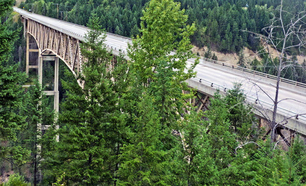
The Moyie River Canyon Bridge is a structural steel truss cantilever bridge at mile marker 70 on U.S. Route 2 spanning the Moyie River near Bonners Ferry and Moyie Springs. It was constructed in 1965 and it is 1,223-foot long and 424 feet high. The current bridge replaced an obsolete bridge built in 1923, directly downstream from the municipally owned Moyie Dam.
The bridge is the second highest in Idaho, exceeded only by the 476-foot high Perrine Bridge across the Snake River near Twin Falls, Idaho.
One of the highest deck truss bridges in the world, the Moyie River bridge is located just south of the Canadian border in the U.S. state of Idaho. Far less known than the Perrine bridge in Idaho Falls, the Moyie crossing is nearly as high at 464 feet (141 mtrs). Constructed in 1964, the current span bypassed more than a mile of twisting road that descended to the bottom of the canyon where it crossed a bridge built in 1923. The Moyie River begins in British Columbia, Canada and flows into the Kootenai before meeting the Columbia River which empties into the Pacific Ocean.
Supporting the 3-span truss are two concrete piers with 3 levels of varying thickness. The tallest of the two piers measures 217 feet (66 mtrs) from foundation to cap. The bridge measures 1,233 feet (373 mtrs) from end to end. On the east side of the bridge there is a parking area where you can walk out onto the bridge. The more adventurous can try to view the structure from a road that descends to the river from the west side.