

|
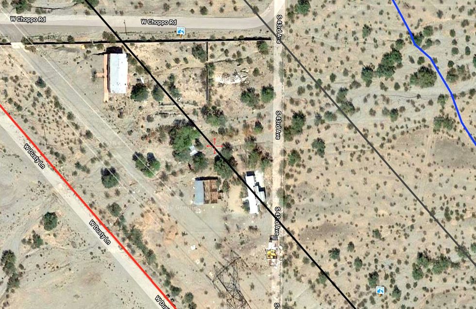
The next four screen caps may not be all that exciting, but I wanted to document what Dusty Lane looked like from the air before the houses were condemned and torn down. (The Google satellite looks to be about 18 months out of date.) The red line is the Rez. The black lines delineate the right-of-way, and the blue line is today's track.