

|
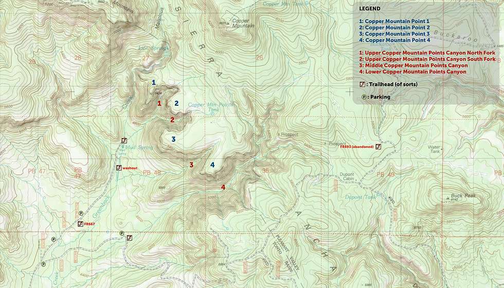
named regions for use on the guide page - topo lines are bit wonky as this is a mix of USGS & an OSM + slope/shading layers for a maximum amount of trail/road information to help with context.
view original size. updated version
view original size. updated version