|
| | | |
| |
|
| Hiking | 2.00 Miles |
800 AEG |
| | Hiking | 2.00 Miles | 1 Hour | | 2.00 mph |
| 800 ft AEG | | | | |
|
|
| |
| Linked |
|
none
[ show ]
| no linked trail guides |
| Partners |
|
none
[ show ]
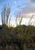
| no partners | | Stopped for a quick hike on my way through Yosemite from a week in Mammoth Lakes. I didn't want to deal with the Yosemite summer crowds and this looked a bit off the beaten path. The small parking lot *just* inside the Tioga Pass entrance was nearly full, but my time on the trail (9:30-10:30 a.m.) was relatively solitary until I started hiking back.
Though just a mile to Middle Gaylor Lake, the first half is a steep climb. Completely doable given the short distance, especially with poles, but perhaps the altitude was getting to me more than I realized and I took many "photo" breaks. The scenery was beautiful, especially after the 2011 amazing snowfall.
I was more than pleased when I crested the "hill" (as the ranger at the booth described it) and saw Middle Gaylor Lake in its glory. Though a bit disappointed that the trail didn't lend a better view of Tioga Pass. In any case, MGL was gorgeous. Despite the snow patches, it was very warm in late July and, of course, the air was full of mosquitoes. I, unfortunately, forgot to spray the back of my shoulders.
I lost the trail just beyond where the (seasonal?) creek enters the lake. So I didn't make it to Upper Gaylor Lake. Next year! |
|
Wildflowers Observation Light
|
|
| _____________________
| | |
|
|
|
 Route Editor