|
| | | |
| |
|
| Hiking | 11.70 Miles |
250 AEG |
| | Hiking | 11.70 Miles | | | |
| 250 ft AEG | | | | |
|
|
| |
| Linked |
|
none
[ show ]
| no linked trail guides |
| Partners |
|
none
[ show ]
| no partners | | BLAST FROM THE PAST!! I had done this hike a waaaay back in July with the idea of doing a GPS download and hike description when I got back to Phoenix. However, my GPS is not talking with my computer and so this intention kept getting pushed off until it was forgotten. Now, with the end of the year approaching and the fact that I am hiking in the same area again I decided it was time to dredge my memory and post this hike.
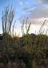
The hike takes place near Lake Elsinore at the Santa Rosa Plateau Ecological Preserve. This preserve has many trails that can be accessed from several TH right off the road. To get to this preserve from I-15, I exited west onto Clinton Keith Rd. This road will climb to the top of the plateau and the main TH for this preserve will be on the left side of the road. There are other places the trails can be accessed from this road and for my hike back in July that's what I did.
My hike started from one of these alternate access points. I did a loop involving a number of trails. (I used the Vernal Pools Trail as my header because it is probably the best known of the trails that I did). Started my hike from Hidden Valley TH. Went in on the Coyote Trail, which included a short loop, called the Oak Tree Loop. Trail was very easy to follow, with little elevation change. Total length of this trail was 1.5 miles. I took a short connector trail (a road) to the next trail called the Tenaja Truck Trail. This was actually a road which is no longer open to motorized vehicles. This trail also did not have any elevation gain. Turned left from this road onto the Waterline Trail. This too was a former dirt road that led to the visitor center for this preserve. This part of the hike amounted to about 1.6 miles.
From the visitor center, I took the Granite Loop trail to the Vista GrandeTrail. These trails were nice single track trails with a little elevation gain toward the end of theVista GrandeTrail. Views went from nice views of rolling hills covered in foot high dry grass to nothing because the trail was bordered by 6 ft. high brush. Trail length was 2.4 miles. From these trails I jumped onto the Punta Mesa Trail. This was the longest single trail that I did going for almost 2.5 miles. It was also the most engaging trail. It started off going down the side of a hill that turned into a dry creek bed which had quite a bit of tree coverage. From the bottom of the wash there was a little climbing that took me to an old farmstead. There was some "historic adobes" at this location too.
The next trail that I jumped onto was Vernal Pool Trail. The initial part of the trail involved a little climbing to the top of a hill that flattened out after that. There are suppose to be a couple of seasonal pools at various locations on this trail. Both pools were just mud holes when I was there. The first mud hole (further east) looked like it was the bigger of the two. There was a wooden platform that went out into the area that is probably standing water on a seasonal basis. When I was there this area was closed. Beyond this area was a large herd of cattle on some fenced property. Taking the Vernal Pool Trail to its end led to another parking area. Trail length was 1.5 miles. I did a little backtracking from this parking lot to take the Trans Preserve Trail back to my car. This last portion of the trek was about 2.2 miles long. Total mileage was 11.7 miles. There many many "trails" in this preserve, offering numerous trail combo's. As you may be able to tell from this write up, none of these trails are very long. So you can do a lot of trails without doing many miles. |
| _____________________
| | |
|
|
|
 Route Editor