|
| | | |
| |
|
| Backpack | 6.20 Miles |
1,250 AEG |
| | Backpack | 6.20 Miles | | | |
| 1,250 ft AEG | | 37 LBS Pack | | |
|
|
| |
| Linked |
|
none
[ show ]
| no linked trail guides |
| Partners |
|
none
[ show ]
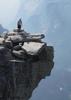
| no partners | | My son and I wanted to do an overnight backpacking trip. I got him his own day pack and he proudly carried 10 pounds. We decided to hike to Dog Lake in Big Cottonwood Canyon in Utah. When we got to the trail head we found out a small mountain fire had closed the trails. We were so bummed! We were looking forward to hiking from Dog Lake to Reynold's Peak (0.5 mile more) to watch the sunset. We had to quickly decide on different trail that was close by. We went over to the next mountain range at Little Cottonwood Canyon and started on the White Pine Lake Trail (I've done in the past) knowing we didn't have time to make it all the way and planned camping halfway there.
We started at 5:18 in the afternoon and stopped 3 miles in to set up our tent before it got too dark. Even though time was against us, it didn't spoil our fun in playing in the stream, enjoying the fall colors, taking pictures, and even spotted two deer on the trail. The night was a little nerve racking with the mountain breezes playing tricks on my mind. It made it memorable being up at 2am playing Candy Crush on our phones passing the time until the wind settled down and we finally dozed off at 3am. I love spending time with my little hiking buddy. |
| | |
|
|
|
 Route Editor