|
| | | |
| |
|
| Hiking | 3.94 Miles |
1,494 AEG |
| | Hiking | 3.94 Miles | 2 Hrs 5 Mns | | 2.13 mph |
| 1,494 ft AEG | 14 Mns Break | | | |
|
|
| |
| Linked |
|
none
[ show ]
| no linked trail guides |
| Partners |
|
none
[ show ]
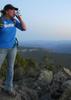
| no partners | | Since I always drive back from Vegas by myself, I like to squeeze in a short hike along the way. Fortification Hill was another one suggested to me by an employee, and this was quite an enjoyable hike. Just the drive to the trailhead made it worth the journey--the scenery is beautiful, and I saw several burros along the way.
As I started the hike, I decided to follow the ridgeline up. Again--very windy! Pretty easy, but definitely uphill, and the trail was easy to follow. When the trail turned sharply to the west, it got a lot steeper. Lots of loose rock in this section, poles were a help. I ditched the poles at the beginning of the climb, which is an easy class 3 for about 10 feet. Luckily, there was no wind where I had to climb, but I only got a break from it for a minute or two. After that, there is a little more scrambling, then the trail quickly reaches the top of the mesa. Once on top, it was an easy 1/2 mile walk west across the mesa to the highpoint.
I scared 4 bighorns along the top, they ran for a few seconds, then stopped to watch me. I passed by them, on my way up to the summit, which was super windy. I took a bunch of pictures, halfheartedly looked around for a register-none that I found-then headed back down. The bighorns were still watching me from the same place, I don't think they moved until I was off the top of the mesa. Again, the climb back down was shielded from the wind. I grabbed my poles, then headed down the steep slope, which was very slippery especially while fighting the wind. Once I was headed back south on the ridge, I decided to drop down to the wash on the west side of it (clearly marked by a cairn) to get out of the wind. It was an easy walk back to the car from that point.
This hike would be a great full-moon night hike in the spring or fall. It is very easy to follow, and the short climb is not difficult. You can see Vegas & Lake Mead from the summit, which would make for some incredible night pictures.
Update to the driving directions: From the highway, you take road 70 north 3.1 miles to the restrooms. At the restrooms, take a hard right onto 70C. There will be a sign after a few hundred feet. take 70C east for 2.5 miles. The road widens for parking, and there is a trailhead sign on your left. Despite what the signs say, if the road is dry, a sedan can make it to the trailhead with no problem. |
| _____________________
| Stop crying and just go do the hike. |
| | |
|
|
|
 Route Editor