|
| | | |
| |
|
| Hiking | 8.40 Miles |
1,550 AEG |
| | Hiking | 8.40 Miles | 6 Hrs 25 Mns | | 1.31 mph |
| 1,550 ft AEG | | 14 LBS Pack | | |
|
|
| |
| Linked |
|
none
[ show ]
| no linked trail guides |
| Partners |
|
none
[ show ]
| no partners | | Go to this website B4 hiking on this trail or any other trail beginning @ the Mt Rose Trailhead for accurate & current weather conditions: https://www.mountain-forecast.com/peaks ... casts/3285.
My hike, by the numbers:
Mt Rose Trailhead = 8,737' elevation; N39° 18.769' W119° 53.850'
Tamarack Peak = 9,899' elevation; N39º 19.100' W119º 55.295'
Hike = 8.4 miles; Accumulated elevation gain 1,550'
3 Sep; I drank 24 oz of water B4 going to bed; I wanted to be fully hydrated for tomorrows hike
0430/4 Sep 2019; shut off my alarm clock & got out of bed. Ate a good breakfast of 2 eggs over easy, 2 strips of bacon, shoestring potatoes I cut fresh, smothered with my home-made sausage/Country gravy mix, a thin cut pork chop, coffee
0615; I'm out the door & driving to Mt Rose Trailhead. All during my drive I'm drinking 20 oz of water + french fry cut slices of Honeycrisp Apple. I want to be FULLY hydrated by the time I reach the trailhead. I normally am drinking 20-24 oz of water as I drive toward any trailhead.
0705; I'm starting my hike from the same Mt Rose Trailhead & will be hiking the same exact trail as the one I hiked back on 28 Aug from TH to 1/4 mile past Galena Waterfall.
I'm carrying just 35 oz of water + a recently purchased MSR Trailshot water filter (5 oz) which gives me the capability of adding filtered water into the bladder inside my backpack.
55º-60º when I started my hike; a very slight, gentle breeze. I'm wearing a long sleeve cotton T-Shirt & have already applied sunscreen & insect repellent on my face & neck. UV sunglasses & Sunvisor on my head, insulated gloves to protect the palms of my hands in case I fall + they keep my hands warm during the early part of my hike. The sun is just starting to shine on mountain peaks. My pack feels light because I'm carrying so little water instead of 70 oz or a little less than I've carried in the past.
0828/ 2.4 miles into the hike; I arrive, @Galena Waterfall, & find my first geocache right where it's supposed to be.
A few hundred feet on the trail past the waterfall I saw a young woman & a couple of kids near their tent who obviously had camped out. I spoke with the lady & asked her what they were using to filter/purify water during their campout. She told me they have the MSR miniworks EX water filter which is one of the best available. It purifies water as good some & better than most.
0844/9,083' elevation; approximately .3 mile past the Waterfall I come to the sign pointing me toward the trail heading UP & off The Mt Rose trail. Co ords: N39° 19.758' W119° 55.555'
It's a well-defined trail that takes me up above & past the top of Galena Waterfall. The trail is generally in a Southwest direction.
0910/9,303' elevation; I reach the Spring (9,280'; N39° 19.583' W119° 55.879') where I could add to my water supply if I needed to.
0925/9,383' elevation; I reach the trail intersect sign with the Tahoe Rim Trail & continue hiking South along the trail a short distance. Co ords: N39° 19.398' W119° 55.911'
0932/9,432' elevation; The trail I'm been hiking intersects with a road that runs from Mt Rose Trailhead all the way up to the Relay Tower. At this intersect I leave the trail & the road intersect & begin bushwhacking EASTWARD up toward a Tube with a View geocache. Co ords: N39° 19.334' W119° 55.934'
1005/9,722' elevation; I've bushwhacked in a generally Eastward direction approx .25 mile & 278' in elevation to reach a Tube with a View geocache, which I quickly find.
1101/9,855' elevation; I've been bushwhacking in a generally SE direction approx .32 miles, 163' gain in elevation from Tube with a View. I've now arrived at FTF Tag, High in Nevada geocache, which I quickly find.
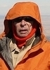
1127/9,880' elevation; I reached Tamarack summit & the geocache after hiking an addition approx 40' in elevation in a generally SSE direction approximately .16 mile & quickly find FTF Tag, High in Nevada geocache. Take numerous photos from Tamarack Peak summit.
1155/ 9,880' elevation; I begin my generally SSW bushwhack down the side of the mountain until I intersect with the Relay Peak Road.
1215/9,286' elevation; I arrive @ Relay Tower Road after bushwhacking down to Relay Road approximately .5 mile & descending 622'. Co ords: N39° 18.938' W119° 55.741'
1324/8,737' elevation; I hike 2.2 miles along the road, total accumulated descent is approximately 600' in a generally SSE direction.
I take off my backpack, wander around for 10 minutes while the back of the T-shirt I'm wearing evaporates the sweat & enjoying Honeycrisp slices & drinking some water/electrolyte from a water bottle in my car. |
| _____________________
| | |
|
|
|
 Route Editor