|
| | | |
| |
|
| Hiking | 7.00 Miles |
|
| | Hiking | 7.00 Miles | | | |
| | | |
| |
| Linked |
|
none
[ show ]
| no linked trail guides |
| Partners |
|
none
[ show ]
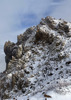
| no partners | | I'm 0-2 trying to get more than 10 miles down Camp Wood Road before my little car is halted by a semi-flooded portion of the road, so without my book of the national forest quad maps (not typically a great thing to forget!) or the knowledge that this website mentions only that the trail "looks untrustworthy," I blindly followed a forest road that disappeared out the back of a clearing I noticed just before I was again forced to turn around. This road was FR 9821B, and I made it perhaps 0.2 miles before I was forced to pull over amid some pretty good ruts. I decided to hike up it, as I didn't have a real backup plan for getting stopped on Camp Wood Road, and ended up running right into 9044.
The beginning of the trail was very well marked with what appeared to be a relatively new sign and was fairly easy to follow. The middle half essentially followed Pine Creek, which had a surprising amount of water flowing throughout. I'm sure I wasn't exactly on the trail the whole time, as the dry part of the creekbed somewhat obscured the exact path, but I ran right into the left turn it takes out of the creekbed and up a hill, where it intersects FR 9807B. This turn was marked with several obvious cairns across the creek, so approaching it from anywhere along the wash shouldn't be an issue.
It was a pleasant hike throughout, with intermittent shade and not too much change in elevation save the last part. Quail were all over the place, and signs of deer were next to every pool. When I reached 9807B, my GPS told me it connected to Camp Wood Road, so I followed that back to my car. It was definitely the shorter route! The road dumped just about all of the elevation gained during the last quarter of 9044, and provided some pretty nice views to the east and west. It was about 2 miles back to my car along Camp Wood Road, which was flat and uninspiring, mostly as a function of having driven it a few times already.
I'm here to tell you that you can trust the trail! It could be harder to do if the water is flowing more heavily, but it was a nice, easy experience, particularly for having little to no idea what to expect next at any point along the hike. |
|
Wildflowers Observation Light
Starting to bloom all along the trail next to the creek. Can't identify any, but there were some small purple ones and lots of bigger, short white ones. |
|
| | |
|
|
|
 Route Editor