|
| | | Apache Peaks & Richmond Basin, AZ | | | |
|
|
Apache Peaks & Richmond Basin, AZ
| | |
| |
|
| Hiking | 12.02 Miles |
3,195 AEG |
| | Hiking | 12.02 Miles | 9 Hrs 7 Mns | | 1.62 mph |
| 3,195 ft AEG | 1 Hour 43 Mns Break | | | |
|
|
| |
| Partners |
|
none
[ show ]
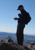
| no partners | | Last week on the Pinals, we had noticed Apache Peaks to the north of Globe, did some research, and decided to check them out this weekend. What was supposed to be an out & back to 6940 with a side trip to Richmond Basin turned into a little bit more.
Trailhead to 6940--We parked at the junction of 220 & 220A and headed uphill. The mountain blocked some of the sun for us, and temps were nice. We followed what appeared to be an old road in places, and game trails in other places. It was all very steep, with plenty of loose rocks. We reached the cliff band, then found the chute to follow up. It was choked with dense brush which was more of a challenge than the scramble itself, although there was one spot where I was about at my limit with how far I could reach and still be able to pull myself over a boulder. Once above the chute, there were more rocks to scramble over, but it was basically like climbing loose steps. After that, it was an easy walk to the saddle, then steeply again uphill. The rocks at the north end of the mountain were great and climbing up on them afforded great views in all directions. From this spot, the idea was formed to follow the ridgeline we could see to the north, then around to the west. A quick check of the topo confirmed that this was probably a feasible option. We continued on to 6940, and took a lunch break. From there, we looked over at 6910, but were unsure about getting across the middle of the ridgeline over to it, and the new possibility of making a loop won us over.
6940 to 6601--From 6940, we retraced our steps to the north, then steeply back downhill to the saddle, heading to 6601, which was hardly noticeable as a peak. We followed the fenceline north, mostly staying on a horse trail.
6601 to 6682--We continued following the horse trail and fence line north, then west uphill to 6682. It was generally pretty easy going uphill.
6682 to 6326--Dropping off the north side of 6682 was very steep and very brushy. Again, mostly following the fenceline. Aside from the brush, it was an easy climb up to 6326.
6326 to 6188--Heading west off 6326 was easy, but brushy. 6188 loomed in front of us, looking very steep. And it was. The brush cleared some, but the steepness and loose rocks increased. Scrambling up was actually quite fun, one of my favorite parts of the day, and it was never difficult to get over the rocks. Great views from the top.
6188 to 5819--Getting down off of 6188 was a whole other story. Extremely steep, mostly scree. I'm surprised neither of us fell at any point. Very slow going through here, and every step sent a cascade of sharp rocks downhill. Getting to the saddle was a relief. Still very rocky, brushy terrain, but seemed easy compared to what we just went through. We followed the fenceline to 5819.
5819 back to the car--From 5819, we followed the rest of the ridge easily down to 220A, then took it back to the car. At the car, we refilled our water, then headed over to Richmond Basin
Richmond Basin--An easy road walk from the car on 220. Lots of mines to explore, which made me very happy. I had already marked all of the larger mines I had wanted to see, so we didn't waste any time heading to all of them. We took 220 to the adits at the end of the road, then explored more mines on our way back to the car.
Great day, all off trail except for the Richmond Basin portion. Temps were mostly good, and a great breeze helped tremendously. Fun to explore an area which doesn't seem to get a whole lot of visitors. |
| _____________________
| Stop crying and just go do the hike. |
| | |
|
|
|
 Route Editor


 or more accurately, the first false-summit, because I would encounter another along the way. Thankfully the second was a bit easier, and once above it I encountered a wide flat grassy field which provided a nice respite to climbing 1 foot vertically for every 5 steps forward. And from that field the summit ridgeline finally reared its head. It just HAD to be the destination. Although it was, the true summit was on the far end of the ridge.