|
| | | |
| |
|
| Hiking | 4.20 Miles |
1,934 AEG |
| | Hiking | 4.20 Miles | 2 Hrs 30 Mns | | 1.68 mph |
| 1,934 ft AEG | | | | |
|
|
| |
| Linked |
|
none
[ show ]
| no linked trail guides |
| Partners |
|
none
[ show ]
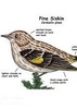
| no partners | | This was a nice push up to the high points of the Mules. Fairly easy to follow, only a couple of areas where the trail is not well defined. The highlights: the viewshed from Fissure Peak and the rare spotting of a Lewis's Woodpecker in the oak forest slopes near the trailhead.
As others have mentioned, perhaps the most difficult navigational aspect of this hike is finding the trail at the trailhead. There is an old two-track the heads west from the parking area at Mule Pass, west of the white obelisk marking the "continental divide" (incorrectly). Take this two-track not more than 15 feet and on the left (south) you'll see two sections of barbed wire fence coming together to form a corner. Just past this fence corner and past a small wash is a faint trail that leads up the hill to the south into the trees. It looks like people may have been jumping the fence and traveling up the wash but this is not necessary. The trail climbs up next to a wash with the boundary fence (private on the east side) on your left (east).
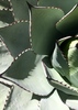
Apparently this is an unofficial or social trail but it is pretty straight forward. It climbs up to the ridge and then follows it southwest through a burn area then into thick scrub: oak, manzanita, juniper, piñon. It is a pretty good climb up to Escabrosa Ridge. The trail gets steeper through denser vegetation just before reaching the ridge and a few cairns can be seen through this area. The trail on the ridge follows the fence for a while - in fact the fence is never far away for the entire hike. The vegetation changes as you make your way toward a southern exposure, notably the abundance of cholla, making an interesting maze through the monsoon grass and 6 ft spiny arms. As you approach Ballard the trail kind of disappears into a network of game trails and social trails. It's clear where one needs to go, it's just a matter of preference at this point. The summit of Ballard is covered in oak so the views, while impressive, are a bit obscured. The register is tucked in a cairn near an oak to the north(ish) of the old fire ring and open area.
From Ballard, Fissure Peak beckons to the NW. It's hard to tell from this perspective if Fissure is any higher than Ballard but it looks interesting to explore with the deep cleft on the south side of the peak. A saddle divides the two peaks and a scramble down the rocky ridge of Ballard took a little time. It's a 250 ft decent over loose rhyolite and sections of heavy brush, then it's up Fissure. The trail here is better defined near the saddle and then fades as it climbs toward the peak. The fence is still there to the south, sometimes reduced to just a single strand of wire. The rhyolite outcropping becomes more prevalent and there's a little rock hopping available to avoid cholla and other brush. On the summit grand views of the Huachucas and the San Pedro river valley await. Nice views to the south into Mexico as well: Sierra San Jose (looking dwarfed at this elevation) and the Sierra Madre hazy on the southwest horizon. The register is in the summit cairn and a folded sheet of paper in the jar claims Fissure to be the true high point of the Mule Mountains. However, comparing the elevations on the HAZ tracks app shows Ballard at about 40 ft higher. Regardless, Fissure is definitely worth climbing for the views.
On the way back I thought I would be clever and traverse from the saddle between Ballard and Fissure, around the north side Ballard, and connect back up with the trail where Escabrosa meets the other ridge. It didn't save me any time or effort. In fact, with all the monsoon grasses covering the slope, it was straight-up difficult. It would have been better to stick to the way I came up.
BT |
|
Wildflowers Observation Light
Paintbrush, smooth bouvardia (?), and various sunflower species up high on Fissure Peak. |
|
| _____________________
| | |
|
|
|
 Route Editor