|
| | | |
| |
|
| Backpack | 10.50 Miles |
255 AEG |
| | Backpack | 10.50 Miles | 3 Days | | |
| 255 ft AEG | | | | |
|
|
| |
| Partners |
|
none
[ show ]
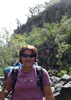
| no partners | | We began our adventure on the side of the I-17 at the Stoneman Lake exit. We walked into the wilderness, our minds filling with excitment. We found a creekbed and walked along it until the walls of Rattlesnake canyon surrounded us. There was a nice breeze, making the hike in the sun a little more bearable. After a few miles we stopped under a big cottonwood tree to rest and eat some lunch. We ate our food and continued on, curious as to what each curve in the canyon had in store for us. There were a few water holes that we had to skirt around, but nothing we couldn't get by. About 2.5 miles in, we encountered a small problem. As we edged forward, we stood on the top of a 30 foot waterfall. My brother made his way down first. Once he was down I lowered our packs down by rope. I climbed down next, then my dad followed. Once we were down, we hiked another few miles until we finally reached the junction of Rattlesnake and Woods Canyon. We decided to stop and set up camp for the night. As we sat around the campfire that night, everything around us came alive. Beneath the moon the crickets chirped, the wind blew softly thru the trees, and the cotamundi called out for one another. I soon fell asleep to the sounds of the wild...
The next day I woke up very sore from the previous day's hike. We had some coffe and pancakes, packed up, and were ready to head out. We hiked about a mile up Woods Canyon and found a nice spot by a some running water and decided to set up camp. After unloading all our gear, we decided to take a dip in the refreshing water. We drip-dried in the sun, then returned to camp where we began to explore. We found a few mountain lion tracks on the outskirts of our camp. Day quickly turned to night, and we found ourselves curled up in our sleeping bags telling stories and laughing at jokes. We drifted into a peaceful sleep.
The time had come; it was our last day out there in the wild. We had about 3.5 miles of boulder hopping to do, and none of it was fun. We were sore, hungry, and tired, not to mention sick of jumping over boulders. After a few more miles we heard the highway, and before we knew it we were being picked up off the side of the 179. The trip overall rates top three most exciting things I have done in my life. The wildlife was scarce, the flowers were numerous, and the weather was great. This trip will live on in my mind forever. |
|
Wildflowers Observation Substantial
|
|
| _____________________
| | |
|
|
|
 Route Editor