|
| | | |
| |
|
| Hiking | 13.80 Miles |
3,169 AEG |
| | Hiking | 13.80 Miles | 8 Hrs 15 Mns | | 1.67 mph |
| 3,169 ft AEG | | | | |
|
|
| |
| Linked |
|
none
[ show ]
| no linked trail guides |
| Partners |
|
none
[ show ]
| no partners | | From Central Phoenix, via the Apache Trail, a full 2 hour drive was required. The views over the last hour allowed the time to slide; so long as you are a passenger. Drivers undoubtedly have their eyes fastened on the sharp dirt road turns that seem to court the cliff’s edge.
The Reavis Ranch Trailhead is a stunning vista. Apache Lake and Four Peaks sandwich a vertical rock face in an unexpected and distracting scene. As the hiking began, I realized I hadn’t even thought to move my keys from my pocket to my pack. A truly hypnotizing view.
Finally on the trail at 8:30 AM; jackets and long pants were necessary. Ridgelines and low sun provided shade for the first few miles. A steep hill proceeded our break into the sunshine. I was dripping sweat and peeling off layers.
From here, the trail and turn-off to the Falls were visible; running along the furthest ridgeline and farther than I initially supposed. The path continued to follow the rim of the canyon feeding Lewis and Prenty Creek. With the trail lying blatantly before us and our anticipation growing, time slowed. This portion of the hike felt the longest in both directions.
Although the turn off from the Reavis Ranch Trail leading to the Falls was small, it was clear and marked with cairns. A bit more incline to the saddle and, finally, a proper perspective of the landscape.
From the saddle, the Falls were hidden by a ridge but the route was apparent. Looking behind, Apache Lake is visible. And once we began the descent, Castle Dome and the Reavis Ranch trail could be seen. Here is literally the high point of the journey.
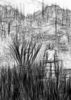
On the way into the canyon, shade trees and grassy patches stood out against a blanket of prickly pear. The trail became a narrow strip of dirt before gaining momentum, then diving into the bushes. The footing was sketchy, resembling a dry creek bed, and the path, crowded with brush and cactus.
The bottom of the canyon came quick; along with it, running water and cool, shaded rest. The up and over of the ridge guarding Reavis Creek was particularly entertaining. Precise steps and leans were required to keep the cactus at bay. While the spillways along the backside of the ridge imply a straight-forward descent, scooting along to the left got us safely to the bottom.
On the opposite side of Reavis Creek, a path led a short way up the canyon before inevitably disappearing. Cairns helped tremendously to navigate the fallen trees and boulders. The hidden hazard came from leaves covering the creek bed and appearing to offer a solid footing.
Shortly after 12 noon, we reached the Falls. The collection pool was absurdly cold to my bare feet. In fact, the temperature at the end of the canyon suggested pants and a jacket.
We left the falls just before 1 PM. Gravity and familiarity pulled us down Reavis Creek. Soon, we found our landmark and exit point; a large, oddly shaped and perhaps fallen tree.
Getting back over the ridge again offered plenty of body contortions and now a noticeable incline. Before the ascent out of the canyon, we rested and made mental preparations.
On the way up, the terrain constantly changed and the slow climb afforded the opportunity to take it in. Breaks under shady trees were available as needed. This portion of the hike didn’t require much thinking and invited a mental break. Once at the saddle, the view and the breeze brought everything back to focus. It was a high point.
The last 3 miles slowly wound down the main ridge. Again, taking longer than expected. All this leading to the finale: seeing the trailhead, the vehicles and, wow, the view.
We reached the trailhead at 4:45 PM. |
| _____________________
| | |
|
|
|
 Route Editor