 Route Editor

| Guide | ♦ | 11 Triplogs | 1 Topic |
details | drive | permit | forecast | route |
stats |
photos | triplogs | topic | location |
| 96 | 11 | 1 |
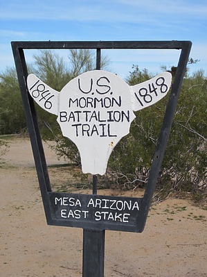
Wagon trail meets the sands of time by Woodsnative History
In 1846, Polk, the U.S. President authorized the army to recruit 500 Mormons to join their forces in the war with Mexico. After encouragement from their leader Brigham Young, 500 men enlisted for one year of service. Departing from Council Bluffs, Iowa in July, they headed for Santa Fe and subsequently the Pacific Ocean, over 2,000 miles away. Before long, their orders were changed from a combat mission to a road-building operation. The government was keenly interested in a southern route to California, as the northern route was impassable up to 9 months of each year due to snow in the mountains. To complete their monumental task, the Battalion took 25 wagons and road-building equipment and created 700 miles of new road between New Mexico and California. In what is now central Arizona, the Mormons met villages of Pima Indians and a very large community of Maricopa Indians. Both groups were friendly with them and guided them along the Gila River. On Christmas Day they traveled 18 miles and camped away from water at a dry camp, which is the starting place for the hike described here. West of the Gila River, the route into California was so dry and desolate that the soldiers and stock animals had to march long distances without water as quickly as possible to survive. During that part of the march, rations were limited, many stock animals gave out, and the soldiers had to improvise new boots out of hide leather. The battalion reached San Diego on January 29, 1847, where they were commended by their commanding officer Colonel Cooke for completing the longest infantry march in history.
Additional History Prior to all of the above, Juan Bautista de Anza, captain of the Presidio at Tucson, led an expedition of colonists and soldiers toward San Francisco. There were 240 people and over 1,000 head of livestock in the caravan. They traveled through the Butterfield Pass in the fall of 1775. Markers along the trail commemorate their 1,000-mile journey. Trail Parts of this trail are easily followed by hikers on the ground, especially on both ends of this five-mile section. Other parts are only visible in satellite pictures of the area. Still, other parts of the trail have succumbed to the forces of erosion and plant life and now appear as small washes. As you leave Christmas Camp and head west, you will notice that the trail rises very gradually throughout its length. Instead of cairns, which might go unnoticed, there are permanent steel markers each about 5-6 feet tall. These are placed as mileposts and are very helpful in showing that you are still on the right track, especially for the middle miles. Given the difficulty of knowing whether you are on the trail or not, I recommend using the Butterfield Pass as a landmark as you head west. It is a very prominent notch in the western hills (Maricopa Mountains). If you take the trail from west to east, watch out for the cow path that heads north, at about 1.5 miles in from the western end of the trail (it leads to nearby Conley Tank, on the north). And, if you happen to have a footsore individual in your hiking party, who just happens to ask how much farther it is to Christmas Camp, be sure not to promise them that the next tree-lined wash is your final destination, since they all look the same from a distance! Most of this trail no longer shows any signs of wagon travel, and what remains is slowly disappearing. I am not sure why this section has not been maintained as a road over the years, since various groups and even the Boy Scouts have been active in marking sections of it and in preserving the desert environment nearby. Maybe it is intentional because as you reach the middle miles, you get a sense of walking through history. The open desert appears to be untouched by humans, and you can imagine a member of the Mormon Battalion as he trekked past, seeing this desert for the first time, thinking of home at Christmastime, and trying to find the best course to lead a wagon. Road Closures The BLM closed the roads which access this trail in 2008, restricting all motorized traffic and off-highway vehicle use. These are to remain closed until September of 2012 when a new management plan is implemented. Check out the Official Route and Triplogs. Leave No Trace and +Add a Triplog after your hike to support this local community. One-Way Notice This hike is listed as One-Way. When hiking several trails on a single "hike", log it with a generic name that describes the hike. Then link the trails traveled, check out the example. | ||||||||||||||||||||||||||||||||||||||||||||||||||||||||||||||||||||||||||||||||||||||


