 Route Editor

| Guide | ♦ | 30 Triplogs | 4 Topics |
details | drive | no permit | forecast | 🔥 route |
stats |
photos | triplogs | topics | location |
| 217 | 30 | 4 |
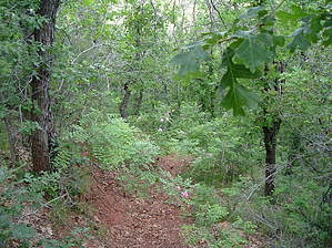
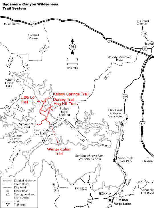
frosty tales in a forest of icicles by HAZ_Hikebot  Winter Cabin Trail descends gradually through Ponderosa Pine, Gambel Oak, and juniper trees with many shaded areas for about a mile and a half to the historic Winter Cabin. Winter Cabin Spring, which normally runs all year, is located in the creek behind the cabin and about 30 feet downstream on the other side of the creek. A campsite is located near the cabin. Winter Cabin Trail descends gradually through Ponderosa Pine, Gambel Oak, and juniper trees with many shaded areas for about a mile and a half to the historic Winter Cabin. Winter Cabin Spring, which normally runs all year, is located in the creek behind the cabin and about 30 feet downstream on the other side of the creek. A campsite is located near the cabin.At the cabin, you can connect with Hog Hill Trail #133 and Kelsey Springs Trail #3, or you can continue on Winter Cabin Trail in a southwest direction as the trail descends about 1,500 feet of elevation in 5 miles through chaparral type of vegetation and a partially shaded canyon to Sycamore Creek. There is no water available in this area of Sycamore Creek. At Sycamore Creek, you can connect with the Sycamore Trail, which runs downstream along Sycamore Creek. Along the lower part of Winter Cabin Trail, there is a short side hike to Ott Lake, where water is unreliable.
Winter Cabin Trail #70 - MAP
Check out the Official Route and Triplogs. Leave No Trace and +Add a Triplog after your hike to support this local community. One-Way Notice This hike is listed as One-Way. When hiking several trails on a single "hike", log it with a generic name that describes the hike. Then link the trails traveled, check out the example. | ||||||||||||||||||||||||||||||||||||||||||||||||||||||||||||||||||||||||||||||||||||||||||||||||||||||||||||||||||||||||||||||||||||||||||||||||||||||||||||||||||||||||||||||||||||||||||||||||||||||||||||||||||


