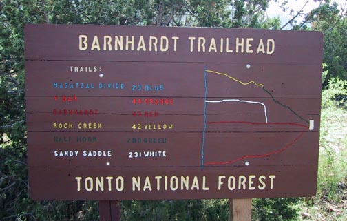
Barnhardt Trail is considered to be one of the "expressways" to the Mazatzals. It starts at Barnhardt trailhead and proceeds westward to the ridge of the Mazatzal range or "Divide" where you intersect the N-S Mazatzal Divide Trail, which is part of the Arizona Trail. It's considered an expressway in that it connects up with numerous other trails in the system that could keep a backpacker busy forever. One note of warning, however, the trails are many and can be confusing. The Mazatzal Peak topo quad shows trails that no longer exist and doesn't offer many that do. Many of the ones that are shown are misnamed. Here's your best bet if you want to get a decent handle on this area: The Forest Service office in Mesa has a nice plasticized Mazatzal Wilderness map that shows all the numbers with the names on the back. Check out the Official Route too. Put the two together, shake well, add a pinch of luck, and you're on your way (remember: author not to be held responsible for resulting chaos:).
Alrighty then, this hike goes from the trailhead up to Chilson Springs and back. The first thing you'll probably notice about this hike is its a "climber." The good news is this: the beauty overwhelms any pain, and there isn't much pain because the grade is so "friendly" (moderate and consistent). "If you're in decent shape and your legs are thirsting for a little action, it just feels awful (good! that is)." Likewise, coming back down is surprisingly easy on the knees.
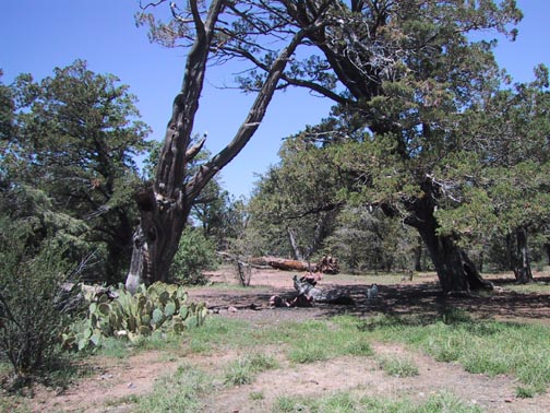
Starting, you'll be ever so briefly in desert scrub before entering Pinon Pines and Juniper. At about a half-mile in, you'll come to a sign denoting the Wilderness Area boundary. Shortly after that, you may notice a side trail dropping down to the right. I'm guessing this MAY be one of your few access points to the canyon floor.
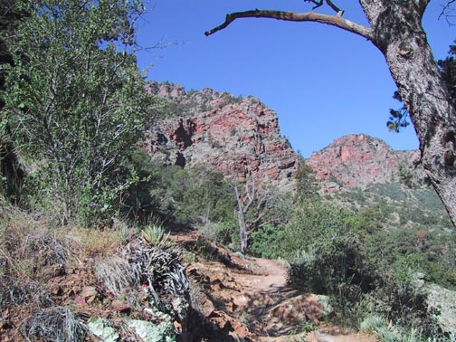
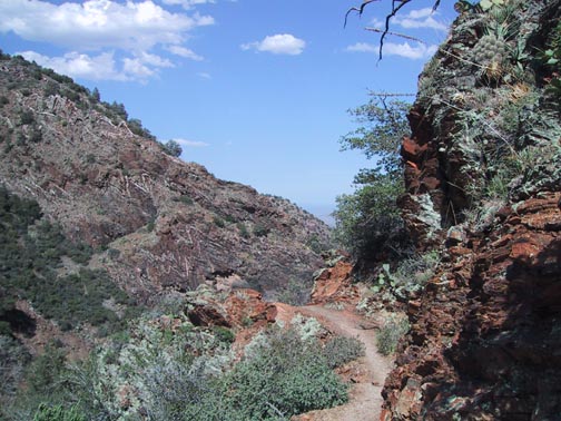
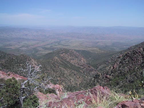
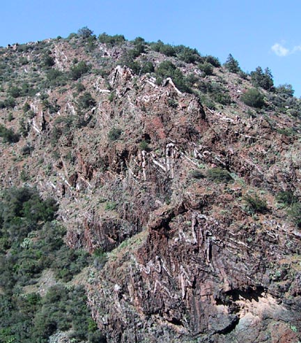
As you continue to gain elevation, you'll gradually come into Ponderosas and small Oaks. The climb contours high along the Barnhardt Canyon wall in some very creative ways making for great views from small promontories and ledges. You get a hawk's eye view of the panorama and the canyon far below which has many unusual features and inviting, but inaccessible pools. I found myself looking ahead thinking, "no way the trail could go up there," and indeed, it did through what I consider to be some very ingenious routing.
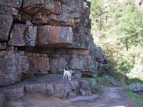
You will turn south at about 1.5 miles and begin a series of switchbacks into a secondary canyon. At this point you'll find a very aesthetic rock formation making a great rest spot. As you begin the switchbacks, you may notice your last chance to access the creek bed from a small break in the trees. A side trip up this canyon bottom would bring you to a point where the water must descend a huge wall but is well hidden from sight on the trail, although the sound is very noticeable.
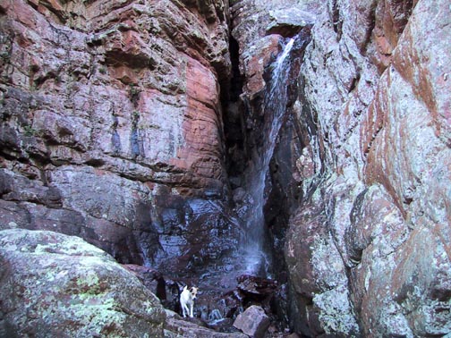
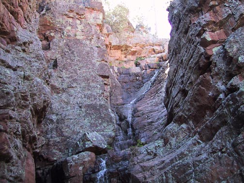
At about 2.5 miles is one of the highlights of the hike in the form of a seasonal cascadingwaterfall with a sheer drop of about twenty feet at the bottom. It's in a grotto tucked back from the trail about twenty yards and enclosed by sheer rock walls on three sides. I tried my best to figure a way to the upper levels but didn't have the guts to try the climb unprotected.
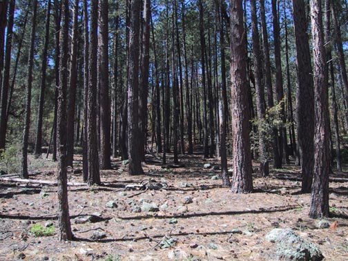
From here, the climb continues unabated for another mile until you reach the Sandy Saddle trail at 6000'. From the falls to the 4mi point is mostly bush with Manzanita predominant. At about 4mi, you'll come to a rather lovely Ponderosa forest, but it bothered me that so many were dying. Don't know if this is from disease or past drought, but didn't notice it elsewhere on the hillsides while driving back.
At 5mi, you top out at about 6200' then at 5.5mi is the intersection with the Mazatzal Divide trail entering from the south (this is not shown on any but the latest revised maps).
From here, you begin descending on what is now technically Mazatzal Divide trail into Chilson Spring, which is a nondescript little well on the north side of the trail. From this spring, they piped the water down to Chilson Camp, which you can reach by cheating and following the pipe or continuing till you hit the Brody Seep trail, take a left and go a quarter-mile. The Camp is a very scenic open area that was
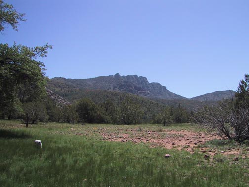
obviously once used as a cattle corral. It is an ideal spot for an overnight or just some lunch.
The return goes a little faster and offers many views you may have missed on the way up. A delightful hike, and I personally look forward to the opportunity to explore this area further. I may have to break down one of these days and buy a backpack! Take care, and may the winds be always at your back (and strong enough to blow away those darn gnats!)
When hiking several trails on a single "hike", log it with a generic name that describes the hike. Then link the trails traveled, check out the example.
WARNING! Hiking and outdoor related sports can be dangerous. Be responsible and prepare for the trip. Study the area you are entering and plan accordingly. Dress for the current and unexpected weather changes. Take plenty of water. Never go alone. Make an itinerary with your plan(s), route(s), destination(s) and expected return time. Give your itinerary to trusted family and/or friends.
Permit $$
None
Directions
Road
FR / Jeep Road - Car possible when dry
To Barnhardt Trailhead From the corner of SR87 & SR260 in Payson go south on SR87 for 14.5 miles to the signed turnoff for Barnhardt trailhead (forest road 419). Follow FR419 5 miles to its end. The parking area is fairly large. Barnhardt trailhead is located at the west end of the parking area. From Phoenix take SR87 north out of Mesa to Payson. The turnoff to the trailhead is 4mi north of the 188 intersection. (think rest stop)
From PHX (I-10 & AZ-51) 83.4 mi - about 1 hour 45 mins From TUC (Jct 1-10 & Grant) 182 mi - about 3 hours 4 mins From FLG (Jct I-17 & I-40) 126 mi - about 2 hours 31 mins
 Route Editor


 Barnhardt Trail is considered to be one of the "expressways" to the Mazatzals. It starts at Barnhardt trailhead and proceeds westward to the ridge of the Mazatzal range or "Divide" where you intersect the N-S Mazatzal Divide Trail, which is part of the Arizona Trail. It's considered an expressway in that it connects up with numerous other trails in the system that could keep a backpacker busy forever. One note of warning, however, the trails are many and can be confusing. The Mazatzal Peak topo quad shows trails that no longer exist and doesn't offer many that do. Many of the ones that are shown are misnamed. Here's your best bet if you want to get a decent handle on this area: The Forest Service office in Mesa has a nice plasticized Mazatzal Wilderness map that shows all the numbers with the names on the back. Check out the Official Route too. Put the two together, shake well, add a pinch of luck, and you're on your way (remember: author not to be held responsible for resulting chaos:).
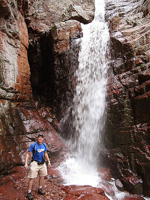


