Route Editor

| Guide | ♦ | 36 Triplogs | 3 Topics |
details | drive | no permit | forecast | route |
stats |
photos | triplogs | topics | location |
| 473 | 36 | 3 |
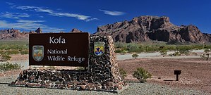
Yuma County Highpoint by chumley   Overview OverviewThis very steep off-trail route leads to the summit of Signal Peak, the highest peak in the Kofa Mountains, and the Yuma County highpoint. Despite the lack of a trail, the route is well-traveled and relatively easy to follow. The grade is challenging, especially on the descent when sections with loose dirt and gravel make firm footing difficult. The views over the rugged Kofa range and surrounding valleys are well worth the effort. Warning The Kofas are a brutal environment. Most of the year it is very hot and dry. There is virtually no shade, and there's no water anywhere near this hike. Winter can be very cold and windy. Weather conditions are key to making this an enjoyable hike. Check the forecast before you go!
The hike begins at the mouth of Ten Ewe Canyon along a high-clearance dirt road in Kofa Queen Canyon. There are a couple of metal stakes in the ground and a small campsite in the wash, but otherwise, the "trailhead" is not obvious. I highly recommend using Davis2001r6's GPS driving route to help you navigate there. Begin the hike by heading up the wash in Ten Ewe Canyon. There may or may not be cairns along the way, but it doesn't really matter at this point. For perspective, as you look up canyon, there's a large cave and dryfall in the cliff face ahead of you and the route will ascend to the left of that but below and to the right of Ten Ewe. After about 0.3 miles in the wash, the route begins to follow the shelf on the left side of the wash. There is not a well-marked exit to the wash, and there are several routes near the bottom, but they all seem to come together quickly and quickly goes parabolic straight up the ridge, climbing ever steeper, directly up to the base of the cliff at 0.6 miles. Here the route turns right and proceeds to a sandy break spot with great views of the dryfall in Indian Canyon on your right at 0.7 miles. The route continues to ascend the left slope of the canyon. Some sections are very steep, there's some loose footing, and a couple of short, easy scrambles, where you'll need to use your hands. At 0.9 miles you reach the top of this section and a saddle that looks over a small basin. From here you will traverse around the left side of the basin, dropping a few feet in elevation as you pass through a small shaded drainage at the 1.0-mile mark. The ascent continues dropping in and out of the Indian Canyon drainage which offers some areas of solid granite footing and easy scrambles. At 1.3 miles the route veers to the right, following the obvious drainage, keeping below a large alcove that could be used for shelter if needed. After getting above the outcropping with the alcove, at 1.45 miles, the route veers left again, climbing a more moderate drainage with loose rock and desert flora before reaching a ridge at 1.6 miles. From here you can see the summit as well as a small communications array on a sub-peak about 300 yards south of the summit. The last 0.15 miles traverses below a secondary peak before arriving at the true summit which features the "Kofa 2" benchmark, and a cemented ammo can register a short distance away. The views in all directions are phenomenal with near-vertical descents to the north and west into Palm Canyon and Four Palms Canyon as well as the views to the southwest over Ten Ewe, Old Smokey, Squaw Peak, and the unnamed Kofa spire next to the nondescript Summit Peak. Return the way you came, or consider a side trip to Ten Ewe if you are a little bit more adventurous! Check out the Official Route and Triplogs. Note This is a moderately difficult hike. Leave No Trace and +Add a Triplog after your hike to support this local community. | |||||||||||||||||||||||||||||||||||||||||||||||||||||||||||||||||||||||||||||||||||||||||||||||||||||||||||||||||||||||||||||||||||||||||||||||||||||||||||||||||||||||||||||||||||||||||||||||||||